Lipple
| Lipple | |||
|---|---|---|---|
| Compass direction | west | east | |
| Pass height | 893 m above sea level NHN | ||
| state | Baden-Württemberg | ||
| Valley locations | Kandern | Tegernau | |
| expansion | L140 | ||
| Mountains | Black Forest | ||
| profile | |||
| Max. Incline | 10/12% | 12% | |
| Map (Baden-Württemberg) | |||
|
|
|||
| Coordinates | 47 ° 46 '11 " N , 7 ° 44' 46" E | ||
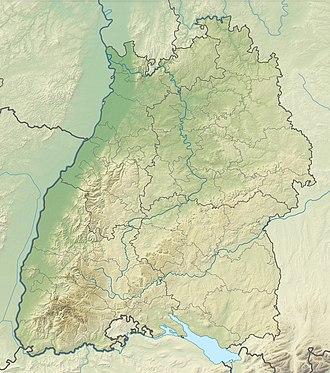
The Lipple is 893 m above sea level. NHN high pass crossing between Kandern and Tegernau in the southern Black Forest. The Kandern pass road, which runs in an east-west direction, is around 20 kilometers long and has a bottom that is open to the south. The pass that connects the Kleine Wiesental with the Kandertal lies on the boundary of the municipality of Malsburg-Marzell . Only a few kilometers from the pass, the Kander rises in several side arms.
profile
The east ramp from Tegernau up to Lipple overcomes an altitude of 450 meters over a distance of 8.5 kilometers, which corresponds to an average gradient of 5.3%. The maximum gradient is 13% in the upper third. The winding to straight course of the east ramp (L140) has no hairpin bend .
At the top of the pass there is a forest parking lot on both sides of the road, from where numerous hiking trails and cross-country skiing trails lead north and south. To the east of the pass there is a source of drinking water at 900 m on the road and at 890 m the Stockmatt hiking home.
The south-west ramp from Kandern is 12.2 kilometers and overcomes 554 meters of altitude in an average gradient of 4.5% with gradient maxima of up to 10% in the upper third. After about 11.2 kilometers, Kanderstraße ( Kreisstraße 6350) meets the L140 coming from Badenweiler , which leads in a south-westerly direction to the pass.
From the west, the ramp from Badenweiler leads 9.4 kilometers up to Lipple, bridging a height of 404 meters with an average gradient of 4.3%. The maximum gradient is 12%, which is reached in the first third. After around 4.6 kilometers there is a dead end turnoff in the direction of Hochblauens . From the junction eastwards, the pass road runs relatively flat past the Kandertal Rehabilitation Clinic, sometimes even on a slight slope, until it meets the confluence with the K6350 coming from Marzell, in order to overcome the remaining 66 meters in altitude to the pass in the last kilometer.
Web links
- Lipple (893 m) - pass description
- High-altitude hike Haldenhof – Lipple – Wies
Individual evidence
- ↑ Ulrike Hillemanns: The most beautiful cross-country skiing areas. Black Forest: south and middle. Bergverlag Rother, Munich 2012, ISBN 978-3-7633-5803-8 , p. 75.
- ↑ Schwarzwaldverein : Wanderheim Stockmatt , last accessed on June 3, 2019
