Lircay
| Lircay | ||
|---|---|---|
|
|
||
| Coordinates | 12 ° 59 ′ S , 74 ° 43 ′ W | |
| Basic data | ||
| Country | Peru | |
| Huancavelica | ||
| province | Angaraes | |
| ISO 3166-2 | PE-HUV | |
| District | Lircay | |
| height | 3278 m | |
| Residents | 9724 (2017) | |
| Website | muniangaraes.gob.pe (Spanish) | |
| politics | ||
| mayor | Jaime Dávila Munárriz (2019-2022) |
|
|
Church in Lircay
|
||
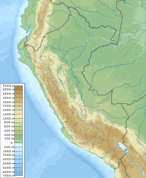
Lircay is the capital of the Angaraes Province in the Huancavelica region in central southern Peru . The city is also the administrative seat of the district of the same name . The 2017 census counted 9,724 inhabitants. Ten years earlier the population was 6563. The population consists mainly of members of indigenous peoples. The city is also nicknamed Ciudad de Las Rosas y Guindos ("City of Roses and Sour Cherries") and Pequeña Suiza ("Little Switzerland").
The city is located 35 km southeast of the regional capital Huancavelica at an altitude of 3278 m in the arid Andean highlands of central Peru. It is located at the confluence of the two source rivers of the Río Urubamba (in parts also Río Lircay), a tributary of the Río Cachi .
In Lircay there are the following educational institutions:
- Universidad para el Desarrollo Andino
- a branch of the Universidad Nacional de Huancavelica
- Instituto Tecnologico Lircay
Individual evidence
- ↑ a b Peru: Huancavelica - Provinces & Places . www.citypopulation.de. Retrieved February 17, 2020.

