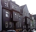
List of architectural monuments in Frohnhausen (Essen)
The list of architectural monuments in Frohnhausen (Essen) contains the listed buildings in the area of Essen-Frohnhausen , district III, in North Rhine-Westphalia (as of January 2016). These architectural monuments are entered in the monuments list of the city of Essen; The basis for the admission is the Monument Protection Act North Rhine-Westphalia (DSchG NRW).
Map with all coordinates: OSM | WikiMap![]()
| image | designation | location | description | construction time | Registered since |
Monument number |
|---|---|---|---|---|---|---|
 more pictures |
West office building | At Westbahnhof 2 Martin-Luther-Straße 118–122 map |
Originally a single home for workers of Friedrich Krupp AG | 1916 | Aug 9, 1990 |
559 |
 more pictures |
Bärendelle School | Bärendelle 15-21 card |
Architect Albert Erbe , opened as a primary school, later secondary school, building was renovated from 2007 to 2012, secondary school closed since summer 2011 | around 1910 | 13 Sep 1994 |
830 |

|
Residential building | Bentheimer Strasse 4 map |
after 1905 | Nov 14, 1991 |
705 |
|

|
Residential building | Bentheimer Strasse 6 map |
after 1905 | Dec 9, 1993 |
793 |
|

|
Residential building | Bentheimer Strasse 8 map |
after 1905 | Nov 14, 1991 |
706 |
|
 more pictures |
Goose Rider Fountain | Berliner Straße (at house number 57) on the corner of An der Apostelkirche map |
Art nouveau fountain behind the Apostle Church , completely renovated between 2008 and 2010 | 1913 | 13 Sep 1994 |
831 |

|
Residential building | Clausthaler Strasse 26 map |
after 1905 | Nov 14, 1991 |
708 |
|

|
Residential building | Clausthaler Strasse 28 map |
1905-1910 | 14 Mar 1991 |
656 |
|

|
four apartment buildings | Dresdener Strasse 52/54/56/58 map |
around 1910 | Nov 14, 1991 |
709 |
|

|
Residential building | Frohnhauser Platz 2 card |
after 1905 | Apr 25, 1996 |
869 |
|

|
Residential building | Frohnhauser Platz 3 card |
after 1905 | Apr 25, 1996 |
870 |
|

|
Residential building | Frohnhauser Platz 4 card |
after 1905 | Oct 10, 1996 |
764 |
|

|
Residential building | Giesebrechtstrasse 3 map |
Early 20th century | Nov 14, 1991 |
710 |
|

|
Half-timbered house Frohnhauser Bauernstube | Hamburger Strasse 114 map |
housed the Frohnhauser Bauernstube restaurant until 2010, then a residential building with kiosk, burned out in July 2016; had to be deleted as a memorial due to the damage caused by the fire and the extinguishing water, demolition began at the end of May 2017 | 1839 | Feb. 14, 1985 |
34 |

|
Residential building | Koelner Strasse 25 map |
1904 | Oct 10, 1996 |
877 |
|

|
Residential building | Koelner Strasse 27 map |
around 1905 | Nov 12, 1987 |
320 |
|
 more pictures |
Parish Church of St. Antonius | Koelner Strasse 33 map |
Architect: Rudolf Schwarz Post-war building of a neo-Gothic predecessor church on the same ground |
1958-1959 | Dec 12, 1985 |
96 |

|
Residential building with restaurant | Map of Lüneburger Strasse 40 and Mülheimer Strasse |
once housed the restaurant Schwarzer Diamant, today another restaurant | around 1910 | Nov 14, 1991 |
711 |

|
Holstenkampskotten / Distelkampskotten | Postreitweg 133 map |
Complete renovation 2011/2012 | 1797 | Dec 14, 1985 |
35 |

|
Half-timbered house (Grotenhof) | Raumerstrasse 76 map |
Partly burned out in 1959, restored in 1996 | 1771 | Dec 12, 1987 |
326 |

|
two apartment buildings | Wiesbadener Strasse 12/14 map |
around 1910 | Nov 14, 1991 |
712 |
|

|
Residential building | Wiesbadener Strasse 18 map |
around 1910 | Nov 14, 1991 |
713 |
|

|
three apartment buildings | Wiesbadener Strasse 21/23/25 map |
around 1910 | Apr 25, 1996 |
871 |
|

|
Residential building | Wiesbadener Strasse 22 map |
around 1910 | Nov 14, 1991 |
715 |
|

|
Residential building | Wiesbadener Strasse 24 map |
around 1910 | Aug 9, 1990 |
560 |
|

|
Residential building | Wiesbadener Strasse 26 map |
around 1910 | Nov 14, 1991 |
716 |
|

|
Residential building | Wiesbadener Strasse 27 map |
1910 | Nov 14, 1991 |
717 |
|

|
Residential building | Wiesbadener Strasse 29 map |
1910 | Oct 13, 1994 |
832 |
|

|
Residential building | Wiesbadener Strasse 31 map |
around 1910 | Nov 14, 1991 |
719 |
Web links
Individual evidence
- ^ Monument authority regrets the demolition of the old half-timbered house , in: Westdeutsche Allgemeine Zeitung of May 30, 2017
