List of architectural monuments in Krebeck
In the list of architectural monuments in Krebeck , all listed buildings of the Lower Saxony municipality of Krebeck ( district of Göttingen ) are listed. The list was in 1997.
General
Krebeck was first mentioned in a document in 1256. The district of Renshausen was first mentioned in 1013 as Reinolveshusen.
The columns contain the following information:
- Location: the address of the monument and the geographical coordinates . Map view to set coordinates . In the map view, monuments without coordinates are shown with a red marker and can be set on the map. Architectural monuments without a picture are marked with a blue marker, architectural monuments with a picture with a green marker.
- Official name: Name of the monument
- Description: the description of the monument. Under § 3 (2) NDSchG individual monuments and under § 3 (3) NDSchG groups of structures and their components are shown.
- ID: the number of the monument
- Image: a picture of the monument
Krebeck
| location | designation | description |
ID |
image |
|---|---|---|---|---|
| Hauptstrasse 25 51 ° 35 ′ 16 ″ N, 10 ° 7 ′ 26 ″ E |
Residential building | |||
| Hauptstrasse 29 51 ° 35 ′ 16 ″ N, 10 ° 7 ′ 22 ″ E |
church | The Catholic Church of St. Alexander and Brothers was built in 1716, with a late medieval tower being included in the church. In the 19th century the tower was given a pointed helmet, which is slated. Inside there is a late baroque high altar. |

|
|
| Main Street 31 51 ° 35 ′ 16 ″ N, 10 ° 7 ′ 20 ″ E |
Residential building | |||
| Kirchring 6 51 ° 35 ′ 15 ″ N, 10 ° 7 ′ 22 ″ E |
Rectory | |||
| Kirchring 19 51 ° 35 ′ 16 ″ N, 10 ° 7 ′ 19 ″ E |
Residential building | |||
| Osteroder Strasse / Gartenstrasse 51 ° 35 ′ 20 ″ N, 10 ° 7 ′ 38 ″ E |
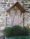
Wayside cross |

|
||
| Rote Straße / Rasenweg 51 ° 35 ′ 14 ″ N, 10 ° 7 ′ 8 ″ E |
Wayside cross |

|
Renshausen
| location | designation | description |
ID |
image |
|---|---|---|---|---|
| At Kirchberg / Auf der Klimp |
Wayside shrine |

|
||
| at Kirchberg |
Paterhof |

|
||
| Am Kirchberg 5 51 ° 36 ′ 13 ″ N, 10 ° 6 ′ 12 ″ E |
Rectory |

|
||
| Am Kirchberg 9 51 ° 36 ′ 12 ″ N, 10 ° 6 ′ 9 ″ E |
church | The Catholic Church of the Birth of the Virgin Mary was built from 1846 to 1850. Before that there was a church in Renshausen, but it was demolished in 1851. Inside there is a miraculous image of Saint Joseph created by Josephus Blume. The picture is the destination of a pilgrimage on the third Sunday in March. |

|
|
| Mönchstrasse 16 51 ° 36 ′ 7 ″ N, 10 ° 6 ′ 9 ″ E |
Residential building | |||
| Sacrificial Dam |
Wayside shrine |
literature
- Monument topography Federal Republic of Germany, architectural monuments in Lower Saxony, district Göttingen, part 2, volume 5.3, 1997, edited by Peter Ferdinand Lufen, published by Christiane Segers-Glocke , Verlag CW Niemeyer Buchverlage , Hameln, ISBN 3-8271-8257-3
Web links
Commons : Architectural monuments in Krebeck - collection of images, videos and audio files

