List of architectural monuments in Dransfeld
In the list of architectural monuments in Dransfeld , all listed buildings of the Lower Saxony municipality of Dransfeld ( district of Göttingen ) are listed. The list is as of 1993.
General
Dransfeld is mentioned as Threnesfelde for the first time in a list of goods from the Hilwartshausen monastery.
The columns contain the following information:
- Location: the address of the monument and the geographical coordinates . Map view to set coordinates . In the map view, monuments without coordinates are shown with a red marker and can be set on the map. Architectural monuments without a picture are marked with a blue marker, architectural monuments with a picture with a green marker.
- Official name: Name of the monument
- Description: the description of the monument. Under § 3 (2) NDSchG individual monuments and under § 3 (3) NDSchG groups of structures and their components are shown.
- ID: the number of the monument
- Image: a picture of the monument
Bead
| location | designation | description |
ID |
image |
|---|---|---|---|---|
| Wide street 1 |
Residential building | |||
| Hohler Weg 3 |
Residential building | |||
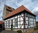
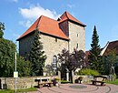
| 51 ° 29 '24 "N, 9 ° 47' 26" E | Ev. chapel | The quarry stone chapel with a compact west tower and a short nave of the same width is medieval in essence. Today's appearance goes back essentially to the time after the Thirty Years War. The interior is covered with a groin vault. |

|
Dransfeld
| location | designation | description |
ID |
image |
|---|---|---|---|---|
| Alt Marktstraße 22 |
Residential building | |||
| Alt Marktstraße 24 |
Residential building | |||
| Alt Marktstraße 26 |
Residential building | |||
| Alt Marktstraße 29 |
Residential building | |||
| Am Wall 2 51 ° 30 ′ 12 ″ N, 9 ° 45 ′ 23 ″ E |
Knustturm | The last remnant of the medieval city fortifications in Dransfeld |

|
|
| Bachstraße 24/26 |
Residential building | |||
| Bachstraße 35 |
Residential building | |||
| Bachstraße 42 |
Residential building | |||
| Bahnhofstrasse 7 |
Residential building | |||
| Bahnhofstraße 10 |
Residential building | |||
| Gerlandstrasse 7 51 ° 30 ′ 13 ″ N, 9 ° 45 ′ 41 ″ E |
Former synagogue | The half-timbered building with a plastered street front, built in 1810 as a synagogue for the Jewish community in Dransfeld, has changed significantly from its original state. 1951–75 it served as a Catholic chapel. |
 More pictures |
|
| Gerlandstraße 9 |
Residential building | |||
| Johannes-Jeep-Straße 2/4 |
Residential building | |||
| 51 ° 29 ′ 43 "N, 9 ° 44 ′ 59" E | Jewish Cemetery |

|
||
| 51 ° 30 ′ 12 "N, 9 ° 45 ′ 34" E | St. Martini Church | The Evangelical Lutheran town church of St. Martini was rebuilt in neoclassical style after the devastating fire in 1834 and inaugurated in 1841. For the reconstruction, only parts of the tower could be taken over from the Gothic previous church. The architect was the Hanover consistory master builder Ludwig Hellner . The large interior is characterized by the wide-span flat ceiling and the segment-arched apse with six high columns. The church has a circumferential gallery, which is taken up on the west side by a wide organ. The organ was built from 1843 to 1845 by Balthasar Conrad Euler from Gottsbüren near Trendelburg, restored in 1985 and has been a listed building since then. The church was restored from 1981 to 1984. |

|
|
| Kirchstraße 1 |
Residential building |

|
||
| Kirchstraße 3 |
Residential building |

|
||
| Long street 4 |
Residential building | |||
| Long road 7 |
Residential building | |||
| Long road 9 |
Residential building | |||
| Lange Straße 11 |
Residential building | |||
| Lange Straße 30/32 |
Residential building | |||
| Long road 37 |
Residential building | |||
| Lange Straße 41 |
Residential building | |||
| Long road 67 |
Residential building | |||
| Nordstraße 2/4 |
Residential building | |||
| Nordstraße 10 |
Residential building | |||
| Zehnstrasse 14 |
Residential building |
Ossenfeld
| location | designation | description |
ID |
image |
|---|---|---|---|---|
| 51 ° 31 '13 "N, 9 ° 47' 53" E | bridge | The bridge is located south of Ossenfeld. It is part of the Göttingen-Dransfeld-Münden railway. It was built in 1856 as a magnificent arch bridge made of sandstone, but after the railway line was closed it was removed and replaced by a dam. | ||
| Göttinger Strasse 3 51 ° 31 ′ 31 ″ N, 9 ° 47 ′ 44 ″ E |
court | |||
| Klostergasse / Göttinger Straße |
court | |||
| Am Thie 10 51 ° 31 '35 "N, 9 ° 47' 44" E |
Kreuzkapelle | The Protestant chapel has a medieval defensive tower to the west, to which a timber-framed nave was added in 1774–76. Structural changes were made in 1831 and 1844. |

|
Varmissen
| location | designation | description |
ID |
image |
|---|---|---|---|---|
| High field 2 |
Residential building | |||
| 51 ° 30 ′ 19 "N, 9 ° 47 ′ 42" E | chapel | The Protestant chapel is a quarry stone building that is dated to the 14th century. A high, rectangular nave was not added to the originally four-story defense tower with narrow window slots until a little later. The current windows of the chapel date from the 18th century. The original vault above the ground floor was later removed. |

|
|
| Marcus cross | The Marcus Cross was found northwest of the entrance to the village. It was created around 1400. Today the round cross is in the municipal museum in Göttingen. | |||
| Schulstraße 3 |
court | |||
| Varmisser Straße 13 |
court | |||
| Varmisser Straße 15 |
court | |||
| Varmisser Straße 22 |
court |
literature
- Monument topography Federal Republic of Germany , architectural monuments in Lower Saxony, district of Göttingen, part 1, volume 5.2, 1993, editors Urs Boeck , Peter F. Lufen and Walter Wulf, Verlag CW Niemeyer Buchverlage , Hameln, ISBN 3-87585-251-6
Web links
Commons : Architectural monuments in Dransfeld - collection of images, videos and audio files
Individual evidence
- ↑ Monument topography of the Federal Republic of Germany, architectural monuments in Lower Saxony, Göttingen district, volume 5.2, 1993, Urs Boeck, Peter F. Lufen and Walter Wulf, Verlag CW Niemeyer Buchverlage, Hameln, ISBN 3-87585-251-6 . Page 115

