List of architectural monuments in Hann. Münden
In the list of architectural monuments in Hann. Münden are all listed buildings of the Lower Saxon community of Hann. Münden ( district of Göttingen ) listed. The list is from 1993 and 1996.
General
The monuments of the outer districts are in the list of monuments in Hann. Münden (outskirts) .
The columns contain the following information:
- Location: the address of the monument and the geographical coordinates . Map view to set coordinates . In the map view, monuments without coordinates are shown with a red marker and can be set on the map. Architectural monuments without a picture are marked with a blue marker, architectural monuments with a picture with a green marker.
- Official name: Name of the monument
- Description: the description of the monument. Under § 3 (2) NDSchG individual monuments and under § 3 (3) NDSchG groups of structures and their components are shown.
- ID: the number of the monument
- Image: a picture of the monument
Hann. Münden
| location | designation | description |
ID |
image |
|---|---|---|---|---|
| 51 ° 24 ′ 54 "N, 9 ° 38 ′ 56" E | City fortifications |
|
||
| Aegidiiplatz 4 51 ° 24 ′ 55 ″ N, 9 ° 39 ′ 7 ″ E |
Residential building | The house was built in 1734 by the city of Münden in the same style as the houses at Aegidiiplatz 6 and 8. The house has a field stone base and two floors. The facade is characterized by a dwarf house. Emigrants from Berchtesgaden have moved in here. |

|
|
| Aegidiiplatz 6 51 ° 24 ′ 54 ″ N, 9 ° 39 ′ 7 ″ E |
Residential building | The house was built in 1734 by the city of Münden in the same style as the houses at Aegidiiplatz 4 and 8. The house has a field stone base and two floors. The facade is characterized by a dwarf house. Emigrants from Berchtesgaden have moved in here. |

|
|
| Aegidiiplatz 8 51 ° 24 ′ 54 ″ N, 9 ° 39 ′ 6 ″ E |
Residential building | The house was built in 1734 by the city of Münden in the same style as the houses at Aegidiiplatz 6 and 8. The house has a field stone base and two floors. The facade is characterized by a dwarf house. Emigrants from Berchtesgaden have moved in here. |

|
|
| Aegidienstraße 1 51 ° 24 ′ 56 ″ N, 9 ° 39 ′ 5 ″ E |
Residential building |

|
||
| Aegidienstraße 7 51 ° 24 ′ 55 ″ N, 9 ° 39 ′ 7 ″ E |
Residential building |

|
||
| Aegidienstraße 9 51 ° 24 ′ 55 ″ N, 9 ° 39 ′ 7 ″ E |
Residential building |

|
||
| Aegidienstraße 13 51 ° 24 ′ 55 ″ N, 9 ° 39 ′ 8 ″ E |
Residential building |

|
||
| Aegidienstraße 15 51 ° 24 ′ 55 ″ N, 9 ° 39 ′ 9 ″ E |
Residential building |

|
||
| Aegidienstraße 17 51 ° 24 ′ 55 ″ N, 9 ° 39 ′ 9 ″ E |
Residential building |

|
||
| Adam-von-Trott-zu-Solz-Platz 51 ° 24 ′ 45 ″ N, 9 ° 39 ′ 28 ″ E |
railway station | The station was built around 1850. |

|
|
| Am Feuerteich 11 51 ° 24 ′ 49 ″ N, 9 ° 39 ′ 10 ″ E |
villa |

|
||
| Am Feuerteich 16 51 ° 24 ′ 46 ″ N, 9 ° 39 ′ 14 ″ E |
villa |

|
||
| Am Feuerteich 28 51 ° 24 ′ 44 ″ N, 9 ° 39 ′ 15 ″ E |
sculpture | The sculpture God breathes Adam into the breath was erected in 1904 by Gustav Eberlein . It is in the park in front of the house at Am Feuerteich 28. |

|
|
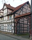
| On Plan 4 51 ° 25 ′ 1 ″ N, 9 ° 39 ′ 13 ″ E |
Residential building |
|
||
| At Plan 5 51 ° 25 ′ 0 ″ N, 9 ° 39 ′ 17 ″ E |
Hampescher Tower | Former tower of the city fortifications of Münden |

|
|
| At Plan 6 51 ° 25 ′ 1 ″ N, 9 ° 39 ′ 13 ″ E |
Residential building |

|
||
| On plan 8A 51 ° 25 ′ 1 ″ N, 9 ° 39 ′ 13 ″ E |
Residential building |

|
||
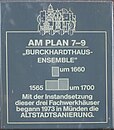
| On plan 9 51 ° 24 ′ 59 ″ N, 9 ° 39 ′ 15 ″ E |
Residential building |
|
||
| On plan 11 51 ° 25 ′ 1 ″ N, 9 ° 39 ′ 14 ″ E |
Residential building | |||
| On plan 13 51 ° 24 ′ 59 ″ N, 9 ° 39 ′ 15 ″ E |
Residential building | |||
| On plan 21 51 ° 24 ′ 59 ″ N, 9 ° 39 ′ 15 ″ E |
Residential building | |||
| Bahnhofstrasse 7 51 ° 24 ′ 57 ″ N, 9 ° 39 ′ 13 ″ E |
Fan tower | Also called Kronenturm after the adjacent former hotel “Zur Krone”. |

|
|
| Bahnhofstrasse 27 51 ° 24 ′ 53 ″ N, 9 ° 39 ′ 25 ″ E |
Post office |

|
||
| Bahnhofstrasse 32 51 ° 24 ′ 51 ″ N, 9 ° 39 ′ 22 ″ E |
Residential building |

|
||
| Bahnhofstrasse 46 51 ° 24 ′ 49 ″ N, 9 ° 39 ′ 27 ″ E |
villa |

|
||
| Beethovenstrasse 6 51 ° 24 ′ 50 ″ N, 9 ° 39 ′ 16 ″ E |
Residential building |

|
||
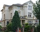
| Beethovenstrasse 9 51 ° 24 ′ 51 ″ N, 9 ° 39 ′ 18 ″ E |
villa |
|
||
| Flower 2-80 51 ° 25 ′ 11 ″ N, 9 ° 39 ′ 12 ″ E |
Residential houses |

|
||
| Flower 52 51 ° 25 ′ 11 ″ N, 9 ° 39 ′ 12 ″ E |
Residential building |

|
||
| Böttcher Strasse 3 51 ° 25 ′ 11 ″ N, 9 ° 39 ′ 12 ″ E |
Former district house |

|
||
| Böttcher Strasse 7 51 ° 24 ′ 56 ″ N, 9 ° 39 ′ 24 ″ E |
high school |

|
||
| Bremer Schlagd 51 ° 25 ′ 7 ″ N, 9 ° 39 ′ 0 ″ E |
Wage Mill | |||
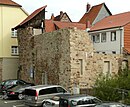
| Bremer Schlagd 10 51 ° 25 ′ 6 ″ N, 9 ° 39 ′ 0 ″ E |
Thin tower | Former tower of the city fortifications of Münden am Bremer Schlagd |
|
|
| Bremer Schlagd 12-14 51 ° 25 ′ 7 ″ N, 9 ° 39 ′ 0 ″ E |
Old Packhof | The Alte Packhof on the banks of the Fulda is a warehouse built in 1837. During the 19th century, the building was used to store goods from long-distance trade across the Fulda, Weser and Werra rivers. With the advent of the railroad, inland shipping declined in Münden. Finally it came to a standstill. The Packhof has been used as a hotel since a renovation in 1999. |

|
|
| Bremer Schlagd 16 51 ° 25 ′ 7 ″ N, 9 ° 39 ′ 0 ″ E |
Sydekum stronghold | The lower part of the lodge house was an originally circular bulwark that was erected at the top . Used around 1729 as an inn Sydekum (Low German: si dek um ); after the town had acquired the house, it served as a local tax office and customs office . In 1872 it was acquired by the Masonic Lodge "Phytagoras to the Three Rivers", founded in 1799 . Due to extensive restorations, the building was entered in the register of nieders on October 17, 1996 . Architectural and cultural monument has been included. |

|
|
| Bremer Schlagd 18 51 ° 25 ′ 8 ″ N, 9 ° 39 ′ 1 ″ E |
Place at the top |

|
||
| Burckhardtstrasse 60 51 ° 24 ′ 35 ″ N, 9 ° 38 ′ 10 ″ E |
Former garrison hospital |

|
||
| Burgstrasse 6 51 ° 25 ′ 2 ″ N, 9 ° 39 ′ 11 ″ E |
Residential building |

|
||
| Burgstrasse 7 51 ° 25 ′ 2 ″ N, 9 ° 39 ′ 11 ″ E |
Residential building |

|
||
| Burgstrasse 8 51 ° 25 ′ 2 ″ N, 9 ° 39 ′ 11 ″ E |
Residential building |

|
||
| Burgstrasse 10 51 ° 25 ′ 1 ″ N, 9 ° 39 ′ 11 ″ E |
Residential building |

|
||
| Burgstrasse 11 51 ° 25 ′ 1 ″ N, 9 ° 39 ′ 11 ″ E |
Residential building |

|
||
| Burgstrasse 12 51 ° 25 ′ 1 ″ N, 9 ° 39 ′ 11 ″ E |
Residential building |

|
||
| Burgstrasse 14 51 ° 25 ′ 1 ″ N, 9 ° 39 ′ 11 ″ E |
Residential building |

|
||
| Burgstrasse 16 51 ° 25 ′ 1 ″ N, 9 ° 39 ′ 10 ″ E |
Residential building |

|
||
| Burgstrasse 18 51 ° 25 ′ 0 ″ N, 9 ° 39 ′ 11 ″ E |
Residential building |

|
||
| Burgstrasse 19 51 ° 25 ′ 0 ″ N, 9 ° 39 ′ 11 ″ E |
Residential building |

|
||
| Burgstrasse 20 51 ° 25 ′ 0 ″ N, 9 ° 39 ′ 10 ″ E |
Residential building |

|
||
| Burgstrasse 21 51 ° 25 ′ 0 ″ N, 9 ° 39 ′ 11 ″ E |
Residential building |

|
||
| Burgstrasse 24 51 ° 25 ′ 0 ″ N, 9 ° 39 ′ 10 ″ E |
Residential building |

|
||
| Burgstrasse 26 51 ° 24 ′ 59 ″ N, 9 ° 39 ′ 10 ″ E |
Residential building |

|
||
| Burgstrasse 28 51 ° 24 ′ 59 ″ N, 9 ° 39 ′ 10 ″ E |
Residential building |

|
||
| Burgstrasse 29 51 ° 24 ′ 59 ″ N, 9 ° 39 ′ 11 ″ E |
Residential building |

|
||
| Burgstrasse 30 51 ° 24 ′ 59 ″ N, 9 ° 39 ′ 10 ″ E |
Residential building |
|
||
| Burgstrasse 32/34 51 ° 24 ′ 59 ″ N, 9 ° 39 ′ 10 ″ E |
Residential building |

|
||
| Burgstrasse 54 51 ° 24 ′ 55 ″ N, 9 ° 39 ′ 10 ″ E |
Residential building |

|
||
| Burgstrasse 159 51 ° 24 ′ 58 ″ N, 9 ° 39 ′ 11 ″ E |
Residential building | |||
| Burgstrasse 160 51 ° 24 ′ 58 ″ N, 9 ° 39 ′ 11 ″ E |
Residential building | |||
| Board trench 51 ° 25 ′ 5 ″ N, 9 ° 39 ′ 19 ″ E |
Former powder tower | Powder Tower or Tatern Tower. Former tower of the Welfenschloss Münden and the city fortifications of Münden . The castle powder was stored here. |

|
|
| Doktorwerder 51 ° 25 ′ 10 ″ N, 9 ° 39 ′ 5 ″ E |
Bark house | The Borkenhaus is located west of the Alte Werra Bridge on the Werrain Island Doktorwerder . Originally the Borkenhaus was used as a chapel. There is also a bathhouse from the 19th century on the island of Doktorwerder. |

|
|
| Eichenweg 51 ° 25 ′ 22 ″ N, 9 ° 38 ′ 56 ″ E |
Weserliedanlage | The Weserliedanlage is a monument erected in 1931 as a roundabout. It is a lookout point above Hann. Münden and is reminiscent of the Weser song from 1835. |

|
|
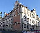
| Friedrich-Ludwig-Jahn-Strasse 2 51 ° 25 ′ 3 ″ N, 9 ° 39 ′ 14 ″ E |
Former boys' school |

|
||
| Friedrich-Ludwig-Jahn-Strasse 4 51 ° 25 ′ 3 ″ N, 9 ° 39 ′ 12 ″ E |
Former boys' school |
|
||
| Friedrichstrasse 3 51 ° 24 ′ 52 ″ N, 9 ° 39 ′ 25 ″ E |
Residential building |

|
||
| Friedrichstrasse 4 51 ° 24 ′ 52 ″ N, 9 ° 39 ′ 26 ″ E |
Residential building |

|
||
| Friedrichstrasse 12 51 ° 24 ′ 53 ″ N, 9 ° 39 ′ 28 ″ E |
Residential building |

|
||
| Fuldabrückenstrasse 10 51 ° 24 ′ 53 ″ N, 9 ° 38 ′ 59 ″ E |
Brick gate tower | Former tower of the city fortifications of Münden |

|
|
| Behind the city wall 2 51 ° 25 ′ 4 ″ N, 9 ° 39 ′ 0 ″ E |
Residential building |

|
||
| Behind the city walls 4 51 ° 25 ′ 4 ″ N, 9 ° 39 ′ 0 ″ E |
Residential building |

|
||
| Behind the city walls 5 51 ° 25 ′ 4 ″ N, 9 ° 39 ′ 0 ″ E |
Residential building |

|
||
| Behind the city wall 14 51 ° 25 ′ 2 ″ N, 9 ° 38 ′ 59 ″ E |
Residential building |

|
||
| Behind the city wall 18 51 ° 25 ′ 2 ″ N, 9 ° 38 ′ 59 ″ E |
Residential building |

|
||
| Behind the city walls 20 51 ° 25 ′ 2 ″ N, 9 ° 38 ′ 58 ″ E |
Residential building | |||
| Behind the city wall 21 51 ° 25 ′ 1 ″ N, 9 ° 38 ′ 59 ″ E |
Residential building |

|
||
| Behind the city walls 23 51 ° 25 ′ 1 ″ N, 9 ° 38 ′ 59 ″ E |
Residential building | Jewish school 1796–1938, from 1834 synagogue in the courtyard, discovered in 1973 the mikvah as a Jewish ritual bath. See also: History of the Jews in Hann. Münden |

|
|
| Behind the city walls 26 51 ° 25 ′ 0 ″ N, 9 ° 38 ′ 57 ″ E |
Residential building |

|
||
| Behind the city wall 34 51 ° 24 ′ 59 ″ N, 9 ° 38 ′ 57 ″ E |
Residential building |

|
||
| Behind the city wall 38 51 ° 24 ′ 59 ″ N, 9 ° 38 ′ 57 ″ E |
Residential building |

|
||
| Jüdenstrasse 6 51 ° 25 ′ 0 ″ N, 9 ° 39 ′ 12 ″ E |
Residential building |

|
||
| Kasseler Schlagd 51 ° 25 ′ 2 ″ N, 9 ° 38 ′ 57 ″ E |
Street train | The Kasseler Schlagd is an approximately 220 meter long street in the old town that runs parallel to the banks of the Fulda. |

|
|
| Kasseler Strasse 1 51 ° 24 ′ 51 ″ N, 9 ° 39 ′ 4 ″ E |
Rotunda Münden | Zwingerturm a bastion of the city fortifications of Münden to secure the Upper Gate |

|
|
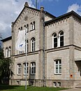
| Kasseler Strasse 5 51 ° 24 ′ 47 ″ N, 9 ° 39 ′ 4 ″ E |
Administration building | Waterways and Shipping Office Hann. Münden |
|
|
| Kasseler Strasse 39 51 ° 24 ′ 40 ″ N, 9 ° 39 ′ 2 ″ E |
villa |

|
||
| Kattenbühl 12 51 ° 24 ′ 38 ″ N, 9 ° 39 ′ 24 ″ E |
Residential building |

|
||
| Kattenbühl 13 51 ° 24 ′ 37 ″ N, 9 ° 39 ′ 27 ″ E |
Residential building |

|
||
| Kattenbühl 15 51 ° 24 ′ 35 ″ N, 9 ° 39 ′ 27 ″ E |
Residential building |

|
||
| Kattenbühl 27 51 ° 24 ′ 32 ″ N, 9 ° 39 ′ 28 ″ E |
Residential building |

|
||
| Kattenbühl 35 51 ° 24 ′ 29 "N, 9 ° 39 ′ 33" E |
Rest home | |||
| Kattenstieg 1 51 ° 24 ′ 30 ″ N, 9 ° 39 ′ 30 ″ E |
Residential and pension house |

|
||
| Kiesau 13 51 ° 25 ′ 6 ″ N, 9 ° 39 ′ 1 ″ E |
Residential building |

|
||
| Kiesau 15 51 ° 25 ′ 6 ″ N, 9 ° 39 ′ 1 ″ E |
Residential building |

|
||
| Kiesau 16 51 ° 25 ′ 7 ″ N, 9 ° 39 ′ 2 ″ E |
Residential building |

|
||
| Kiesau 17 51 ° 25 ′ 7 ″ N, 9 ° 39 ′ 1 ″ E |
Residential building |

|
||
| Kiesau 20 51 ° 25 ′ 7 ″ N, 9 ° 39 ′ 2 ″ E |
Residential building |

|
||
| Aegidiiplatz 1 51 ° 24 ′ 54 ″ N, 9 ° 39 ′ 8 ″ E |
Church of St. Aegidia | The St. Aegidien Church is the smaller of the two historic old town churches in Hann. Münden. In its current form, the church, which mostly dates from the 17th and 18th centuries, was deconstructed in 2006. It has housed a café since 2010. |

|
|
| Ziegelstrasse 51 ° 25 ′ 0 ″ N, 9 ° 39 ′ 4 ″ E |
St. Blasii Church | The Evangelical Lutheran St. Blasius Church is a listed church building. The three-aisled, Gothic hall church stands in the middle of the old town, surrounded by historic houses. |

|
|
| Böttcherstrasse 10 51 ° 24 ′ 54 ″ N, 9 ° 39 ′ 26 ″ E |
St. Elisabeth Church | St. Elisabeth is a Catholic parish church. The neo-Romanesque church with the patronage of St. Elisabeth of Thuringia was built from 1887 to 1889. |

|
|
| Kirchstrasse 1 51 ° 24 ′ 59 ″ N, 9 ° 39 ′ 7 ″ E |
Residential building |

|
||
| Kirchstrasse 6 51 ° 24 ′ 59 ″ N, 9 ° 39 ′ 8 ″ E |
Residential building |

|
||
| Kirchstrasse 7 51 ° 24 ′ 59 ″ N, 9 ° 39 ′ 8 ″ E |
Residential building |

|
||
| Kirchstrasse 8 51 ° 24 ′ 59 ″ N, 9 ° 39 ′ 8 ″ E |
Residential building |

|
||
| Kirchstrasse 9 51 ° 24 ′ 59 ″ N, 9 ° 39 ′ 9 ″ E |
Residential building |

|
||
| Kirchplatz 4 51 ° 24 ′ 59 ″ N, 9 ° 39 ′ 3 ″ E |
Former sexton's house |

|
||
| Kirchplatz 5 51 ° 24 ′ 59 ″ N, 9 ° 39 ′ 4 ″ E |
Residential and commercial buildings | Wüstenfeldsches Palais |

|
|
| Kirchplatz 7 51 ° 24 ′ 59 ″ N, 9 ° 39 ′ 3 ″ E |
Residential building |

|
||
| Kirchplatz 9 51 ° 24 ′ 59 ″ N, 9 ° 39 ′ 3 ″ E |
Residential building |

|
||
| Lange Straße 1 51 ° 25 ′ 7 ″ N, 9 ° 39 ′ 9 ″ E |
Residential building |

|
||
| Lange Straße 8 51 ° 25 ′ 7 ″ N, 9 ° 39 ′ 8 ″ E |
Residential building |

|
||
| Lange Straße 9 51 ° 25 ′ 6 ″ N, 9 ° 39 ′ 8 ″ E |
Residential building |

|
||
| Lange Straße 10 51 ° 25 ′ 6 ″ N, 9 ° 39 ′ 7 ″ E |
Residential building |

|
||
| Lange Straße 15 51 ° 25 ′ 6 ″ N, 9 ° 39 ′ 8 ″ E |
Residential building |

|
||
| Lange Straße 17 51 ° 25 ′ 5 ″ N, 9 ° 39 ′ 7 ″ E |
Front building |

|
||
| Lange Straße 19/21 51 ° 25 ′ 5 ″ N, 9 ° 39 ′ 8 ″ E |
Residential building |

|
||
| Lange Straße 20 51 ° 25 ′ 6 ″ N, 9 ° 39 ′ 7 ″ E |
Residential building |

|
||
| Lange Straße 22 51 ° 25 ′ 5 ″ N, 9 ° 39 ′ 6 ″ E |
Residential building |

|
||
| Lange Straße 23 51 ° 25 ′ 5 ″ N, 9 ° 39 ′ 8 ″ E |
Residential building |

|
||
| Lange Straße 26 51 ° 25 ′ 5 ″ N, 9 ° 39 ′ 6 ″ E |
Residential building |

|
||
| Lange Straße 29 51 ° 25 ′ 3 ″ N, 9 ° 39 ′ 8 ″ E |
Residential building | Built in 1554 by councilor, wholesaler and wool merchant Barthold Mattenberg. The most stately town house of the place with rich construction and decorative elements. Magnificent portal from the Rococo period |

|
|
| Lange Straße 31 51 ° 25 ′ 3 ″ N, 9 ° 39 ′ 7 ″ E |
Residential building |

|
||
| Lange Straße 36 51 ° 25 ′ 3 ″ N, 9 ° 39 ′ 6 ″ E |
Residential building |

|
||
| Lange Straße 37 51 ° 25 ′ 2 ″ N, 9 ° 39 ′ 7 ″ E |
Residential building |

|
||
| Lange Straße 45 51 ° 25 ′ 1 ″ N, 9 ° 39 ′ 8 ″ E |
Residential building |

|
||
| Lange Straße 46 51 ° 25 ′ 2 ″ N, 9 ° 39 ′ 5 ″ E |
Residential building |

|
||
| Lange Straße 47 51 ° 25 ′ 1 ″ N, 9 ° 39 ′ 8 ″ E |
Residential building |

|
||
| Lange Straße 49 51 ° 25 ′ 1 ″ N, 9 ° 39 ′ 8 ″ E |
Residential building |

|
||
| Lange Straße 50 51 ° 25 ′ 1 ″ N, 9 ° 39 ′ 6 ″ E |
Residential building |

|
||
| Lange Straße 51 51 ° 25 ′ 0 ″ N, 9 ° 39 ′ 7 ″ E |
Residential building |

|
||
| Lange Straße 53 51 ° 25 ′ 0 ″ N, 9 ° 39 ′ 6 ″ E |
Residential building |

|
||
| Lange Straße 57 51 ° 25 ′ 0 ″ N, 9 ° 39 ′ 7 ″ E |
Residential building |

|
||
| Lange Straße 63 51 ° 24 ′ 59 ″ N, 9 ° 39 ′ 7 ″ E |
Residential building |

|
||
| Lange Straße 65 51 ° 24 ′ 58 ″ N, 9 ° 39 ′ 6 ″ E |
Residential building |

|
||
| Lange Straße 69 51 ° 24 ′ 58 ″ N, 9 ° 39 ′ 6 ″ E |
Residential building |

|
||
| Lange Straße 71 51 ° 24 ′ 57 ″ N, 9 ° 39 ′ 6 ″ E |
Residential building |

|
||
| Lange Straße 75 51 ° 24 ′ 56 ″ N, 9 ° 39 ′ 6 ″ E |
Residential building |

|
||
| Lange Straße 82 51 ° 24 ′ 56 ″ N, 9 ° 39 ′ 3 ″ E |
Residential building | The so-called marble house was built in 1685. The plaster was removed from the facade in 1978, revealing a facade painting that simulates marble. |

|
|
| Lange Straße 84 51 ° 24 ′ 56 ″ N, 9 ° 39 ′ 3 ″ E |
Residential building |

|
||
| Lange Straße 95 51 ° 24 ′ 53 ″ N, 9 ° 39 ′ 5 ″ E |
Residential building |

|
||
| Lange Straße 99 51 ° 24 ′ 53 ″ N, 9 ° 39 ′ 4 ″ E |
Residential building |

|
||
| Lange Straße 102 51 ° 24 ′ 53 ″ N, 9 ° 39 ′ 3 ″ E |
Residential building |

|
||
| Kapellenweg 51 ° 25 ′ 21 ″ N, 9 ° 38 ′ 36 ″ E |
Church ruins of St. Laurentius | The church ruins are in the Altmünden district. The church was the place of worship in Gimundi, a precursor settlement of Münden, of which only a few remains of the wall have survived above ground. |

|
|
| Lohstrasse 3 51 ° 25 ′ 5 ″ N, 9 ° 39 ′ 3 ″ E |
Residential building |

|
||
| Lohstrasse 13 51 ° 25 ′ 6 ″ N, 9 ° 39 ′ 4 ″ E |
Residential building |

|
||
| Lotzestrasse 19 51 ° 25 ′ 1 ″ N, 9 ° 39 ′ 5 ″ E |
Residential building |

|
||
| Markt 2 51 ° 25 ′ 5 ″ N, 9 ° 39 ′ 6 ″ E |
Residential building |

|
||
| Markt 8 51 ° 25 ′ 5 ″ N, 9 ° 39 ′ 4 ″ E |
Residential building |

|
||
| Marktplatz 51 ° 25 ′ 2 ″ N, 9 ° 39 ′ 4 ″ E |
Münden town hall | The town hall is a listed building, the core of which dates from the 14th century. A renovation at the beginning of the 17th century gave it its façade in the Weser Renaissance style, which has been preserved to this day. |

|
|
| Marktplatz 51 ° 25 ′ 1 ″ N, 9 ° 39 ′ 4 ″ E |
arkt |

|
||
| Marktstrasse 1 51 ° 25 ′ 4 ″ N, 9 ° 39 ′ 8 ″ E |
Residential building |

|
||
| Marktstrasse 9 51 ° 25 ′ 4 ″ N, 9 ° 39 ′ 9 ″ E |
Residential building |

|
||
| Marktstrasse 11 51 ° 25 ′ 5 ″ N, 9 ° 39 ′ 9 ″ E |
Münden stone works | The Münden stone works is a medieval bower in the old town center of Hann. Münden in southern Lower Saxony. The stone works was built in the first half of the 13th century as a secular building in the urban area. |

|
|
| Marktstrasse 14 51 ° 25 ′ 3 ″ N, 9 ° 39 ′ 9 ″ E |
Residential building |

|
||
| Marktstrasse 15 51 ° 25 ′ 4 ″ N, 9 ° 39 ′ 10 ″ E |
Residential building |

|
||
| Mitscherlichstrasse 5 51 ° 24 ′ 56 ″ N, 9 ° 39 ′ 30 ″ E |
Botanical Garden | The forest botanical garden Hann. Mündens was founded in 1868 when Hann. Münden housed the forestry faculty (1868 to 1970). Today it still has over 700 trees and bushes in a reduced form and is under special protection. |

|
|
| Mühlenstrasse 2 51 ° 25 ′ 5 ″ N, 9 ° 39 ′ 0 ″ E |
Badstoven Münden | In 1562, on the corner of Hinter der Stadtmauer and Mühlenstraße, the Badstoven was built as a bathhouse , also known as the Badstube. The Badstoven contained bathtubs, people met here for fun. Medical baths were added later. In 1845 the house became a widow's house and the farm was renovated in 1978 (according to the stone slab above the front door). |

|
|
| Mühlenstrasse 10 51 ° 25 ′ 5 ″ N, 9 ° 39 ′ 1 ″ E |
Residential building |

|
||
| Mühlenstrasse 11 51 ° 25 ′ 4 ″ N, 9 ° 39 ′ 1 ″ E |
Residential building |

|
||
| Mühlenstrasse / Kiesau 51 ° 25 ′ 5 ″ N, 9 ° 39 ′ 0 ″ E |
Needle weir |

|
||
| Parkstrasse 9 51 ° 24 ′ 59 ″ N, 9 ° 39 ′ 29 ″ E |
Residential building |

|
||
| Petersilienstraße 1/3 51 ° 24 ′ 58 ″ N, 9 ° 39 ′ 0 ″ E |
Residential building |

|
||
| Petersilienstraße 2 51 ° 24 ′ 58 ″ N, 9 ° 38 ′ 59 ″ E |
Residential building |

|
||
| Petersilienstraße 6 51 ° 24 ′ 58 ″ N, 9 ° 38 ′ 59 ″ E |
at home |

|
||
| Petersilienstraße 8 51 ° 24 ′ 58 ″ N, 9 ° 38 ′ 58 ″ E |
Residential building |

|
||
| Petersilienstraße 13 51 ° 24 ′ 58 ″ N, 9 ° 38 ′ 57 ″ E |
Residential building |

|
||
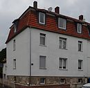
| Questenbergweg 5 51 ° 25 ′ 13 ″ N, 9 ° 39 ′ 12 ″ E |
Residential building |
|
||
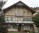
| Questenbergweg 9 51 ° 25 ′ 14 ″ N, 9 ° 39 ′ 11 ″ E |
Residential building |
|
||
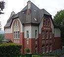
| Questenbergweg 34 51 ° 25 ′ 19 ″ N, 9 ° 39 ′ 24 ″ E |
villa |
|
||
| Radbrunnenstrasse 1 51 ° 24 ′ 54 ″ N, 9 ° 38 ′ 56 ″ E |
Ferry gate tower | Former tower of the city fortifications of Münden , used as a scrap tower from 1848–1980 , museum since 2000 |
|
|
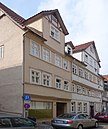
| Radbrunnenstrasse 13/15 51 ° 24 ′ 53 ″ N, 9 ° 39 ′ 1 ″ E |
Residential building |
|
||
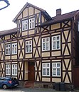
| Radbrunnenstrasse 19 51 ° 24 ′ 54 ″ N, 9 ° 38 ′ 59 ″ E |
Residential building |
|
||
| Radbrunnenstrasse 22 51 ° 24 ′ 54 ″ N, 9 ° 38 ′ 59 ″ E |
||||
| Radbrunnenstrasse 26 51 ° 24 ′ 54 ″ N, 9 ° 38 ′ 59 ″ E |
Residential building | |||
| Ritterstrasse 3 51 ° 24 ′ 55 ″ N, 9 ° 39 ′ 3 ″ E |
Residential building |

|
||
| Ritterstrasse 5 51 ° 24 ′ 55 ″ N, 9 ° 39 ′ 2 ″ E |
Residential building |

|
||
| Ritterstrasse 7 51 ° 24 ′ 55 ″ N, 9 ° 39 ′ 2 ″ E |
Residential building |

|
||
| Ritterstrasse 20 51 ° 24 ′ 56 ″ N, 9 ° 39 ′ 1 ″ E |
Residential building |

|
||
| Rosenstrasse 3 51 ° 24 ′ 58 ″ N, 9 ° 39 ′ 7 ″ E |
Residential building |

|
||
| Rosenstrasse 17 51 ° 24 ′ 57 ″ N, 9 ° 39 ′ 10 ″ E |
Residential building |

|
||
| Schlossplatz 51 ° 25 ′ 5 ″ N, 9 ° 39 ′ 16 ″ E |
Welfenschloss Münden | The Welfenschloss Münden was part of the medieval city fortifications of Münden. The palace complex, which today consists of two wings, was built in the Gothic style from 1501. |

|
|
| Schmiedstrasse 13 51 ° 24 ′ 57 ″ N, 9 ° 39 ′ 1 ″ E |
Residential building |

|
||
| Siebenturmstrasse 9/11 51 ° 24 ′ 56 ″ N, 9 ° 38 ′ 58 ″ E |
Residential building |

|
||
| Siebenturmstrasse 12 51 ° 24 ′ 56 ″ N, 9 ° 38 ′ 58 ″ E |
Residential building |

|
||
| Siebenturmstrasse 13 51 ° 24 ′ 56 ″ N, 9 ° 38 ′ 58 ″ E |
Residential building |

|
||
| Speckstrasse 3 51 ° 25 ′ 7 ″ N, 9 ° 39 ′ 7 ″ E |
Residential building |

|
||
| Speckstrasse 6 51 ° 25 ′ 7 ″ N, 9 ° 39 ′ 6 ″ E |
Residential building |

|
||
| Stumpfeturmstrasse 7 51 ° 24 ′ 59 ″ N, 9 ° 38 ′ 55 ″ E |
Blunt tower | Former tower of the city fortifications of Münden |

|
|
| Sydekumstrasse 3 51 ° 25 ′ 7 ″ N, 9 ° 39 ′ 10 ″ E |
New Sydekum | he building was erected in 1783 as a hotel. It has housed a mosque since 2000. |

|
|
| Sydekumstrasse 8 51 ° 25 ′ 7 ″ N, 9 ° 39 ′ 10 ″ E |
Residential building | Haus Ochsenkopf was built as a late Gothic house in 1528 and renovated from 1976 to 1979. |

|
|
| Sydekumstrasse 13 51 ° 25 ′ 7 ″ N, 9 ° 39 ′ 12 ″ E |
Residential building |

|
||
| Sydekumstrasse 17 51 ° 25 ′ 6 ″ N, 9 ° 39 ′ 11 ″ E |
Residential building |

|
||
| Tanzwerder Strasse 9 51 ° 25 ′ 0 ″ N, 9 ° 39 ′ 0 ″ E |
Residential building |

|
||
| Tanzwerder Strasse 14 51 ° 25 ′ 0 ″ N, 9 ° 38 ′ 59 ″ E |
Residential building |

|
||
| Tanzwerder Strasse 17 51 ° 25 ′ 0 ″ N, 9 ° 38 ′ 57 ″ E |
Residential building |

|
||
| Tanzwerder Strasse 19 51 ° 25 ′ 0 ″ N, 9 ° 38 ′ 57 ″ E |
Residential building |

|
||
| Tanzwerder Strasse 22 51 ° 25 ′ 1 ″ N, 9 ° 38 ′ 56 ″ E |
Residential building |

|
||
| Tanzwerder Strasse 23 51 ° 25 ′ 0 ″ N, 9 ° 38 ′ 56 ″ E |
Residential building |

|
||
| 51 ° 25 ′ 1 ″ N, 9 ° 38 ′ 36 ″ E | Tillyschanze | The Tillyschanze is a 25 meter high observation tower on the hill of the wooded Rabanenkopf in the Reinhardswald, about 90 meters above Hann. Münden. It offers a view of the old town of the place. |

|
|
| Tillyschanzenweg 1 51 ° 24 ′ 48 ″ N, 9 ° 38 ′ 38 ″ E |
Residential building |

|
||
| Tillyschanzenweg 4 51 ° 24 ′ 50 ″ N, 9 ° 38 ′ 37 ″ E |
Former officers' mess |

|
||
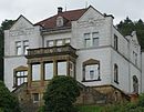
| Veckenhäger Strasse 27 51 ° 25 ′ 10 ″ N, 9 ° 38 ′ 39 ″ E |
villa |
|
||
| Veckenhäger Strasse 41 51 ° 25 ′ 14 ″ N, 9 ° 38 ′ 35 ″ E |
Residential building |

|
||
| Veckenhäger Strasse 49 51 ° 25 ′ 16 ″ N, 9 ° 38 ′ 34 ″ E |
Residential building |

|
||
| Veckenhäger Strasse 65 51 ° 25 ′ 21 ″ N, 9 ° 38 ′ 30 ″ E |
Residential building |

|
||
| Before orbit 9 51 ° 24 '47 "N, 9 ° 39' 28" E |
Residential building | |||
| In front of the castle 3/5 51 ° 25 ′ 5 ″ N, 9 ° 39 ′ 11 ″ E |
Residential building |

|
||
| In front of the castle 7 51 ° 25 ′ 5 ″ N, 9 ° 39 ′ 11 ″ E |
Residential building | |||
| In front of the castle 13 51 ° 25 ′ 5 ″ N, 9 ° 39 ′ 12 ″ E |
Residential building |

|
||
| In front of the castle 15 51 ° 25 ′ 5 ″ N, 9 ° 39 ′ 11 ″ E |
Residential building |

|
||
| In front of the castle 19 51 ° 25 ′ 6 ″ N, 9 ° 39 ′ 11 ″ E |
Residential building |

|
||
| Wall 2 51 ° 24 ′ 55 "N, 9 ° 39 ′ 14" E |
Residential building | |||
| Wall 3 51 ° 24 ′ 55 ″ N, 9 ° 39 ′ 14 ″ E |
Residential building |

|
||
| Wall 4 51 ° 24 ′ 55 ″ N, 9 ° 39 ′ 13 ″ E |
Residential building | |||
| Wall 7 51 ° 24 ′ 53 ″ N, 9 ° 39 ′ 6 ″ E |
Residential building |

|
||
| Wall 9 51 ° 24 ′ 53 ″ N, 9 ° 39 ′ 12 ″ E |
Residential building |

|
||
| Wall 12 51 ° 24 ′ 55 ″ N, 9 ° 39 ′ 11 ″ E |
villa |

|
||
| Rampart | ||||
| Wanfrieder Schlagd 51 ° 25 ′ 8 ″ N, 9 ° 39 ′ 5 ″ E |
Street train | The Wanfrieder Schlagd is an approximately 130 meter long street in the old town that runs parallel to the banks of the Werra. For centuries it served as a ship landing stage, goods handling and trading center. |

|
|
| Old Werra Bridge 51 ° 25 ′ 9 ″ N, 9 ° 39 ′ 10 ″ E |
Old Werra Bridge | 105 meter long stone arch bridge over the Werra , which was probably built around 1250 and first mentioned in a document in 1329. |

|
|
| Wilhelmshäuserstraße 51 ° 24 ′ 21 ″ N, 9 ° 38 ′ 23 ″ E |
Kurhessen barracks | Ensemble protection |

|
|
| Wilhelmshäuserstraße 20 51 ° 24 ′ 46 ″ N, 9 ° 38 ′ 39 ″ E |
Neumünden municipal cemetery | The Neumünden municipal cemetery is a historic cemetery, some of which is only used for urn burials. It was inaugurated on September 11, 1882 after the old cemetery on Bahnhofstrasse (now Wall) was closed. |

|
|
| Wilhelmshaeuser Strasse 64/66 51 ° 24 ′ 31 ″ N, 9 ° 38 ′ 35 ″ E |
Administration building |

|
||
| Wilhelmstrasse 13 51 ° 24 ′ 52 ″ N, 9 ° 39 ′ 18 ″ E |
Residential building |

|
||
| Wilhelmstrasse 24 51 ° 24 ′ 50 ″ N, 9 ° 39 ′ 11 ″ E |
villa |

|
||
| Wilhelmstrasse 27 51 ° 24 ′ 48 ″ N, 9 ° 39 ′ 13 ″ E |
villa |

|
||
| Woorthweg 7 51 ° 24 ′ 42 ″ N, 9 ° 39 ′ 13 ″ E |
Residential building |

|
||
| Ziegelstrasse 2 51 ° 25 ′ 4 ″ N, 9 ° 39 ′ 3 ″ E |
Residential building |

|
||
| Ziegelstrasse 4 51 ° 25 ′ 4 ″ N, 9 ° 39 ′ 3 ″ E |
Residential building |

|
||
| Ziegelstrasse 6 51 ° 25 ′ 3 ″ N, 9 ° 39 ′ 3 ″ E |
Residential building |

|
||
| Ziegelstrasse 14 51 ° 25 ′ 2 ″ N, 9 ° 39 ′ 3 ″ E |
Residential building |

|
||
| Ziegelstrasse 39 51 ° 24 ′ 58 ″ N, 9 ° 39 ′ 1 ″ E |
Residential building |

|
||
| Ziegelstrasse 41 51 ° 24 ′ 58 ″ N, 9 ° 39 ′ 1 ″ E |
Residential building |

|
||
| Ziegelstrasse 45 51 ° 24 ′ 57 ″ N, 9 ° 39 ′ 1 ″ E |
Residential building |

|
||
| Ziegelstrasse 48 51 ° 24 ′ 57 ″ N, 9 ° 39 ′ 0 ″ E |
Residential building |

|
||
| Ziegelstrasse 49 51 ° 24 ′ 57 ″ N, 9 ° 39 ′ 0 ″ E |
Residential building |

|
||
| Ziegelstrasse 56 51 ° 24 ′ 55 ″ N, 9 ° 39 ′ 0 ″ E |
Residential building |

|
||
| Ziegelstrasse 66 51 ° 24 ′ 54 ″ N, 9 ° 38 ′ 59 ″ E |
Residential building | Built around 1400 |

|
|
| Ziegelstrasse 82 51 ° 24 ′ 54 ″ N, 9 ° 39 ′ 0 ″ E |
Residential building |
literature
- Monument topography Federal Republic of Germany , architectural monuments in Lower Saxony, Göttingen district, part 1, volume 5.2, 1993, editors Urs Boeck , Peter F. Lufen and Walter Wulf, CW Niemeyer book publishers , Hameln, ISBN 3-87585-251-6
Web links
Commons : Architectural monuments in Hann. Münden - collection of pictures, videos and audio files
- List of architectural monuments in the land use plan Hann. Münden from November 22, 2001, p. 87ff (pdf)
- 574 house lanes ... The houses in Hann. Mündens core city
Individual evidence
- ↑ Monument topography of the Federal Republic of Germany, architectural monuments in Lower Saxony, Göttingen district, part 1, volume 5.2, 1993, editors Urs Boeck, Peter F. Lufen and Walter Wulf, Verlag CW Niemeyer Buchverlage, Hameln, pages 126 and 165, ISBN 3-87585-251 -6
- ↑ Monument topography of the Federal Republic of Germany, architectural monuments in Lower Saxony, Göttingen district, part 1, volume 5.2, 1993, editors Urs Boeck, Peter F. Lufen and Walter Wulf, Verlag CW Niemeyer Buchverlage, Hameln, pages 126 and 165, ISBN 3-87585-251 -6
- ↑ Monument topography of the Federal Republic of Germany, architectural monuments in Lower Saxony, Göttingen district, part 1, volume 5.2, 1993, editors Urs Boeck, Peter F. Lufen and Walter Wulf, Verlag CW Niemeyer Buchverlage, Hameln, pages 126 and 165, ISBN 3-87585-251 -6
- ↑ Monument topography of the Federal Republic of Germany, architectural monuments in Lower Saxony, Göttingen district, part 1, volume 5.2, 1993, edited by Urs Boeck, Peter F. Lufen and Walter Wulf, Verlag CW Niemeyer Buchverlage, Hameln, pages 174–175, ISBN 3-87585-251 -6
- ↑ Freemason Lodge , on the homepage www.denkmalkunst-kunstdenkmal.de/ (accessed on October 22, 2015).
- ^ Since October 17, 1996 lower. Architectural and cultural monument , on the homepage freimaurerloge-pythagoras.de/ (accessed on October 22, 2015).
- ↑ Monument topography Federal Republic of Germany, architectural monuments in Lower Saxony, district of Göttingen, part 1, volume 5.2, 1993, editors Urs Boeck, Peter F. Lufen and Walter Wulf, Verlag CW Niemeyer Buchverlage, Hameln, page 1128, ISBN 3-87585-251-6
- ↑ Monument topography of the Federal Republic of Germany, architectural monuments in Lower Saxony, Göttingen district, part 1, volume 5.2, 1993, editors Urs Boeck, Peter F. Lufen and Walter Wulf, Verlag CW Niemeyer Buchverlage, Hameln, page 141, ISBN 3-87585-251-6
- ↑ Data sheet for house number 450, Hinter der Stadtmauer 2 (Badstoven) at 574 house lanes ...
- ↑ Data server for house number 450, Hinter der Stadtmauer 2 (Badstoven) ( Memento of the original from August 31, 2011 in the Internet Archive ) Info: The archive link was automatically inserted and not yet checked. Please check the original and archive link according to the instructions and then remove this notice. with 574 house lanes ...

