List of architectural monuments in Ebergötzen
In the list of architectural monuments in Ebergötzen , all listed buildings of the Lower Saxony municipality of Ebergötzen ( district of Göttingen ) are listed. The list was in 1997.
General
Ebergötzen was first mentioned in a document as Evergotesham in 1013.
The columns contain the following information:
- Location: the address of the monument and the geographical coordinates . Map view to set coordinates . In the map view, monuments without coordinates are shown with a red marker and can be set on the map. Architectural monuments without a picture are marked with a blue marker, architectural monuments with a picture with a green marker.
- Official name: Name of the monument
- Description: the description of the monument. Under § 3 (2) NDSchG individual monuments and under § 3 (3) NDSchG groups of structures and their components are shown.
- ID: the number of the monument
- Image: a picture of the monument
Boar idols
| location | designation | description |
ID |
image |
|---|---|---|---|---|
| Göttinger Strasse 7 51 ° 34 ′ 8 ″ N, 10 ° 5 ′ 59 ″ E |
Former moated castle / Amtshof | The Radolfshausen Forestry Office was located here and the European Bread Museum is located here today . In 1508 Dietrich von Plesse built a moated castle. But this was destroyed in the Thirty Years War. |

|
|
| Göttinger Strasse 8 51 ° 34 ′ 12 ″ N, 10 ° 5 ′ 59 ″ E |
Residential building | |||
| Herzberger Strasse 51 ° 34 ′ 18 ″ N, 10 ° 6 ′ 27 ″ E |
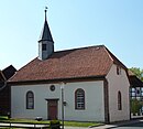
Evangelical Church of St. Cosmas and Damian | The Protestant church was built in 1772. It is a plastered hall building, the west tower takes up almost the entire width of the church. The broad square tower thus shapes the image of the church. |

|
|
| Herzberger Straße 35 |
Residential building | Former school house, built in 1830 |

|
|
| Herzberger Straße 38 |
Rectory | Former rectory of the Protestant church. Two-storey half-timbered building with a crooked hip roof in an exposed location. Designed in 1793 by Georg Heinrich Borheck and OL Scheidemann |

|
|
| Hohler Graben 5 |
court | |||
| Hollow Path 2 51 ° 34 ′ 20 ″ N, 10 ° 6 ′ 32 ″ E |
court | The farm's house is the oldest house in the village. It was built at the end of the 16th century. |

|
|
| Lindenweg 51 ° 34 ′ 2 ″ N, 10 ° 5 ′ 56 ″ E |
Sandstone bridge |

|
||
| Mühlengasse 8 |
Residential building | |||
| 51 ° 34 ′ 13 ″ N, 10 ° 6 ′ 24 ″ E | Niedermühle | The mill is also known as the Wilhelm-Busch-Mühle or Herrenmühle. The mill was probably built in the 18th century. |

|
Holzerode
| location | designation | description |
ID |
image |
|---|---|---|---|---|
| Dorfstrasse 1 51 ° 35 ′ 43 ″ N, 10 ° 3 ′ 52 ″ E |
Residential building | |||
| Dorfstrasse 2 51 ° 35 ′ 44 ″ N, 10 ° 3 ′ 53 ″ E |
Residential building | |||
| Dorfstrasse 18 51 ° 35 ′ 48 ″ N, 10 ° 3 ′ 48 ″ E |
Residential building | |||
| Dorfstraße 20 |
Residential building | |||
| Dorfstraße 21 |
Evangelical Reformed Church | Built in 1738. Triaxial rectangular hall with portal on the southern long side. Roof with half hips on the narrow sides and roof turrets on the west side. Inside organ from 1840. |

|
|
| Dorfstraße 23 |
Residential houses | Simple, two-storey half-timbered house with a half-hip, inscribed from 1825. Former village school. |

|
|
| Hünstollenstraße 15 |
Residential building | |||
| 51 ° 35 ′ 15 "N, 10 ° 2 ′ 57" E | Mouse tower | The mouse tower is the steeple of the former St. Crucis church in the deserted village of Moseborn (see below). It is 13 meters high and has a footprint of 5.65 meters by 6.20 meters. |

|
|
| Mühlenstraße 4 |
Residential building | |||
| Mühlenstraße 15 |
Residential building | |||
| Obere Straße 23 51 ° 35 ′ 48 ″ N, 10 ° 3 ′ 40 ″ E |
Residential building | |||
| 51 ° 35 ′ 15 "N, 10 ° 2 ′ 57" E | Moseborn desert | The desert is located one kilometer southwest of Holzerode. The village of Moseborn was probably in the 12./13. Founded in the 17th century and fell desolate in the late Middle Ages. The only remnant is the mouse tower (see above). |
literature
- Monument topography Federal Republic of Germany, architectural monuments in Lower Saxony, district Göttingen, part 2, volume 5.3, 1997, edited by Peter Ferdinand Lufen, published by Christiane Segers-Glocke, Verlag CW Niemeyer Buchverlage , Hameln, ISBN 3-8271-8257-3
Web links
Commons : Architectural monuments in Ebergötzen - collection of images, videos and audio files

