List of architectural monuments in Friedland (Lower Saxony)
In the list of architectural monuments in Friedland , all listed buildings of the Lower Saxon community Friedland ( district of Göttingen ) are listed. The list is as of 1997.
General
Friedland became known through the border transit camp .
The columns contain the following information:
- Location: the address of the monument and the geographical coordinates . Map view to set coordinates . In the map view, monuments without coordinates are shown with a red marker and can be set on the map. Architectural monuments without a picture are marked with a blue marker, architectural monuments with a picture with a green marker.
- Official name: Name of the monument
- Description: the description of the monument. Under § 3 (2) NDSchG individual monuments and under § 3 (3) NDSchG groups of structures and their components are shown.
- ID: the number of the monument
- Image: a picture of the monument
Ballenhausen
| location | designation | description |
ID |
image |
|---|---|---|---|---|
| Bodenhausen castle ruins | Burgstall as a hill with a moat. |

|
||
| Forester's house Hasenwinkel | ||||
| Heerstraße 2 |
court |

|
||
| Heerstraße 6 |
Residential building | Former Meierhof, two-storey half-timbered building under a gable roof with a crooked hip from 1801/02 with an exposed location on Heerstraße |

|
|
| Heerstraße 10 |
Residential building | |||
| Johannisstraße |
Tie | |||
| Johannisstrasse 1 51 ° 27 ′ 18 ″ N, 9 ° 56 ′ 59 ″ E |
St. John's Church |

|
||
| Rhienstraße 17 |
Residential building |
Deiderode
| location | designation | description |
ID |
image |
|---|---|---|---|---|
| At Bühgraben 6 |
court | |||
| Well width 2 |
Residential building | |||
| Well width 4 |
Residential building | |||
| Well width 9 51 ° 25 ′ 20 ″ N, 9 ° 51 ′ 49 ″ O |
church | Single-aisle Gothic rectangular building with three-bay ribbed vaults, ornate Gothic portal from the 14th century and remains of late Gothic paintings |

|
|
| Well width 51 ° 25 ′ 21 ″ N, 9 ° 51 ′ 47 ″ E |
Tie |

|
Elkershausen
| location | designation | description |
ID |
image |
|---|---|---|---|---|
| Kastanienstraße 51 ° 25 ′ 23 ″ N, 9 ° 53 ′ 32 ″ E |
Tie |

|
||
| Kastanienstraße 1 51 ° 25 ′ 19 ″ N, 9 ° 53 ′ 33 ″ E |
Residential building |

|
||
| Kastanienstraße 2 51 ° 25 ′ 19 ″ N, 9 ° 53 ′ 33 ″ E |
Residential building |

|
||
| Kastanienstraße 9 51 ° 25 ′ 23 ″ N, 9 ° 53 ′ 31 ″ E |
church | Ev.-luth. Parish church of St. Nicolaus, built in 1836/37 as a hall church made of quarry stone masonry with corner blocks and edging of round arched windows made of ashlar. Tower-like gable turret above the western front. |

|
|
| Kastanienstraße 11 51 ° 25 ′ 24 ″ N, 9 ° 53 ′ 28 ″ E |
court |

|
||
| Kastanienstraße 12 |
Residential building |

|
||
| To the oak forest 1 51 ° 25 ′ 29 ″ N, 9 ° 53 ′ 25 ″ E |
Residential house with bakery |

|
||
| Second 3 |
Residential building |
Friedland
| location | designation | description |
ID |
image |
|---|---|---|---|---|
| Am Alten Schulplatz 1 51 ° 25 ′ 8 ″ N, 9 ° 55 ′ 9 ″ E |
Residential and farm buildings |

|
||
| Am Alten Schulplatz 4 51 ° 25 ′ 8 ″ N, 9 ° 55 ′ 11 ″ E |
Residential building |

|
||
| At the old school place 5 51 ° 25 ′ 8 ″ N, 9 ° 55 ′ 12 ″ E |
church | Simple hall church made of quarry stone, built at the end of the 17th century, is said to contain older parts |
 More pictures |
|
| At the old school square 6 51 ° 25 ′ 7 ″ N, 9 ° 55 ′ 11 ″ E |
Residential building |

|
||
| 51 ° 25 ′ 14 "N, 9 ° 54 ′ 58" E | Bridge over the Mühlengraben | Sandstone arch bridge from the last third of the 19th century |

|
|
| 51 ° 25 ′ 24 "N, 9 ° 54 ′ 42" E | Border transit camp | The camp was put into operation on September 20, 1945. Hundreds of thousands of former prisoners of war were taken into the camp. Later repatriates from the GDR were received. |
 More pictures |
|
| Leinestrasse 6 51 ° 25 ′ 9 ″ N, 9 ° 55 ′ 5 ″ E |
Residential house with bakery |

|
||
| Leinestrasse 8 |
Residential building | |||
| Leinestrasse 10 51 ° 25 ′ 4 ″ N, 9 ° 55 ′ 7 ″ E |
Mill | Mill building belonging to the Amtshof. 1389 first documented mention of the previous building, today's building erected in 1747 and rebuilt several times, heightening and roof in 1922 |

|
|
| 51 ° 25 ′ 16 ″ N, 9 ° 55 ′ 10 ″ E | Sandstone arch bridge | Built around 1870 as part of the expansion of the Chaussee (today B 27) |

|
|
| Schlossstrasse 11 51 ° 25 ′ 7 ″ N, 9 ° 54 ′ 57 ″ E |
Amtshof | Administrative seat and farm yard of the former Friedland office, built between 1740 and 1750 |

|
|
| Schlossstrasse 12 51 ° 25 ′ 5 ″ N, 9 ° 54 ′ 53 ″ E |
Court house | Built around 1820, seat of the Friedland District Court until 1859 |

|
|
| Witzenhäuser Straße 2 |
Residential building |
Big snow
| location | designation | description |
ID |
image |
|---|---|---|---|---|
| At Mühlenberg 1 |
Residential building | |||
| At Mühlenberg 3A |
Residential building | |||
| Gänseanger 6 |
Residential building | |||
| Country road 6 |
Residential building | |||
| Lappstraße 4 |
Residential building | |||
| Lappstraße 8 |
Residential building | |||
| Ludolfshauser Straße 16 |
||||
| Michaelisstrasse 12 51 ° 26 ′ 16 ″ N, 9 ° 55 ′ 39 ″ E |
Parish church | Ev.-luth. St. Michaelis Church. Medieval west tower, hall building rebuilt in 1701/07 after destruction in the Thirty Years War, including older parts |

|
|
| Petrosilienstraße 8 |
Residential building | |||
| Petrosilienstraße 10 |
Residential building | |||
| Teichstraße |
Tie |

|
||
| Teichstraße 13 |
Residential building |
Small snow
| location | designation | description |
ID |
image |
|---|---|---|---|---|
| 3 on the wide stone |
Residential building | |||
| Friedländer Straße 12 |
court | |||
| Friedländer Straße 17/19 |
court | |||
| In Unterdorf 1 |
Residential building | |||
| In the Unterdorf 3 |
Residential building | |||
| K 27 51 ° 26 '23 "N, 9 ° 55' 1" E |
bridge |
![Bridge [1]](https://upload.wikimedia.org/wikipedia/commons/thumb/e/e5/Leinebruecke_Klein_Schneen.jpg/130px-Leinebruecke_Klein_Schneen.jpg)
|
||
| Lindenstraße 2 |
Residential building | |||
| Obernjesaer Straße 2 |
Residential building | |||
| Thiestrasse 2 51 ° 26 ′ 37 ″ N, 9 ° 54 ′ 22 ″ E |
||||
| Thiestrasse 10 51 ° 26 ′ 35 ″ N, 9 ° 54 ′ 19 ″ E |
Residential building | |||
| Thiestrasse 16 51 ° 26 ′ 33 ″ N, 9 ° 54 ′ 20 ″ E |
church | Ev.-luth. Church in the immediate vicinity of the manor. Core building from 1430 with an attached hall from 1775, remains of Gothic wall paintings inside. |

|
|
| Thiestrasse 18 51 ° 26 ′ 31 ″ N, 9 ° 54 ′ 19 ″ E |
Well |

|
||
| Thiestrasse 22 51 ° 26 ′ 34 ″ N, 9 ° 54 ′ 23 ″ E |
Residential building |
Lichtenhagen
| location | designation | description |
ID |
image |
|---|---|---|---|---|
| Am Försterberg 5 51 ° 25 ′ 43 ″ N, 10 ° 0 ′ 15 ″ E |
Former school | |||
| Am Försterberg 7 51 ° 25 ′ 40 ″ N, 10 ° 0 ′ 16 ″ E |
Residential building | |||
| Am Försterberg 8 51 ° 25 ′ 42 ″ N, 10 ° 0 ′ 19 ″ E |
Protestant church | Simple hall church with a polygonal choir. The current shape is based on changes made in the early 18th century |

|
|
| Am Försterberg 10 51 ° 25 ′ 39 ″ N, 10 ° 0 ′ 16 ″ E |
District forestry | Two-storey half-timbered building with a slight protrusion under a hipped mansard roof, built in the 2nd half of the 18th century |

|
|
| Am Försterberg 11 51 ° 25 ′ 38 ″ N, 10 ° 0 ′ 15 ″ E |
Residential building | |||
| Mahlmannstrasse 22 51 ° 25 ′ 42 ″ N, 10 ° 0 ′ 24 ″ E |
Residential building |
Ludolfshausen
| location | designation | description |
ID |
image |
|---|---|---|---|---|
| L 567 51 ° 25 ′ 29 "N, 9 ° 58 ′ 53" E |
Tie | Tie with trees that characterize the townscape |

|
|
| L 567 No. 2 51 ° 25 ′ 27 ″ N, 9 ° 58 ′ 45 ″ E |
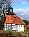
Protestant church | A simple half-timbered hall church with a hung west tower, largely replaced by plastered masonry in the west in 1958/59 |
|
|
| L 567 No. 14 |
court | |||
| L 567 No. 16 |
court | |||
| L 567 No. 24 |
court | |||
| L 567 No. 33 51 ° 25 ′ 31 ″ N, 9 ° 59 ′ 0 ″ E |
court | |||
| 51 ° 25 ′ 27 ″ N, 9 ° 59 ′ 13 ″ E | Sandstone bridge | Sandstone arch bridge over the Schleierbach, built in 1878, preserved in its original design |

|
Mollenfelde
| location | designation | description |
ID |
image |
|---|---|---|---|---|
| An der Landwehr 1 51 ° 24 ′ 32 ″ N, 9 ° 50 ′ 35 ″ E |
Protestant church | Small quarry stone church with a mediaeval east tower and an attached nave from the middle of the 18th century |

|
|
| At the Landwehr 3 |
court | |||
| Berlepscher Strasse 27 51 ° 24 ′ 4 ″ N, 9 ° 50 ′ 27 ″ E |
The European Bread Museum was located here until 2004 . | |||
| Deideröder Straße 2 |
court | |||
| Deideröder Straße 9 |
Residential building | |||
| Deideröder Straße 14 |
Residential house with bakery |
Niedergandern
| location | designation | description |
ID |
image |
|---|---|---|---|---|
| Niedergandern 11 51 ° 23 ′ 37 ″ N, 9 ° 56 ′ 15 ″ E |
court |

|
||
| Niedergandern 12 51 ° 23 ′ 35 ″ N, 9 ° 56 ′ 12 ″ E |
Well | The manor house was built between 1698 and 1702 instead of a house from around 1600. The house has eleven axes, two storeys and a hipped roof. The manor chapel is located south of the manor. It was built from 1807 to 1810 by Heinrich Bodo von Bodenhausen. |

|
|
| Niedergandern 12 51 ° 23 ′ 37 ″ N, 9 ° 56 ′ 13 ″ E |
Manor house of the estate | Part of the group "Gutsanlage von Bodenhausen, No. 12" |

|
|
| Niedergandern 12 51 ° 23 ′ 36 ″ N, 9 ° 56 ′ 13 ″ E |
former administrator's house | Part of the group "Gutsanlage von Bodenhausen, No. 12" |

|
|
| Niedergandern 12 51 ° 23 ′ 36 ″ N, 9 ° 56 ′ 14 ″ E |
Quarry stone enclosure | Part of the group "Gutsanlage von Bodenhausen, No. 12" |

|
|
| Niedergandern 12 51 ° 23 ′ 36 ″ N, 9 ° 56 ′ 12 ″ E |
Trees | Part of the group "Gutsanlage von Bodenhausen, No. 12" |

|
|
| Niedergandern 16 51 ° 23 ′ 33 ″ N, 9 ° 56 ′ 12 ″ E |
chapel | Part of the group "Gutsanlage von Bodenhausen, No. 12" |

|
|
| Niedergandern 12 51 ° 23 ′ 35 ″ N, 9 ° 56 ′ 8 ″ E |
Farm buildings | Part of the group "Gutsanlage von Bodenhausen, No. 12" |

|
|
| Niedergandern 12 51 ° 23 ′ 40 ″ N, 9 ° 56 ′ 12 ″ E |
park | Part of the group "Gutsanlage von Bodenhausen, No. 12" |

|
|
| Niedergandern 13, 15 51 ° 23 ′ 34 ″ N, 9 ° 56 ′ 16 ″ E |
Group "Landesstrasse 567 No. 13.15" | |||
| Niedergandern 13 51 ° 23 ′ 35 ″ N, 9 ° 56 ′ 15 ″ E |
court | Part of the group "Landesstrasse 567 No. 13.15" |

|
|
| Niedergandern 15 51 ° 23 ′ 34 ″ N, 9 ° 56 ′ 14 ″ E |
court | Part of the group "Landesstrasse 567 No. 15,17" |
Niedergandern / Besenhausen
| location | designation | description |
ID |
image |
|---|---|---|---|---|
| Besenhausen 1, 37133 Friedland (Lower Saxony) 51 ° 23 ′ 21 ″ N, 9 ° 57 ′ 3 ″ E |
Well | Besenhausen manor |
 More pictures |
Niedergandern / Hottenrode
| location | designation | description |
ID |
image |
|---|---|---|---|---|
| 51 ° 22 ′ 58 "N, 9 ° 56 ′ 35" E | Group "Friedhof Hottenrode" | 35229478 |
 More pictures |
|
| 51 ° 22 ′ 58 "N, 9 ° 56 ′ 35" E | Field Church Hottenrode | Part of the group "Friedhof Hottenrode" | 35254127 |
 More pictures |
| 51 ° 22 ′ 58 "N, 9 ° 56 ′ 35" E | graveyard | Part of the group "Friedhof Hottenrode" | 35254149 |
 More pictures |
Niedernjesa
| location | designation | description |
ID |
image |
|---|---|---|---|---|
| Drive 51 ° 28 ′ 34 ″ N, 9 ° 55 ′ 35 ″ E |
church | Ev.-luth. Church of St. Laurentius with a mediaeval east tower and a plastered hall building attached to the west according to plans by O. Praël 1855 |

|
|
| Drive 4 51 ° 28 ′ 35 ″ N, 9 ° 55 ′ 35 ″ E |
school |
|
||
| Drive 8 51 ° 28 ′ 34 ″ N, 9 ° 55 ′ 36 ″ E |
Rectory | Two-storey half-timbered house under a hipped roof |

|
|
| Klothgasse 4 51 ° 28 ′ 42 ″ N, 9 ° 55 ′ 28 ″ E |
court |
|
||
| Winkelstrasse 2 51 ° 28 ′ 32 ″ N, 9 ° 55 ′ 32 ″ E |
court |
|
||
| Winkelstrasse 13 51 ° 28 ′ 28 ″ N, 9 ° 55 ′ 30 ″ E |
court |
|
||
| To the island / drive 51 ° 28 ′ 34 ″ N, 9 ° 55 ′ 32 ″ E |
Tie | Exposed place with sandstone wall border, Tiestein and old linden tree |

|
|
| To island 3 51 ° 28 ′ 32 ″ N, 9 ° 55 ′ 27 ″ E |
Residential building |
|
Niedernjesa / Reinshof
| location | designation | description |
ID |
image |
|---|---|---|---|---|
| 51 ° 29 ′ 51 ″ N, 9 ° 55 ′ 52 ″ E | Gut Reinshof | The former Vorwerk of the Weende monastery estate, which emerged from a village settlement, has been an independent estate since 1890 |
 More pictures |
Reckershausen
| location | designation | description |
ID |
image |
|---|---|---|---|---|
| At Tieberg 1 |
Residential building | |||
| At the Tieberg 4 |
Residential building | |||
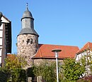
| Am Tieberg 7 51 ° 24 ′ 30 ″ N, 9 ° 56 ′ 17 ″ E |
church |
|
||
| At Tieberg 12 |
court | |||
| Am Tieberg / Dorfstrasse 51 ° 24 ′ 28 ″ N, 9 ° 56 ′ 13 ″ E |
Tie |

|
||
| Dorfstraße 1 |
Residential building | |||
| Dorfstraße 9 |
Residential building | |||
| Dorfstraße 15 |
Residential building | |||
| Dorfstraße 23 |
Residential building | |||
| Dorfstraße 30 |
Residential building | |||
| Heiligenstädter Strasse 1 51 ° 24 ′ 18 ″ N, 9 ° 56 ′ 5 ″ E |
Group "Gutshof von Reckershausen" | |||
| Heiligenstädter Strasse 1 51 ° 24 ′ 18 ″ N, 9 ° 56 ′ 6 ″ E |
Mansion | Part of the group "Gutshof von Reckershausen" |

|
|
| Heiligenstädter Strasse 1 51 ° 24 ′ 19 ″ N, 9 ° 56 ′ 4 ″ E |
barn | Part of the group "Gutshof von Reckershausen" |

|
|
| Heiligenstädter Strasse 1 51 ° 24 ′ 17 ″ N, 9 ° 56 ′ 3 ″ E |
barn | Part of the group "Gutshof von Reckershausen" | ||
| Heiligenstädter Strasse 1 51 ° 24 ′ 18 ″ N, 9 ° 56 ′ 5 ″ E |
Storage | Part of the group "Gutshof von Reckershausen" | ||
| Madeburg |
Former castle | |||
| Märzhäuser Strasse 2 51 ° 24 ′ 20 ″ N, 9 ° 56 ′ 4 ″ E |
barn |

|
||
| Rosenwinkel 3 |
Residential building | |||
| 51 ° 24 '17 "N, 9 ° 55' 53" E | Sandstone bridge | Arched bridge over the Leine, built of red sandstone with a closed parapet, inscribed dated 1821 |

|
Reiffenhausen
| location | designation | description |
ID |
image |
|---|---|---|---|---|
| At Lindenberg 4 |
Residential building | |||
| Bachstraße 17 |
Residential building | |||
| Bachstraße 21 |
Residential building | |||
| Bachstraße 22 |
Residential building | |||
| Bachstraße 24 |
Residential building | |||
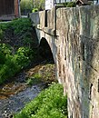
| bridge |
|
|||
| Kirchstraße 9 |
Residential building | |||
| Kirchstrasse 10 51 ° 24 ′ 26 ″ N, 9 ° 58 ′ 11 ″ E |
church | Basically a medieval church with structural changes from the 18th century, tower dated 1796, nave dated 1742; Baroque fittings inside |

|
|
| Kirchstraße 11 |
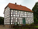
Rectory | Two-storey half-timbered house with a half-hipped roof on a sandstone ashlar base, built at the end of the 19th century |
|
|
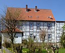
| Kirchstraße 12 |
Residential building |
|
||
| Kirchstraße 20 |
Residential building | |||
| Seibigstraße 1 |
Residential building | |||
| Seibigstraße 10 |
Residential building | |||
| Seibigstraße 12 |
Residential building | |||
| Seibigstraße 15 |
Residential building | |||
| Talstraße 1 |
Residential building | |||
| Talstraße 2 |
Residential building | |||
| Talstraße 15 |
Residential building | |||
| Talstraße 19 |
Residential building | |||
| Tiestrasse 51 ° 24 ′ 31 ″ N, 9 ° 58 ′ 16 ″ E |
Tie |

|
Stockhausen
| location | designation | description |
ID |
image |
|---|---|---|---|---|
| Göttinger Straße 3 |
court | |||
| Göttinger Straße 19 |
Residential building | |||
| Göttinger Straße 20 |
Residential building | |||
| Göttinger Straße 26 |
school | |||
| Göttinger Strasse 28 51 ° 27 ′ 36 ″ N, 9 ° 55 ′ 55 ″ E |
church | The ev.-luth. Church of St. Bonifatius is a simple, rectangular hall building with a gable on the west side. The three-axis solid building with corner blocks was intended for plastering and dates from the middle of the 18th century. The church is in the area of the cemetery. |

|
|
| 51 ° 27 '38 "N, 9 ° 55' 53" E | Leine bridge |

|
literature
- Monument topography Federal Republic of Germany, architectural monuments in Lower Saxony, district Göttingen, part 2, volume 5.3, 1997, edited by Peter Ferdinand Lufen, published by Christiane Segers-Glocke, Verlag CW Niemeyer Buchverlage , Hameln, ISBN 3-8271-8257-3
Individual evidence
- ↑ This object is not mentioned in the text part of the monument topography. It is marked as a monument on the map on page 61
Web links
Commons : Baudenkmale in Friedland (Lower Saxony) - Collection of images, videos and audio files

