List of architectural monuments in Niemetal
In the list of architectural monuments in Niemetal , all listed buildings of the Lower Saxony community of Niemetal ( district of Göttingen ) are listed. The list is as of 1993.
General
Niemetal was created on January 1, 1973 from the communities of Ellershausen near Münden, Imbsen, Löwenhagen and Varlose.
The columns contain the following information:
- Location: the address of the monument and the geographical coordinates . Map view to set coordinates . In the map view, monuments without coordinates are shown with a red marker and can be set on the map. Architectural monuments without a picture are marked with a blue marker, architectural monuments with a picture with a green marker.
- Official name: Name of the monument
- Description: the description of the monument. Under § 3 (2) NDSchG individual monuments and under § 3 (3) NDSchG groups of structures and their components are shown.
- ID: the number of the monument
- Image: a picture of the monument
Ellershausen
| location | designation | description |
ID |
image |
|---|---|---|---|---|
| Haardstraße 1 |
Residential building | |||
| Haardstraße 16 |
Residential building | |||
| Long road 8 |
Residential building | |||
| Long street 16 |
Residential building | |||
| Long road 17 |
Residential building | |||
| Long road 20 |
Residential building | |||
| Lange Straße 34–44 |
Residential building | This group of half-timbered houses was almost completely built in the second half of the 19th century. | ||
| Lange Straße 49 51 ° 30 ′ 37 ″ N, 9 ° 40 ′ 42 ″ E |
Residential building | |||
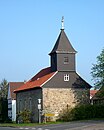
| 51 ° 30 ′ 37 "N, 9 ° 40 ′ 59" E | church | The church was built in 1801. It is a simple building with three axes, there is a gable turret on the roof. The baptism from the middle of the 18th century probably comes from the previous building. |

|
Snacks
| location | designation | description |
ID |
image |
|---|---|---|---|---|
| Well |

|
|||
| Dorfstraße 11 |
Residential building | |||
| Dorfstrasse 15 51 ° 31 ′ 17 ″ N, 9 ° 43 ′ 36 ″ E |
Residential building | |||
| Dorfstraße 19 |
barn | |||
| 51 ° 31 '17 "N, 9 ° 43' 40" E | church |

|
Löwenhagen
| location | designation | description |
ID |
image |
|---|---|---|---|---|
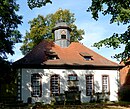
| Estate | The manor house was built in 1905 in a historicizing style, the surrounding manor park with the hereditary burial of the Lords of Stockhausen was established around 1900. The estate also includes the "Alte Park" and an outbuilding on Kohlenbergstrasse. |

|
||
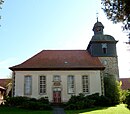
| 51 ° 31 ′ 15 "N, 9 ° 42 ′ 20" E | St. Michael Church | The rectangular church was built in 1792. The client was the then patron Ernst Friedrich Christian Börries von Stockhausen. The church has five axes and there is a ridge turret on the hipped roof. The interior is from the construction period. |

|
|
| Niemetalstraße 14 |
court | |||
| Niemetalstraße 17 |
court | |||
| Niemetalstraße 22 |
court | |||
| Niemetalstraße 26 |
court | |||
| Schulstrasse 3 51 ° 31 ′ 15 ″ N, 9 ° 42 ′ 9 ″ E |
Former school | The former school was built around 1900. Today there is a kindergarten here. |
Varlose
| location | designation | description |
ID |
image |
|---|---|---|---|---|
| Bührer Straße 4 |
Residential building | elongated, two-story half-timbered building, built in 1671 |

|
|
| Bührer Straße 6 |
Residential building | |||
| Bührer Straße 7 |
Residential building | |||
| Bührer Straße 8 |
Residential building | |||
| Bührer Straße 10 |
Residential building | |||
| Bührer Straße 15 |
Residential building | |||
| Bührer Straße 17 |
Residential building | |||
| Hinterdorfstraße 6 |
Residential building | |||
| Hinterdorfstraße 10 |
Residential building | |||
| Hinterdorfstraße 14 |
Residential building | |||
| Hinterdorfstraße 31 |
Residential building | |||
| At an angle of 2 51 ° 30 ′ 11 "N, 9 ° 42 ′ 37" E |
Residential building | |||
| In the angle 3 |
Residential building | |||
| In the angle 5 |
Residential building | |||
| 51 ° 30 ′ 7 "N, 9 ° 42 ′ 52" E | St. Michael Church | The church was built in 1794, the previous building was demolished. The church has five axes, the west tower adjoins the hall. The tower has a Welsche hood with a lantern. Inside there is an organ by the organ builder Johann Stephan Heeren from 1791. |

|
|
| Löwenhagener Straße 1 |
Residential building | |||
| Löwenhagener Straße 4 |
Residential building | |||
| Mitteldorfstraße 6 |
Residential building | |||
| Mitteldorfstraße 9 |
Residential building | |||
| Mitteldorfstraße 20 |
Residential building | |||
| Mitteldorfstraße 21 |
Residential building | |||
| Mitteldorfstraße 22 |
Residential building | |||
| Mitteldorfstraße 24 |
Residential building |
literature
- Monument topography Federal Republic of Germany . Architectural monuments in Lower Saxony, Göttingen district, part 1, volume 5.2, 1993, edited by Urs Boeck , Peter F. Lufen and Walter Wulf, Verlag CW Niemeyer Buchverlage , Hameln, ISBN 3-87585-251-6
Web links
Commons : Architectural monuments in Niemetal - collection of images, videos and audio files

