List of architectural monuments in Adelebsen
In the list of monuments in Adelebsen all listed buildings are of Lower Saxony patch Adelebsen ( Göttingen district ) listed. This consists of the core town of Adelebsen and the districts of Barterode , Eberhausen , Erbsen , Güntersen , Lödingsen and Wibbecke . The list is as of 1993.
General
The columns contain the following information:
- Location: the address of the monument and the geographical coordinates . Map view to set coordinates . In the map view, monuments without coordinates are shown with a red marker and can be set on the map. Architectural monuments without a picture are marked with a blue marker, architectural monuments with a picture with a green marker.
- Official name: Name of the monument
- Description: the description of the monument. Under § 3 (2) NDSchG individual monuments and under § 3 (3) NDSchG groups of structures and their components are shown.
- ID: the number of the monument
- Image: a picture of the monument
Adelebsen
| location | designation | description |
ID |
image |
|---|---|---|---|---|
| 51 ° 34 ′ 39 "N, 9 ° 44 ′ 55" E | Castle complex (Adelebsen Castle) | The castle was built in the 13th century. The castle burned down in 1466, and there was further damage in the Thirty Years' War. Reconstruction began in 1650 and the castle was expanded into a palace. |
 More pictures |
|
| 51 ° 34 ′ 37 ″ N, 9 ° 45 ′ 1 ″ E | Gutsanlage, "Hubensackhaus" | The manor complex below the castle includes the so-called Hubensackhaus, a two-storey former farm workers' house in half-timbered construction with a high gable roof, which served as a storage facility. The house was built in the second half of the 18th century using an older timber frame from the 17th century. |

|
|
| 51 ° 34 ′ 33 "N, 9 ° 44 ′ 27" E | Jewish Cemetery | The cemetery was occupied from 1733 to 1948. There are 229 tombstones in the cemetery. |
 More pictures |
|
| 51 ° 34 ′ 21 ″ N, 9 ° 42 ′ 22 ″ E | Chapel ruin | The chapel ruin belongs to the Reinhardeshagen desert . |
 More pictures |
|
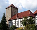
| 51 ° 34 ′ 42 "N, 9 ° 45 ′ 0" E | St. Martini Church | The church was built in the 13th century. The church has been rebuilt several times over the years. |
 More pictures |
|
| Lange Straße 1 51 ° 34 ′ 44 ″ N, 9 ° 45 ′ 9 ″ E |
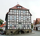
town hall | Stately half-timbered building on a high sandstone ashlar base in the line of sight of Langen Straße, built in 1827. Slate-hung on the southeast side, two-flight sandstone staircase on the northwestern gable side |

|
|
| Lange Straße 9 51 ° 34 ′ 45 ″ N, 9 ° 45 ′ 11 ″ E |
Residential building |

|
||
| Lange Straße 19 51 ° 34 ′ 45 ″ N, 9 ° 45 ′ 13 ″ E |
Residential building |

|
||
| Lange Straße 21 51 ° 34 ′ 45 ″ N, 9 ° 45 ′ 13 ″ E |
Residential building |

|
||
| Lange Straße 23 51 ° 34 ′ 45 ″ N, 9 ° 45 ′ 14 ″ E |
Residential building |

|
||
| Lange Straße 31 51 ° 34 ′ 47 ″ N, 9 ° 45 ′ 17 ″ E |
Residential building |

|
||
| Mühlenanger 8 51 ° 34 ′ 51 ″ N, 9 ° 45 ′ 26 ″ E |
Residential building |

|
||
| Obere Straße 7 51 ° 34 ′ 44 ″ N, 9 ° 45 ′ 5 ″ E |
Residential building |

|
||
| Stegemühle 1 51 ° 34 ′ 28 ″ N, 9 ° 44 ′ 19 ″ E |
Mill | Former Stegemühle west of the village, built around 1800 |

|
|
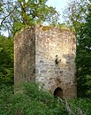
| 51 ° 34 ′ 21 ″ N, 9 ° 42 ′ 22 ″ E | Watch tower | The watch tower belongs to the Reynhardeshagen desert and was built to secure the road in the Schwülmetal. |

|
Barterode
| location | designation | description |
ID |
image |
|---|---|---|---|---|
| Am Born 6 51 ° 33 ′ 1 ″ N, 9 ° 46 ′ 17 ″ E |
Residential building |
|
||
| At location 3 51 ° 33 ′ 8 ″ N, 9 ° 46 ′ 34 ″ E |
Residential building |
|
||
| Bethelstrasse 5 51 ° 33 ′ 1 ″ N, 9 ° 46 ′ 32 ″ E |
Residential building | The house was built in 1834. |
|
|
| Bethelstrasse 7 51 ° 33 ′ 2 ″ N, 9 ° 46 ′ 31 ″ E |
Residential building |
|
||
| Bethelstrasse 8 51 ° 33 ′ 2 ″ N, 9 ° 46 ′ 32 ″ E |
Residential building |
|
||
| Göttinger Strasse 19 51 ° 32 ′ 56 ″ N, 9 ° 46 ′ 27 ″ E |
Residential building |
|
||
| Göttinger Strasse 25 51 ° 32 ′ 58 ″ N, 9 ° 46 ′ 33 ″ E |
Rectory | Built in 1784 |

|
|
| Göttinger Strasse 29 51 ° 33 ′ 2 ″ N, 9 ° 46 ′ 39 ″ E |
Residential building |
|
||
| Old School 51 ° 32 ′ 59 ″ N, 9 ° 46 ′ 31 ″ E |
St. Pankratii Church | The Ev.-luth. Church of St. Pankratii was added to a tower that was essentially older as a hall church around 1730. The pulpit altar and baptismal font (1740) also date from the construction period, and the organ was built by Kuhlmann in 1825 . |
 More pictures |
|
| Dransfelder Landstrasse 8 51 ° 32 ′ 17 ″ N, 9 ° 45 ′ 38 ″ E |
Mill building |
|
||
| Tie place 3 51 ° 33 ′ 3 ″ N, 9 ° 46 ′ 24 ″ E |
Residential building |
|
Eberhausen
| location | designation | description |
ID |
image |
|---|---|---|---|---|
| 51 ° 33 '14 "N, 9 ° 42' 59" E | St. Nicolai Church | The Evangelical Lutheran Church of St. Nicolai in Eberhausen has a medieval tower made of quarry stone. A simple half-timbered church nave was added to its east side in 1841, which was structurally modified in 1960. |
 More pictures |
|
| 51 ° 33 ′ 25 ″ N, 9 ° 43 ′ 30 ″ E | Paper mill |

|
||
| Tränkestrasse 1 51 ° 33 ′ 13 ″ N, 9 ° 43 ′ 3 ″ E |
Residential building | |||
| Tränkestrasse 2 51 ° 33 ′ 14 ″ N, 9 ° 43 ′ 0 ″ E |
Residential building |
Peas
| location | designation | description |
ID |
image |
|---|---|---|---|---|
| Alte Dorfstrasse 18 51 ° 35 ′ 6 ″ N, 9 ° 48 ′ 25 ″ E |
Residential building | |||
| On the Kirchberge 2 51 ° 34 ′ 58 ″ N, 9 ° 48 ′ 27 ″ E |
Rectory | The half-timbered house was built in 1795, it forms a group with its outbuildings, especially the parish barn. |

|
|
| Höbelweg 5-7 51 ° 34 ′ 59 ″ N, 9 ° 48 ′ 18 ″ E |
grange | |||
| 51 ° 34 ′ 57 "N, 9 ° 48 ′ 25" E | St. Vitus Church | One church has been known since 1446. In the 17th century the church was renovated and rebuilt. |
 More pictures |
|
| 51 ° 34 ′ 59 "N, 9 ° 48 ′ 18" E | Watermill |
Güntersen
| location | designation | description |
ID |
image |
|---|---|---|---|---|
| Bachstrasse 4 51 ° 32 ′ 17 ″ N, 9 ° 44 ′ 22 ″ E |
Residential building | |||
| Bachstrasse 12 51 ° 32 ′ 14 ″ N, 9 ° 44 ′ 19 ″ E |
school | |||
| Hauptstrasse 11 51 ° 32 ′ 9 ″ N, 9 ° 44 ′ 22 ″ E |
distillery | The grain distillery was built around 1900 and expanded in 1920. | ||
| 51 ° 32 ′ 12 "N, 9 ° 44 ′ 21" E | St. Martini Church |
 More pictures |
Lödingsen
| location | designation | description |
ID |
image |
|---|---|---|---|---|
| At the church 6 51 ° 35 ′ 45 ″ N, 9 ° 46 ′ 58 ″ E |
Residential building |
|
||
| Heertorstrasse 7 51 ° 35 ′ 51 ″ N, 9 ° 47 ′ 0 ″ E |
Residential building |
|
||
| Hettenser Strasse 1 51 ° 35 ′ 55 ″ N, 9 ° 46 ′ 58 ″ E |
school | The school was built in 1910. |

|
|
| 51 ° 35 ′ 48 "N, 9 ° 46 ′ 58" E | St. Petri Chapel | The chapel was built from 1840 to 1844. It is a hall building with five axes and a gable roof. There is a clad gable turret on the roof. |
 More pictures |
|
| Lindenweg 22 51 ° 35 ′ 53 ″ N, 9 ° 46 ′ 57 ″ E |
Residential building |
|
||
| Steinweg 9 51 ° 35 ′ 49 ″ N, 9 ° 46 ′ 50 ″ E |
Residential building |
|
||
| Steinweg 10 51 ° 35 ′ 49 ″ N, 9 ° 46 ′ 51 ″ E |
Residential building |
|
||
| Steinweg 12 51 ° 35 ′ 50 ″ N, 9 ° 46 ′ 50 ″ E |
court |
|
||
| Steinweg 14 51 ° 35 ′ 50 ″ N, 9 ° 46 ′ 48 ″ E |
Residential building |
|
Wibbecke
| location | designation | description |
ID |
image |
|---|---|---|---|---|
| At Beke 2 51 ° 34 ′ 33 ″ N, 9 ° 46 ′ 45 ″ E |
court | The courtyard was built in the first half of the 19th century. It consists of a dwelling house, farm buildings such as a stable, barn and bakery and an outbuilding to divide the elderly. |

|
|
| At the Beke 6 51 ° 34 ′ 28 ″ N, 9 ° 46 ′ 47 ″ E |
barn |
|
||
| At the chapel 1 51 ° 34 '26 "N, 9 ° 46' 43" E |
Residential building |
|
||
| Old Route 8 51 ° 34 ′ 30 ″ N, 9 ° 46 ′ 43 ″ E |
Residential building |
|
||
| 51 ° 34 ′ 25 ″ N, 9 ° 46 ′ 45 ″ E | chapel | The chapel was built from 1150. It was probably the castle chapel of the Lords of Wibbecke. Around 1600 the chapel was raised by one floor. This floor was not used for church purposes. (see also article Wibbecke ) |

|
literature
- Monument topography Federal Republic of Germany . Architectural monuments in Lower Saxony, Göttingen district, part 1, volume 5.2, 1993, edited by Urs Boeck , Peter F. Lufen and Walter Wulf, Verlag CW Niemeyer Buchverlage , Hameln, ISBN 3-87585-251-6
Web links
Commons : Architectural monuments in Adelebsen - Collection of images, videos and audio files

