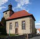
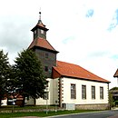
List of architectural monuments in Rosdorf
In the list of architectural monuments in Rosdorf , all listed buildings of the Lower Saxony community of Rosdorf ( district of Göttingen ) are listed. The list is as of 1993.
General
Rosdorf was first mentioned in 1004.
The columns contain the following information:
- Location: the address of the monument and the geographical coordinates . Map view to set coordinates . In the map view, monuments without coordinates are shown with a red marker and can be set on the map. Architectural monuments without a picture are marked with a blue marker, architectural monuments with a picture with a green marker.
- Official name: Name of the monument
- Description: the description of the monument. Under § 3 (2) NDSchG individual monuments and under § 3 (3) NDSchG groups of structures and their components are shown.
- ID: the number of the monument
- Image: a picture of the monument
Atzenhausen
| location | designation | description |
ID |
image |
|---|---|---|---|---|
| Brackenberg 51 ° 26 ′ 1 ″ N, 9 ° 45 ′ 23 ″ E |
Stone work | |||
| 51 ° 25 ′ 10 "N, 9 ° 48 ′ 51" E | Church of St. Petri | Medieval tower, hall built 1821–22 |

|
|
| Lindenteichstrasse 5 51 ° 25 ′ 15 ″ N, 9 ° 48 ′ 49 ″ E |
Residential building | |||
| Lindenteichstrasse 6 51 ° 25 ′ 14 ″ N, 9 ° 48 ′ 50 ″ E |
Residential building | |||
| Lindenteichstrasse 8 51 ° 25 ′ 14 ″ N, 9 ° 48 ′ 51 ″ E |
Residential building |
Dahlenrode
| location | designation | description |
ID |
image |
|---|---|---|---|---|
| 51 ° 25 ′ 47 "N, 9 ° 51 ′ 10" E | Gut Wetenborn | |||
| 51 ° 25 ′ 37 "N, 9 ° 50 ′ 12" E | church |

|
||
| Lindenbachstrasse 9 51 ° 25 ′ 36 ″ N, 9 ° 50 ′ 7 ″ E |
Residential building |
Dramfeld
| location | designation | description |
ID |
image |
|---|---|---|---|---|
| Hauptstraße 8 |
Residential building | |||
| Hauptstraße 20 |
Residential building | |||
| Hauptstraße 22 |
Residential building | |||
| Hauptstraße 24 |
Residential building | |||
| Hauptstraße 37 |
Residential building | |||
| Hauptstraße 38 |
Residential building | |||
| 51 ° 27 '20 "N, 9 ° 52' 57" E | St. Nicolai Church | Original building probably in 1259, expanded as a two-storey chapel around 1300, redesigned in 1776 (window, portal). Former tower demolished in 1868 and replaced by a turret. |

|
|
| 51 ° 26 ′ 42 "N, 9 ° 52 ′ 9" E | Mariengarten monastery | The Mariengarten monastery was founded in the middle of the 13th century on or in the immediate vicinity of the village of the deserted village of Welderekeshusen. |
 More pictures |
|
| Long road 36 |
Residential building | |||
| Long street 50 |
Residential building | |||
| Marktstraße 1 |
Residential building |
Klein-Wiershausen
| location | designation | description |
ID |
image |
|---|---|---|---|---|
| Dorfstraße 13 |
Residential building | |||
| Dorfstraße 20 |
Residential building | |||
| 51 ° 30 ′ 27 "N, 9 ° 48 ′ 51" E | chapel | Three-storey tower building with an area of 8 by 8 m, the ground floor was formerly vaulted. |

|
Lemshausen
| location | designation | description |
ID |
image |
|---|---|---|---|---|
| 51 ° 28 ′ 40 "N, 9 ° 51 ′ 56" E | Good friction stone | Estate of the Göttingen senator and banker F. Reibstein, built 1895–1901 on the site of a former Junkernhof v. Mengershausen. The mansion with corner turrets was planned in 1895 by the Göttingen architect Georg Rott as an elaborate plastered building with ashlar structure and ornamental framework; it contrasts with the simple farm buildings in red exposed brickwork and a small workers' house. |

|
|
| In the village 1 |
Residential building | |||
| 7 village |
Residential building | |||
| 9 village |
Residential building | |||
| 11 village |
Residential building | |||
| 51 ° 29 ′ 3 ″ N, 9 ° 51 ′ 50 ″ E | St. Urbanus Church | Consecrated in 1515, half-timbered upper floor renewed around 1700, extension and roof turret early 19th century |

|
|
| 51 ° 28 ′ 57 "N, 9 ° 49 ′ 17" E | Hot valley Vorwerk | |||
| 51 ° 28 ′ 53 "N, 9 ° 49 ′ 57" E | Vorwerk Örshausen | The outer structure of the Hilwartshausen monastery consists of a sandstone barn, a stable and storage building made of natural stone masonry, an attached two-story half-timbered house (around 1850), another one-story half-timbered residential building and a one-story half-timbered coach house. |

|
Mengershausen
| location | designation | description |
ID |
image |
|---|---|---|---|---|
| Four behind the pond |
Bakehouse | |||
| Behind the pond 12 |
Residential building | |||
| 14 behind the pond |
Residential building | |||
| 51 ° 29 ′ 26 ″ N, 9 ° 52 ′ 0 ″ E | church | Built in 1793 by Georg Heinrich Borheck. Classicist simple plastered building with corner blocks and edging made of sandstone |

|
|
| Lindenstraße 7 |
Residential building | |||
| Lindenstraße 10 |
Residential building | |||
| Lindenstraße 37 |
Residential building | |||
| Lindenstraße 38 |
court |
Obernjesa
| location | designation | description |
ID |
image |
|---|---|---|---|---|
| 3 at the Dramme |
Residential building | |||
| Angerstraße 13/15 |
Residential building | |||
| Angerstraße 21/23 |
Residential building | |||
| Dramfelder Straße |
bridge | Sandstone arch bridge, built in the mid-19th century |

|
|
| Drammestrasse 1 |
Residential building | |||
| Hohlebachsstraße 4 |
Residential building | |||
| 51 ° 27 ′ 42 "N, 9 ° 54 ′ 54" E | St. Mary's Church | First mentioned in writing in 1284, the church tower is essentially medieval. |
![St. Mary's Church [1]](https://upload.wikimedia.org/wikipedia/commons/thumb/9/99/StMarien_Obernjesa.jpg/88px-StMarien_Obernjesa.jpg)
|
|
| Mühlenhof 2 |
Residential building | |||
| Steintorstraße 8 |
court | |||
| Steintorstraße 12 |
court |
Rosdorf
Settmarshausen
| location | designation | description |
ID |
image |
|---|---|---|---|---|
| church |

|
|||
| Olenhusen |
Manor Olenhusen | Manor complex with park and chapel, aristocratic residence fortified as early as the Middle Ages in the Grundbach valley. Remains of the fortifications have been preserved, the mansion destroyed in the Second World War except for the preserved stair tower. |

|
Sieboldshausen
Volkerode
| location | designation | description |
ID |
image |
|---|---|---|---|---|
| 6 at the potion |
Residential building | |||
| Karl-Bertling-Straße 9 |
Residential building | |||
| Karl-Bertling-Straße 15 |
Residential building | |||
| 51 ° 28 ′ 4 "N, 9 ° 51 ′ 21" E | church |

|
||
| Oberdorf 6 |
Residential building | |||
| Unterdorf 3 |
Residential building | |||
| Unterdorf 6 |
Residential building | |||
| Unterdorf 7 |
Residential building | |||
| Unterdorf 8 |
Residential building |
literature
- Monument topography Federal Republic of Germany , architectural monuments in Lower Saxony, district of Göttingen, part 1, volume 5.2, 1993, editors Urs Boeck , Peter F. Lufen and Walter Wulf, Verlag CW Niemeyer Buchverlage , Hameln, ISBN 3-87585-251-6
Individual evidence
- ↑ St. Marien Obernjesa on the website of the ev.-luth. Parish Association Parochie Obernjesa, accessed on June 17, 2013
- ↑ Monument topography of the Federal Republic of Germany, architectural monuments in Lower Saxony, Göttingen district, part 1, volume 5.2, 1993, editors Urs Boeck, Peter F. Lufen and Walter Wulf, Verlag CW Niemeyer Buchverlage, Hameln, ISBN 3-87585-251-6 , p. 70f
Web links
Commons : Architectural monuments in Rosdorf - collection of images, videos and audio files


