List of architectural monuments in Vahrenwald-List
The list of architectural monuments in Vahrenwald-List contains the architectural monuments of the Hanover districts List and Vahrenwald . The entries in this list are mainly based on a list from the Office for Monument Protection from 1985 and must be checked in each individual case with regard to whether it is up-to-date.
Vahrenwald
| location | designation | description |
ID |
image |
|---|---|---|---|---|
| On the mandrel 21, 22, 23, 23a, 24, 24a, 25, 26, 27 52 ° 23 ′ 41 ″ N, 9 ° 43 ′ 33 ″ O |
In the ensemble with Guts-Muths-Straße 1, Havemannstraße 2 and Philipsbornstraße 35, 36 |

|
||
| Guts-Muths-Strasse 1 52 ° 23 ′ 41 ″ N, 9 ° 43 ′ 42 ″ E |
skyscraper | In the ensemble with Auf dem Dorn, Havemannstrasse 2 and Philipsbornstrasse 35, 36 |

|
|
| Havemannstrasse 2 52 ° 23 ′ 39 ″ N, 9 ° 43 ′ 40 ″ E |
In the ensemble with Auf dem Dorn, Guts-Muths-Straße 1 and Philipsbornstraße 35, 36 |

|
||
| Philipsbornstrasse 35 and 36 52 ° 23 ′ 37 ″ N, 9 ° 43 ′ 44 ″ E |
In the ensemble with Auf dem Dorn, Guts-Muths-Straße 1 and Havemannstraße 2 |

|
||
| Grabbestrasse 25, 27, 29, 33 52 ° 23 ′ 38 ″ N, 9 ° 43 ′ 52 ″ E |
In the ensemble with Halkettstrasse 20, 22, 24, 26 and Jahnplatz 1, 3, 5, 7 including the garden design of the inner courtyard |

|
||
| Halkettstrasse 20, 22, 24, 26 52 ° 23 ′ 37 ″ N, 9 ° 43 ′ 51 ″ E |
In the ensemble with Grabbestrasse 25, 27, 29, 33 and Jahnplatz 1, 3, 5, 7 including the garden design of the inner courtyard. |

|
||
| Jahnplatz 1, 3, 5, 7 52 ° 23 ′ 39 ″ N, 9 ° 43 ′ 49 ″ E |
In the ensemble with Grabbestrasse 25, 27, 29, 33 and Halkettstrasse 20, 22, 24, 26 including the garden design of the inner courtyard. |

|
||
| Halkettstrasse 29, 31, 35, 36, 37, 38, 39, 41 52 ° 23 ′ 35 ″ N, 9 ° 43 ′ 49 ″ E |
In the ensemble with Philipsbornstrasse 16, 17, 18, 19, 43, 44 |

|
||
| Philipsbornstrasse 16, 17, 18, 19, 43, 44 52 ° 23 ′ 26 ″ N, 9 ° 43 ′ 54 ″ E |
In the ensemble with Halkettstraße 29, 31, 35, 36, 37, 38, 39, 41 |

|
||
| Helmholtzstrasse 3, 5, 7, 9, 11 52 ° 23 ′ 39 ″ N, 9 ° 43 ′ 34 ″ E |

|
|||
| Alemannstrasse 5 52 ° 23 ′ 33 ″ N, 9 ° 43 ′ 53 ″ E |
school |

|
||
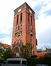
| Dessauer Strasse 2 52 ° 23 ′ 18 ″ N, 9 ° 44 ′ 12 ″ E |
Tower of St. Luke's Church | Built 1899–1901 according to plans by Karl Börgemann . |
|
|
| Dragonerstraße 35, 37, 39, 41 52 ° 23 ′ 39 ″ N, 9 ° 44 ′ 19 ″ E |
Remnants of the Hanover Military Riding Institute | Built in 1876 |

|
|
| Kriegerstrasse 28 / Dessauer Strasse 22 52 ° 23 ′ 25 ″ N, 9 ° 44 ′ 12 ″ E |
Residential building |

|
||
| Philipsbornstrasse 65 52 ° 23 ′ 17 ″ N, 9 ° 43 ′ 57 ″ E |
Production halls of Continental AG |

|
||
| Vahrenwalder Strasse 7 52 ° 23 ′ 10 ″ N, 9 ° 44 ′ 0 ″ E |
Continental AG administration building | Built 1912–1914 according to plans by Peter Behrens , today Hannover Technology Center (TCH). |

|
|
| Zietenstrasse 3 52 ° 23 ′ 31 ″ N, 9 ° 44 ′ 16 ″ E |
Residential building |

|
Cunning
| location | designation | description |
ID |
image |
|---|---|---|---|---|
| Adalbert-Stifter-Straße 1, 2, 3, 4, 5, 6, 7, 8, 9, 10, 11, 12, 14 52 ° 24 ′ 8 ″ N, 9 ° 46 ′ 55 ″ E |
In the ensemble with Am Langen Kampe 8, 9, 10, 11, Anzengruberstraße 1, 2, 3, 4, 5, 6, 7, 8, 9, 10, Dingelstedtstraße 1, 2, 3, 4, 5, 6, 7, 8, 9, 10, Gottfried-Keller-Straße 2, 4, 4a, 6, 8, 10, 12, 14, 16, 18, 20, 22, Grillparzerstraße 1, 3, 5, 7, Im Kreuzkampe 5, 6, 7, 8, 9, 10, 11, 12, 13, 14, 15, 17, Podbielskistraße 245, 247, 249, Spannhagenstraße 12, 14, 16, 18, 20, 22, 24. |

|
||
| Am Langen Kampe 8, 9, 10, 11 52 ° 24 ′ 6 ″ N, 9 ° 46 ′ 55 ″ E |
In the ensemble with Adalbert-Stifter-Straße 1, 2, 3, 4, 5, 6, 7, 8, 9, 10, 11, 12, 14, Anzengruberstraße 1, 2, 3, 4, 5, 6, 7, 8 , 9, 10, Dingelstedtstraße 1, 2, 3, 4, 5, 6, 7, 8, 9, 10, Gottfried-Keller-Straße 2, 4, 4a, 6, 8, 10, 12, 14, 16, 18 , 20, 22, Grillparzerstraße 1, 3, 5, 7, Im Kreuzkampe 5, 6, 7, 8, 9, 10, 11, 12, 13, 14, 15, 17, Podbielskistraße 245, 247, 249, Spannhagenstraße 12, 14, 16, 18, 20, 22, 24. |

|
||
| Anzengruberstrasse 1, 2, 3, 4, 5, 6, 7, 8, 9, 10 52 ° 24 ′ 9 ″ N, 9 ° 47 ′ 4 ″ E |
In the ensemble with Adalbert-Stifter-Straße 1, 2, 3, 4, 5, 6, 7, 8, 9, 10, 11, 12, 14, Am Langen Kampe 8, 9, 10, 11, Dingelstedtstraße 1, 2, 3, 4, 5, 6, 7, 8, 9, 10, Gottfried-Keller-Straße 2, 4, 4a, 6, 8, 10, 12, 14, 16, 18, 20, 22, Grillparzerstraße 1, 3, 5, 7, Im Kreuzkampe 5, 6, 7, 8, 9, 10, 11, 12, 13, 14, 15, 17, Podbielskistraße 245, 247, 249, Spannhagenstraße 12, 14, 16, 18, 20, 22, 24. |

|
||
| Dingelstedtstrasse 1, 2, 3, 4, 5, 6, 7, 8, 9, 10 52 ° 24 ′ 8 ″ N, 9 ° 47 ′ 9 ″ E |
In the ensemble with Adalbert-Stifter-Straße 1, 2, 3, 4, 5, 6, 7, 8, 9, 10, 11, 12, 14, Am Langen Kampe 8, 9, 10, 11, Anzengruberstraße 1, 2, 3, 4, 5, 6, 7, 8, 9, 10, Gottfried-Keller-Straße 2, 4, 4a, 6, 8, 10, 12, 14, 16, 18, 20, 22, Grillparzerstraße 1, 3, 5, 7, Im Kreuzkampe 5, 6, 7, 8, 9, 10, 11, 12, 13, 14, 15, 17, Podbielskistraße 245, 247, 249, Spannhagenstraße 12, 14, 16, 18, 20, 22, 24. |

|
||
| Gottfried-Keller-Strasse 2, 4, 4a, 6, 8, 10, 12, 14, 16, 18, 20, 22 52 ° 24 ′ 10 ″ N, 9 ° 47 ′ 3 ″ E |
In the ensemble with Adalbert-Stifter-Straße 1, 2, 3, 4, 5, 6, 7, 8, 9, 10, 11, 12, 14, Am Langen Kampe 8, 9, 10, 11, Anzengruberstraße 1, 2, 3, 4, 5, 6, 7, 8, 9, 10, Dingelstedtstraße 1, 2, 3, 4, 5, 6, 7, 8, 9, 10, Grillparzerstraße 1, 3, 5, 7, Im Kreuzkampe 5, 6, 7, 8, 9, 10, 11, 12, 13, 14, 15, 17, Podbielskistraße 245, 247, 249, Spannhagenstraße 12, 14, 16, 18, 20, 22, 24. |

|
||
| Grillparzerstrasse 1, 3, 5, 7 52 ° 24 ′ 7 ″ N, 9 ° 47 ′ 7 ″ E |
In the ensemble with Adalbert-Stifter-Straße 1, 2, 3, 4, 5, 6, 7, 8, 9, 10, 11, 12, 14, Am Langen Kampe 8, 9, 10, 11, Anzengruberstraße 1, 2, 3, 4, 5, 6, 7, 8, 9, 10, Dingelstedtstraße 1, 2, 3, 4, 5, 6, 7, 8, 9, 10, Gottfried-Keller-Straße 2, 4, 4a, 6, 8, 10, 12, 14, 16, 18, 20, 22, Im Kreuzkampe 5, 6, 7, 8, 9, 10, 11, 12, 13, 14, 15, 17, Podbielskistraße 245, 247, 249, Spannhagenstraße 12, 14, 16, 18, 20, 22, 24. |

|
||
| Im Kreuzkampe 5, 6, 7, 8, 9, 10, 11, 12, 13, 14, 15, 17 52 ° 24 ′ 8 ″ N, 9 ° 46 ′ 59 ″ E |
In the ensemble with Adalbert-Stifter-Straße 1, 2, 3, 4, 5, 6, 7, 8, 9, 10, 11, 12, 14, Am Langen Kampe 8, 9, 10, 11, Anzengruberstraße 1, 2, 3, 4, 5, 6, 7, 8, 9, 10, Dingelstedtstraße 1, 2, 3, 4, 5, 6, 7, 8, 9, 10, Gottfried-Keller-Straße 2, 4, 4a, 6, 8, 10, 12, 14, 16, 18, 20, 22, Grillparzerstraße 1, 3, 5, 7, Podbielskistraße 245, 247, 249, Spannhagenstraße 12, 14, 16, 18, 20, 22, 24. |

|
||
|
Podbielskistraße 245, 247, 249 52 ° 24 ′ 6 ″ N, 9 ° 47 ′ 9 ″ E |
In the ensemble with Adalbert-Stifter-Straße 1, 2, 3, 4, 5, 6, 7, 8, 9, 10, 11, 12, 14, Am Langen Kampe 8, 9, 10, 11, Anzengruberstraße 1, 2, 3, 4, 5, 6, 7, 8, 9, 10, Dingelstedtstraße 1, 2, 3, 4, 5, 6, 7, 8, 9, 10, Gottfried-Keller-Straße 2, 4, 4a, 6, 8, 10, 12, 14, 16, 18, 20, 22, Grillparzerstraße 1, 3, 5, 7, Im Kreuzkampe 5, 6, 7, 8, 9, 10, 11, 12, 13, 14, 15, 17 , Spannhagenstrasse 12, 14, 16, 18, 20, 22, 24. |

|
||
|
Podbielskistraße 258-300 52 ° 24 ′ 8 ″ N, 9 ° 47 ′ 21 ″ E |
List city | ensemble |

|
|
| Spannhagenstrasse 12, 14, 16, 18, 20, 22, 24 52 ° 24 ′ 8 ″ N, 9 ° 46 ′ 53 ″ E |
In the ensemble with Adalbert-Stifter-Straße 1, 2, 3, 4, 5, 6, 7, 8, 9, 10, 11, 12, 14, Am Langen Kampe 8, 9, 10, 11, Anzengruberstraße 1, 2, 3, 4, 5, 6, 7, 8, 9, 10, Dingelstedtstraße 1, 2, 3, 4, 5, 6, 7, 8, 9, 10, Gottfried-Keller-Straße 2, 4, 4a, 6, 8, 10, 12, 14, 16, 18, 20, 22, Grillparzerstraße 1, 3, 5, 7, Im Kreuzkampe 5, 6, 7, 8, 9, 10, 11, 12, 13, 14, 15, 17 , Podbielskistraße 245, 247, 249. |

|
||
| Am Listholze 1, 2, 3, 4, 5, 6, 7, 8, 9, 10, 11, 12, 13, 14, 15, 16 52 ° 23 '47 "N, 9 ° 45' 53" E |
In the ensemble with Bothfelder Straße 8, 9, 10, Matthiasstraße 4, 6, 8, 10, 12, 14, Podbielskistraße 99, 101, 103, Uelzestraße 2, 4, 6. |

|
||
| Bothfelder Strasse 8, 9, 10 52 ° 23 ′ 49 ″ N, 9 ° 45 ′ 48 ″ E |
In the ensemble with Am Listholze 1, 2, 3, 4, 5, 6, 7, 8, 9, 10, 11, 12, 13, 14, 15, 16, Matthiasstraße 4, 6, 8, 10, 12, 14, Podbielskistraße 99, 101, 103, Uelzestraße 2, 4, 6. |

|
||
| Matthiasstrasse 4, 6, 8, 10, 12, 14 52 ° 23 ′ 47 ″ N, 9 ° 45 ′ 48 ″ E |
In the ensemble with Am Listholze 1, 2, 3, 4, 5, 6, 7, 8, 9, 10, 11, 12, 13, 14, 15, 16, Bothfelder Straße 8, 9, 10, Podbielskistraße 99, 101, 103, Uelzestrasse 2, 4, 6. |

|
||
| Podbielskistraße 99, 101, 103 52 ° 23 ′ 45 ″ N, 9 ° 45 ′ 50 ″ E |
In the ensemble with Am Listholze 1, 2, 3, 4, 5, 6, 7, 8, 9, 10, 11, 12, 13, 14, 15, 16, Bothfelder Straße 8, 9, 10, Matthiasstraße 4, 6, 8, 10, 12, 14, Uelzestrasse 2, 4, 6. |

|
||
| Uelzestrasse 2, 4, 6 52 ° 23 ′ 50 ″ N, 9 ° 45 ′ 53 ″ E |
In the ensemble with Am Listholze 1, 2, 3, 4, 5, 6, 7, 8, 9, 10, 11, 12, 13, 14, 15, 16, Bothfelder Straße 8, 9, 10, Matthiasstraße 4, 6, 8, 10, 12, 14, Podbielskistraße 99, 101, 103. |

|
||
| Bunsenstrasse 2, 4, 6, 8, 10 52 ° 23 ′ 39 ″ N, 9 ° 45 ′ 10 ″ E |
In the ensemble with De-Haën-Platz 1, 2, 3, 4, 5, 6, 8, 9, 10, 12, 13, 14, Fraunhoferstraße 1, 2, 3, 4, 5, 6, 7, 8, 9 , 10, 11, Hammersteinstrasse 12, 13, Hertzstrasse 1, 2, 3, 4, 5, 6, 7, 8, 9, 10, 12, Lister Strasse 24, 24a, Röntgenstrasse 1, 2, 3, 4, Waldstrasse 4 , 5, 6, 7, 8, 11. |

|
||
| De-Haën-Platz 1, 2, 3, 4, 5, 6, 8, 9, 10, 12, 13, 14 52 ° 23 ′ 34 ″ N, 9 ° 45 ′ 14 ″ E |
In the ensemble with Bunsenstrasse 2, 4, 6, 8, 10, Fraunhoferstrasse 1, 2, 3, 4, 5, 6, 7, 8, 9, 10, 11, Hammersteinstrasse 12, 13, Hertzstrasse 1, 2, 3, 4 , 5, 6, 7, 8, 9, 10, 12, Lister Straße 24, 24a, Röntgenstraße 1, 2, 3, 4, Waldstraße 4, 5, 6, 7, 8, 11. |

|
||
| Fraunhoferstrasse 1, 2, 3, 4, 5, 6, 7, 8, 9, 10, 11 52 ° 23 ′ 38 ″ N, 9 ° 45 ′ 13 ″ E |
In the ensemble with Bunsenstraße 2, 4, 6, 8, 10, De-Haën-Platz 1, 2, 3, 4, 5, 6, 8, 9, 10, 12, 13, 14, Hammersteinstraße 12, 13, Hertzstraße 1 , 2, 3, 4, 5, 6, 7, 8, 9, 10, 12, Lister Straße 24, 24a, Röntgenstraße 1, 2, 3, 4, Waldstraße 4, 5, 6, 7, 8, 11. |
 More pictures |
||
| Hammersteinstrasse 12, 13 52 ° 23 ′ 33 ″ N, 9 ° 45 ′ 18 ″ E |
In the ensemble with Bunsenstraße 2, 4, 6, 8, 10, De-Haën-Platz 1, 2, 3, 4, 5, 6, 8, 9, 10, 12, 13, 14, Fraunhoferstraße 1, 2, 3, 4, 5, 6, 7, 8, 9, 10, 11, Hertzstraße 1, 2, 3, 4, 5, 6, 7, 8, 9, 10, 12, Lister Straße 24, 24a, Röntgenstraße 1, 2, 3, 4, Waldstrasse 4, 5, 6, 7, 8, 11. |
 More pictures |
||
| Hertzstrasse 1, 2, 3, 4, 5, 6, 7, 8, 9, 10, 12 52 ° 23 ′ 38 ″ N, 9 ° 45 ′ 17 ″ E |
In the ensemble with Bunsenstraße 2, 4, 6, 8, 10, De-Haën-Platz 1, 2, 3, 4, 5, 6, 8, 9, 10, 12, 13, 14, Fraunhoferstraße 1, 2, 3, 4, 5, 6, 7, 8, 9, 10, 11, Hammersteinstraße 12, 13, Lister Straße 24, 24a, Röntgenstraße 1, 2, 3, 4, Waldstraße 4, 5, 6, 7, 8, 11. |
 More pictures |
||
| Lister Strasse 24, 24a 52 ° 23 ′ 35 ″ N, 9 ° 45 ′ 8 ″ E |
In the ensemble with Bunsenstraße 2, 4, 6, 8, 10, De-Haën-Platz 1, 2, 3, 4, 5, 6, 8, 9, 10, 12, 13, 14, Fraunhoferstraße 1, 2, 3, 4, 5, 6, 7, 8, 9, 10, 11, Hammersteinstraße 12, 13, Hertzstraße 1, 2, 3, 4, 5, 6, 7, 8, 9, 10, 12, Röntgenstraße 1, 2, 3 , 4, Waldstrasse 4, 5, 6, 7, 8, 11. |
 More pictures |
||
| Röntgenstrasse 1, 2, 3, 4 52 ° 23 ′ 36 ″ N, 9 ° 45 ′ 9 ″ E |
In the ensemble with Bunsenstraße 2, 4, 6, 8, 10, De-Haën-Platz 1, 2, 3, 4, 5, 6, 8, 9, 10, 12, 13, 14, Fraunhoferstraße 1, 2, 3, 4, 5, 6, 7, 8, 9, 10, 11, Hammersteinstraße 12, 13, Hertzstraße 1, 2, 3, 4, 5, 6, 7, 8, 9, 10, 12, Lister Straße 24, 24a, Waldstrasse 4, 5, 6, 7, 8, 11. |
 More pictures |
||
| Waldstrasse 4, 5, 6, 7, 8, 11 52 ° 23 ′ 32 ″ N, 9 ° 45 ′ 15 ″ E |
In the ensemble with Bunsenstraße 2, 4, 6, 8, 10, De-Haën-Platz 1, 2, 3, 4, 5, 6, 8, 9, 10, 12, 13, 14, Fraunhoferstraße 1, 2, 3, 4, 5, 6, 7, 8, 9, 10, 11, Hammersteinstraße 12, 13, Hertzstraße 1, 2, 3, 4, 5, 6, 7, 8, 9, 10, 12, Lister Straße 24, 24a, Röntgenstrasse 1, 2, 3, 4. |

|
||
| Burckhardtstrasse 2 52 ° 23 ′ 23 ″ N, 9 ° 45 ′ 13 ″ E |
In the ensemble with Podbielskistraße 14/16, 18, 20, 22. |

|
||
| Podbielskistraße 14/16, 18, 20, 22 52 ° 23 ′ 23 ″ N, 9 ° 45 ′ 11 ″ E |
In the ensemble with Burckhardtstrasse 2. |

|
||
| Drostestrasse 1, 2, 4, 6 52 ° 23 ′ 9 ″ N, 9 ° 44 ′ 57 ″ E |
In the ensemble with In der Steinriede 1, 2, 3, 4, 5, 7, 8, 9, 10, 11, 12, Körtingstraße 5, Wedekindplatz 3, Wedekindstraße 26, 27, 28, 29 as well as the buildings of the Ensemble Flüggestraße ( see List of architectural monuments in Hanover-Oststadt ). |

|
||
| In the Steinriede 1, 2, 3, 4, 5, 7, 8, 9, 10, 11, 12 52 ° 23 ′ 12 ″ N, 9 ° 45 ′ 3 ″ E |
In the ensemble with Drostestrasse 1, 2, 4, 6, Körtingstrasse 5, Wedekindplatz 3, Wedekindstrasse 26, 27, 28, 29 as well as the buildings of the Ensemble Flüggestrasse ( see list of architectural monuments in Hanover-Oststadt ). |

|
||
| Körtingstrasse 5 52 ° 23 ′ 12 ″ N, 9 ° 45 ′ 1 ″ E |
In the ensemble with Drostestraße 1, 2, 4, 6, In der Steinriede 1, 2, 3, 4, 5, 7, 8, 9, 10, 11, 12, Wedekindplatz 3, Wedekindstraße 26, 27, 28, 29 and the Building of the Flüggestraße ensemble ( see list of architectural monuments in Hanover-Oststadt ). |

|
||
| Wedekindplatz 3 52 ° 23 ′ 9 ″ N, 9 ° 45 ′ 0 ″ E |
In the ensemble with Drostestraße 1, 2, 4, 6, In der Steinriede 1, 2, 3, 4, 5, 7, 8, 9, 10, 11, 12, Körtingstraße 5, Wedekindstraße 26, 27, 28, 29 and the Building of the Flüggestraße ensemble ( see list of architectural monuments in Hanover-Oststadt ). |

|
||
| Wedekindstrasse 26, 27, 28, 29 52 ° 23 ′ 10 ″ N, 9 ° 45 ′ 3 ″ E |
In the ensemble with Drostestraße 1, 2, 4, 6, In der Steinriede 1, 2, 3, 4, 5, 7, 8, 9, 10, 11, 12, Körtingstraße 5, Wedekindplatz 3 and the buildings of the Ensemble Flüggestraße ( see List of architectural monuments in Hanover-Oststadt ). |

|
||
| Edenstrasse 42 52 ° 23 ′ 20 ″ N, 9 ° 44 ′ 56 ″ E |
In the ensemble with Jakobistraße 3, 5, 9. |

|
||
| Jakobistraße 3, 5 and 9 52 ° 23 ′ 20 ″ N, 9 ° 44 ′ 57 ″ E |
In the ensemble with Edenstrasse 42. |

|
||
| Ferdinand-Wallbrecht-Strasse 35, 38, 40, 42, 43, 44, 45, 46 52 ° 23 ′ 33 ″ N, 9 ° 44 ′ 50 ″ E |
In the ensemble with Husarenstraße 1, 2, 4, Moltkeplatz 1, 2, 3, 4, 5, 6, 7, 8, 9, 10, 11, Voßstraße 62, 63, Waldstraße 22, 23. |

|
||
| Husarenstrasse 1, 2, 4 52 ° 23 ′ 34 ″ N, 9 ° 44 ′ 40 ″ E |
In the ensemble with Ferdinand-Wallbrecht-Straße 35, 38, 40, 42, 43, 44, 45, 46, Moltkeplatz 1, 2, 3, 4, 5, 6, 7, 8, 9, 10, 11, Voßstraße 62, 63, Waldstrasse 22, 23. |

|
||
| Moltkeplatz 1, 2, 3, 4, 5, 6, 7, 8, 9, 10, 11 52 ° 23 ′ 32 ″ N, 9 ° 44 ′ 42 ″ O |
In the ensemble with Ferdinand-Wallbrecht-Strasse 35, 38, 40, 42, 43, 44, 45, 46, Husarenstrasse 1, 2, 4, Voßstrasse 62, 63, Waldstrasse 22, 23. |
 More pictures |
||
| Vossstrasse 62, 63 52 ° 23 ′ 31 ″ N, 9 ° 44 ′ 44 ″ E |
In the ensemble with Ferdinand-Wallbrecht-Straße 35, 38, 40, 42, 43, 44, 45, 46, Husarenstraße 1, 2, 4, Moltkeplatz 1, 2, 3, 4, 5, 6, 7, 8, 9, 10, 11, Waldstrasse 22, 23. |

|
||
| Waldstrasse 22, 23 52 ° 23 ′ 34 ″ N, 9 ° 44 ′ 50 ″ E |
In the ensemble with Ferdinand-Wallbrecht-Straße 35, 38, 40, 42, 43, 44, 45, 46, Husarenstraße 1, 2, 4, Moltkeplatz 1, 2, 3, 4, 5, 6, 7, 8, 9, 10, 11, Vossstraße 62, 63. |

|
||
| Franz-Bork-Strasse 1, 2, 3, 4, 5, 6, 8, 10, 12, 19, 21 52 ° 23 ′ 30 ″ N, 9 ° 45 ′ 4 ″ E |
In the ensemble with Lister Straße 27, 28, 30, 31. |

|
||
| Lister Strasse 27, 28, 30, 31 52 ° 23 ′ 33 ″ N, 9 ° 45 ′ 6 ″ E |
In the ensemble with Franz-Bork-Straße 1, 2, 3, 4, 5, 6, 8, 10, 12, 19, 21. |

|
||
| Gabelsbergerstrasse 1, 2, 3, 4, 5, 6, 6a, 7, 8, 9, 10, 11, 16, 17, 18 52 ° 23 ′ 29 ″ N, 9 ° 44 ′ 44 ″ E |
In the ensemble with Harnischstraße 4, 6, 7, 9, 10, 11, Jakobistraße 24, 26, 28, 30, 32, 34, 36, 38, Kollenrodtstraße 10, 11, 12, 13, 14, 55, 56, 57, 58, 59, 60, Slicherstraße 1, 2, 3, 4, 6, 7, 8, Stromeyerstraße 1, 2, 3, 4, 5, 5a, 6. |

|
||
| Harnischstrasse 4, 6, 7, 9, 10, 11 52 ° 23 ′ 25 ″ N, 9 ° 44 ′ 45 ″ E |
In the ensemble with Gabelsbergerstraße 1, 2, 3, 4, 5, 6, 6a, 7, 8, 9, 10, 11, 16, 17, 18, Jakobistraße 24, 26, 28, 30, 32, 34, 36, 38 , Kollenrodtstraße 10, 11, 12, 13, 14, 55, 56, 57, 58, 59, 60, Slicherstraße 1, 2, 3, 4, 6, 7, 8, Stromeyerstraße 1, 2, 3, 4, 5, 5a, 6. |

|
||
| Jakobistraße 24, 26, 28, 30, 32, 34, 36, 38 52 ° 23 ′ 23 ″ N, 9 ° 44 ′ 48 ″ E |
In the ensemble with Gabelsbergerstraße 1, 2, 3, 4, 5, 6, 6a, 7, 8, 9, 10, 11, 16, 17, 18, Harnischstraße 4, 6, 7, 9, 10, 11, Kollenrodtstraße 10, 11, 12, 13, 14, 55, 56, 57, 58, 59, 60, Slicherstraße 1, 2, 3, 4, 6, 7, 8, Stromeyerstraße 1, 2, 3, 4, 5, 5a, 6. |

|
||
| Kollenrodtstrasse 10, 11, 12, 13, 14, 55, 56, 57, 58, 59, 60 52 ° 23 ′ 24 ″ N, 9 ° 44 ′ 51 ″ E |
In the ensemble with Gabelsbergerstraße 1, 2, 3, 4, 5, 6, 6a, 7, 8, 9, 10, 11, 16, 17, 18, Harnischstraße 4, 6, 7, 9, 10, 11, Jakobistraße 24, 26, 28, 30, 32, 34, 36, 38, Slicherstraße 1, 2, 3, 4, 6, 7, 8, Stromeyerstraße 1, 2, 3, 4, 5, 5a, 6. |

|
||
| Slicherstrasse 1, 2, 3, 4, 6, 7, 8 52 ° 23 ′ 28 ″ N, 9 ° 44 ′ 42 ″ E |
In the ensemble with Gabelsbergerstraße 1, 2, 3, 4, 5, 6, 6a, 7, 8, 9, 10, 11, 16, 17, 18, Harnischstraße 4, 6, 7, 9, 10, 11, Jakobistraße 24, 26, 28, 30, 32, 34, 36, 38, Kollenrodtstraße 10, 11, 12, 13, 14, 55, 56, 57, 58, 59, 60, Stromeyerstraße 1, 2, 3, 4, 5, 5a, 6th |

|
||
| Stromeyerstrasse 1, 2, 3, 4, 5, 5a, 6 52 ° 23 ′ 29 ″ N, 9 ° 44 ′ 47 ″ E |
In the ensemble with Gabelsbergerstraße 1, 2, 3, 4, 5, 6, 6a, 7, 8, 9, 10, 11, 16, 17, 18, Harnischstraße 4, 6, 7, 9, 10, 11, Jakobistraße 24, 26, 28, 30, 32, 34, 36, 38, Kollenrodtstraße 10, 11, 12, 13, 14, 55, 56, 57, 58, 59, 60, Slicherstraße 1, 2, 3, 4, 6, 7, 8th. |

|
||
| Hammersteinstrasse 1, 2 52 ° 23 ′ 31 ″ N, 9 ° 45 ′ 26 ″ E |
In the ensemble with Podbielskistraße 36, 38, 40, 41, 42, 43, 44, 45, 46, 47, 48, 49, 50 with the corner buildings, Waldstraße 1. |
 More pictures |
||
| Podbielskistraße 36, 38, 40, 41, 42, 43, 44, 45, 46, 47, 48, 49, 50 with the corner buildings 52 ° 23 ′ 30 ″ N, 9 ° 45 ′ 21 ″ E |
In the ensemble with Hammersteinstrasse 1, 2, Waldstrasse 1. |

|
||
| Waldstrasse 1 52 ° 23 ′ 28 ″ N, 9 ° 45 ′ 21 ″ E |
In the ensemble with Hammersteinstraße 1, 2, Podbielskistraße 36, 38, 40, 41, 42, 43, 44, 45, 46, 47, 48, 49, 50 with the corner buildings. |

|
||
| Hebbelstrasse 1, 3 52 ° 23 ′ 57 ″ N, 9 ° 46 ′ 31 ″ E |
In the ensemble with Klopstockstraße 27, 29, 31, Podbielskistraße 151, 153, 155, 157, 159, 161, 163, 165, 167, 169, 171, 173, Raabestraße 1, 2, 3, 4, 5, 6, 8, 10, 10a, 12, 14, 16, 18, Trojanstrasse 1. |

|
||
| Klopstockstrasse 27, 29, 31 52 ° 24 ′ 1 ″ N, 9 ° 46 ′ 29 ″ E |
In the ensemble with Hebbelstraße 1, 3, Podbielskistraße 151, 153, 155, 157, 159, 161, 163, 165, 167, 169, 171, 173, Raabestraße 1, 2, 3, 4, 5, 6, 8, 10, 10a, 12, 14, 16, 18, Trojanstrasse 1. |

|
||
| Podbielskistraße 151, 153, 155, 157, 159, 161, 163, 165, 167, 169, 171, 173 52 ° 23 ′ 54 ″ N, 9 ° 46 ′ 24 ″ E |
In the ensemble with Hebbelstraße 1, 3, Klopstockstraße 27, 29, 31, Raabestraße 1, 2, 3, 4, 5, 6, 8, 10, 10a, 12, 14, 16, 18, Trojanstraße 1. |

|
||
| Raabestrasse 1, 2, 3, 4, 5, 6, 8, 10, 10a, 12, 14, 16, 18 52 ° 23 ′ 58 ″ N, 9 ° 46 ′ 27 ″ O |
In the ensemble with Hebbelstraße 1, 3, Klopstockstraße 27, 29, 31, Podbielskistraße 151, 153, 155, 157, 159, 161, 163, 165, 167, 169, 171, 173, Trojanstraße 1. |

|
||
| Sylter Weg 20 52 ° 23 ′ 53 ″ N, 9 ° 44 ′ 48 ″ E |
Award-winning day-care center, architect Rolf-Dieter Ramcke , opened in 1967, listed as a historical monument in 2012. |

|
||
| Trojanstrasse 1 52 ° 23 ′ 55 ″ N, 9 ° 46 ′ 25 ″ E |
In the ensemble with Hebbelstraße 1, 3, Klopstockstraße 27, 29, 31, Podbielskistraße 151, 153, 155, 157, 159, 161, 163, 165, 167, 169, 171, 173, Raabestraße 1, 2, 3, 4, 5 , 6, 8, 10, 10a, 12, 14, 16, 18. |

|
||
| Immengarten 2, 3, 4, 5, 6, 7, 8, 9, 10, 11, 12, 13, 14, 15 52 ° 23 ′ 49 ″ N, 9 ° 45 ′ 57 ″ E |
In the ensemble with Podbielskistraße 105, 107, 109, 111. |

|
||
| Podbielskistraße 105, 107, 109, 111 52 ° 23 ′ 45 ″ N, 9 ° 45 ′ 54 ″ E |
In the ensemble with Immengarten 2, 3, 4, 5, 6, 7, 8, 9, 10, 11, 12, 13, 14, 15. |

|
||
| In the Steinriede 9 52 ° 23 ′ 13 ″ N, 9 ° 45 ′ 2 ″ E |
In the ensemble with Körtingstrasse 1, 2, 3, 4, 5, 6, 7, 8, Lister Meile 66, 68. |

|
||
| Körtingstrasse 1, 2, 3, 4, 5, 6, 7, 8 52 ° 23 ′ 11 ″ N, 9 ° 45 ′ 0 ″ E |
In the ensemble with In der Steinriede 9, Lister Meile 66, 68. | |||
| Lister mile 66, 68 52 ° 23 ′ 13 ″ N, 9 ° 44 ′ 56 ″ E |
In the ensemble with In der Steinriede 9, Körtingstraße 1, 2, 3, 4, 5, 6, 7, 8. |

|
||
| Isernhagener Strasse 64 52 ° 23 ′ 37 ″ N, 9 ° 44 ′ 27 ″ E |
In the ensemble with Steinmetzstraße 1 ( St. Josephs Church with parish hall). |

|
||
| Steinmetzstrasse 1 52 ° 23 ′ 38 ″ N, 9 ° 44 ′ 31 ″ E |
St. Joseph's Church with the parish hall | In the ensemble with Isernhagener Straße 64. |

|
|
| Klopstockstrasse 1, 3, 5, 7, 9 52 ° 24 ′ 1 ″ N, 9 ° 46 ′ 45 ″ E |
In the ensemble with Podbielskistraße 197, 199, 201. |

|
||
| Podbielskistraße 197, 199, 201 52 ° 24 ′ 0 ″ N, 9 ° 46 ′ 46 ″ E |
In the ensemble with Klopstockstraße 1, 3, 5, 7, 9. |

|
||
| Kollenrodtstrasse 16, 17, 18, 19, 20, 21 (east side) with corner building 52 ° 23 ′ 31 ″ N, 9 ° 44 ′ 55 ″ E |
In the ensemble with Waldstrasse 29. |
 More pictures |
||
| Waldstrasse 29 52 ° 23 ′ 33 ″ N, 9 ° 44 ′ 57 ″ E |
In the ensemble with Kollenrodtstrasse 16, 17, 18, 19, 20, 21 (east side) with corner building. |

|
||
|
Lister Platz 1, 2, 3 52 ° 23 ′ 20 ″ N, 9 ° 45 ′ 2 ″ E |
Lister place | In the ensemble with Oskar-Winter-Straße 9, Podbielskistraße 1, 2, 3, 3a, 4, 5, 6, 7, 8, 10. |

|
|
| Oskar-Winter-Strasse 9 52 ° 23 ′ 19 ″ N, 9 ° 45 ′ 3 ″ E |
In the ensemble with Lister Platz 1, 2, 3, Podbielskistraße 1, 2, 3, 3a, 4, 5, 6, 7, 8, 10. |

|
||
| Podbielskistraße 1, 2, 3, 3a, 4, 5, 6, 7, 8, 10 52 ° 23 ′ 21 ″ N, 9 ° 45 ′ 5 ″ E |
In the ensemble with Lister Platz 1, 2, 3, Oskar-Winter-Straße 9. |
 More pictures |
||
| Lister Strasse 10-14 52 ° 23 ′ 24 "N, 9 ° 45 ′ 3" E |
Bahlsen works with fire station | In the ensemble with Podbielskistraße 11 ff., 19 (Bahlsen works with fire station). Built around 1911. |

|
|
| Podbielskistraße 11 ff., 19 52 ° 23 ′ 23 ″ N, 9 ° 45 ′ 8 ″ E |
Bahlsen works with fire station | In the ensemble with Lister Straße 10-14. Built around 1911. |

|
|
| Möckernstrasse 30 52 ° 24 ′ 3 ″ N, 9 ° 44 ′ 43 ″ E |
Nordringkaserne | In the ensemble. |

|
|
| Podbielskistraße 29, 31, 33, 35 52 ° 23 ′ 27 ″ N, 9 ° 45 ′ 15 ″ E |
In the ensemble. |
 More pictures |
||
| Podbielskistraße 139, 141 52 ° 23 ′ 51 ″ N, 9 ° 46 ′ 12 ″ E |
Pelican district | In the ensemble. |

|
|
| Am Welfenplatz 1 52 ° 23 ′ 8 ″ N, 9 ° 44 ′ 36 ″ E |
In an ensemble with buildings on Kollenrodtstrasse and Lützerodestrasse. |

|
||
| At the Lister Church 1, 2 52 ° 23 ′ 42 ″ N, 9 ° 44 ′ 49 ″ E |
Matthew Church | In the ensemble with Lister Kirchweg 30, Wöhlerstraße 9. |

|
|
| Lister Kirchweg 30 52 ° 23 ′ 43 ″ N, 9 ° 44 ′ 46 ″ E |
In the ensemble with An der Lister Kirche 1, 2, Wöhlerstraße 9. |

|
||
| Wöhlerstraße 9 52 ° 23 ′ 40 ″ N, 9 ° 44 ′ 49 ″ E |
In the ensemble with An der Lister Church 1, 2 and Lister Kirchweg 30. |

|
||
| At the Markuskirche 1, 2, 3, 4 52 ° 23 ′ 20 ″ N, 9 ° 45 ′ 7 ″ E |
In the ensemble with Oskar-Winter-Straße 1, 2, 3, 4, 5, 7 (Markuskirche), 8. |

|
||
| Oskar-Winter-Strasse 1, 2, 3, 4, 5, 7, 8 52 ° 23 ′ 18 ″ N, 9 ° 45 ′ 8 ″ E |
St. Mark's Church | In the ensemble with An der Markuskirche 1, 2, 3, 4. Built 1902–1906 according to plans by the architect Otto Lüer . |

|
|
| Bödekerstraße 57, 59, 61, 63, 65, 67, 69, 71, 73, 75, 77, 79, 81, 83, 84, 85, 86, 88, 90, 92, 94, 96, 98, 100, 102 52 ° 23 '18 "N, 9 ° 45' 2" E |
In the ensemble. |

|
||
| Bonifatiusplatz 9, 10, 11 52 ° 23 ′ 22 ″ N, 9 ° 44 ′ 39 ″ E |
In the ensemble with Vossstraße 35, 37, 39, 41, 42, 43, 44, 45, 46, 47, 48, 49, 50, 51, 52, 53, 54, 55, 56, 57, 58, 59, 60, 61. |

|
||
| Voßstraße 35, 37, 39, 41, 42 (picture), 43, 44, 45, 46, 47, 48, 49, 50, 51, 52, 53, 54, 55, 56, 57, 58, 59, 60, 61 52 ° 23 '22 "N, 9 ° 44' 36" E |
In the ensemble with Bonifatiusplatz 9, 10, 11. |

|
||
| Podbielskistraße 144 52 ° 23 ′ 50 ″ N, 9 ° 46 ′ 14 ″ E |
In the ensemble with Rubensstrasse 2, 2a, 4, 4a, 6, 8. |

|
||
| Podbielskistraße 146 52 ° 23 ′ 50 ″ N, 9 ° 46 ′ 15 ″ E |
In the ensemble with Rubensstrasse 2, 2a, 4, 4a, 6, 8. |

|
||
| Podbielskistraße 219 52 ° 24 ′ 2 ″ N, 9 ° 46 ′ 54 ″ E |
In the ensemble with Spannhagenstrasse 2. |

|
||
| Podbielskistraße 217, 221, 223, 225, 227, 229, 231 52 ° 24 ′ 2 ″ N, 9 ° 46 ′ 55 ″ E |
In the ensemble with Spannhagenstrasse 2. |

|
||
| Rubensstrasse 2 52 ° 23 ′ 49 ″ N, 9 ° 46 ′ 16 ″ E |
In the ensemble with Podbielskistraße 144, 146. |

|
||
| Rubensstrasse 2a 52 ° 23 ′ 49 ″ N, 9 ° 46 ′ 16 ″ E |
In the ensemble with Podbielskistraße 144, 146. |

|
||
| Rubensstrasse 4 52 ° 23 ′ 49 ″ N, 9 ° 46 ′ 16 ″ E |

|
|||
| Rubensstrasse 4a 52 ° 23 ′ 48 ″ N, 9 ° 46 ′ 16 ″ E |

|
|||
| Rubensstrasse 6 52 ° 23 ′ 48 ″ N, 9 ° 46 ′ 16 ″ E |

|
|||
| Rubensstrasse 8 52 ° 23 ′ 48 ″ N, 9 ° 46 ′ 17 ″ E |

|
|||
| Spannhagenstrasse 2 52 ° 24 ′ 1 ″ N, 9 ° 46 ′ 53 ″ E |
In the ensemble with Podbielskistraße 217, 219, 221, 223, 225, 227, 229, 231. |

|
||
| Spannhagengarten 1, 2, 3, 4, 5, 6, 7, 8, 9, 10, 11, 11a, 12, 12a, 13, 14, 15, 16 52 ° 24 ′ 3 ″ N, 9 ° 46 ′ 46 ″ O |
Spannhagengarten | As an ensemble. |

|
|
| At Welfenplatz 52 ° 23 ′ 8 ″ N, 9 ° 44 ′ 35 ″ E |
War memorial |

|
||
| Am Welfenplatz 2 52 ° 23 ′ 10 ″ N, 9 ° 44 ′ 30 ″ E |
barracks |

|
||
| Bonifatiusplatz 6 52 ° 23 ′ 22 ″ N, 9 ° 44 ′ 40 ″ E |
Boniface School | Built in 1902 according to plans by Paul Rowald and Carl Wolff . |

|
|
| Bonifatiusplatz 15 52 ° 23 ′ 20 ″ N, 9 ° 44 ′ 38 ″ E |
Ricarda Huch School | Built in 1907 according to plans by Paul Rowald and Carl Wolff , expanded in 1966 according to plans by Edgar Schlubach . |

|
|
| Brahmsstrasse 1 52 ° 23 ′ 36 ″ N, 9 ° 45 ′ 36 ″ E |
Residential building |

|
||
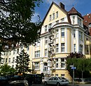
| Brahmsstrasse 3 52 ° 23 ′ 37 ″ N, 9 ° 45 ′ 39 ″ E |
Residential building |
|
||
| Brahmsstrasse 4 52 ° 23 ′ 38 ″ N, 9 ° 45 ′ 38 ″ E |
Residential building |

|
||
| Drostestrasse 22 52 ° 23 ′ 15 ″ N, 9 ° 44 ′ 45 ″ E |
St. Nicolai's pen |

|
||
| Edenstrasse 23 52 ° 23 ′ 17 ″ N, 9 ° 44 ′ 50 ″ E |
Elementary school | Built in 1895 according to plans by Paul Rowald . |

|
|
| Hammersteinstrasse 3 52 ° 23 ′ 30 ″ N, 9 ° 45 ′ 30 ″ E |
Residential building |

|
||
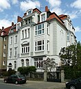
| Hammersteinstrasse 5 52 ° 23 ′ 32 ″ N, 9 ° 45 ′ 28 ″ E |
Residential building |
|
||
| Hammersteinstrasse 7 52 ° 23 ′ 34 ″ N, 9 ° 45 ′ 22 ″ E |
Residential building |

|
||
| Höfestraße 35 52 ° 23 ′ 48 ″ N, 9 ° 45 ′ 16 ″ E |
Former school |

|
||
| Hohenzollernstrasse 47 52 ° 23 ′ 11 ″ N, 9 ° 45 ′ 13 ″ E |
villa |

|
||
| Hohenzollernstrasse 54 52 ° 23 ′ 14 ″ N, 9 ° 45 ′ 10 ″ E |
villa |

|
||
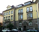
| Hohenzollernstrasse 55 52 ° 23 ′ 15 ″ N, 9 ° 45 ′ 10 ″ E |
Residential and office building |
|
||
| Hohenzollernstrasse 56 52 ° 23 ′ 16 ″ N, 9 ° 45 ′ 9 ″ E |
Residential and office building |

|
||
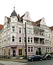
| Holbeinstrasse 16 52 ° 23 ′ 47 ″ N, 9 ° 46 ′ 7 ″ E |
Residential building |
|
||
| Hubertusstrasse 1 52 ° 23 ′ 21 ″ N, 9 ° 45 ′ 8 ″ E |
Residential building |

|
||
| Hubertusstrasse 2 52 ° 23 ′ 20 ″ N, 9 ° 45 ′ 9 ″ E |
Residential building |

|
||
| Hubertusstrasse 4 52 ° 23 ′ 21 ″ N, 9 ° 45 ′ 10 ″ E |
Residential building |

|
||
| Hunaeusstrasse 1 52 ° 23 ′ 42 ″ N, 9 ° 45 ′ 41 ″ E |
skyscraper |

|
||
| Kollenrodtstrasse 3 52 ° 23 ′ 18 ″ N, 9 ° 44 ′ 47 ″ E |
Comenius School | Built 1898–1900 according to plans by Paul Rowald and Carl Wolff . |

|
|
| Lister Kirchweg 51 52 ° 23 ′ 43 ″ N, 9 ° 44 ′ 59 ″ E |
Villa Kollenrodt |

|
||
| Lister Platz 52 ° 23 ′ 19 ″ N, 9 ° 45 ′ 2 ″ E |
Normal clock |

|
||
| Lister Strasse 52 ° 23 ′ 25 ″ N, 9 ° 45 ′ 2 ″ E |
Hansel and Gretel fountain | Terracotta figures, created in 1912 by the sculptor Georg Herting . |

|
|
| Lützerodestrasse 1 52 ° 23 ′ 12 ″ N, 9 ° 44 ′ 41 ″ E |
Clementine house (old hospital building, chimney) | Chimney of the former hospital power plant from 1885. |

|
|
| North ring 52 ° 24 ′ 14 ″ N, 9 ° 44 ′ 39 ″ E |
War memorial |

|
||
| Podbielskistraße 34 52 ° 23 ′ 28 ″ N, 9 ° 45 ′ 19 ″ E |
Residential building |

|
||
| Podbielskistraße 93 / Lister Kirchweg 112 52 ° 23 ′ 43 ″ N, 9 ° 45 ′ 45 ″ E |
Grenzburg rental house |

|
||
| Podbielskistraße 126 52 ° 23 ′ 47 ″ N, 9 ° 46 ′ 5 ″ E |
Residential building |

|
||
| Podbielskistraße 164 52 ° 23 ′ 53 ″ N, 9 ° 46 ′ 26 ″ E |
Deutsche Grammophon factory building |

|
||
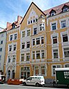
| Vossstrasse 36 52 ° 23 ′ 20 ″ N, 9 ° 44 ′ 32 ″ E |
Residential building |
|
||
| Pelikanplatz E |
Factory building "Scandinavienhaus" in the Pelikanviertel | Built in 1910 as part of the development of the new factory premises according to plans by Otto Taaks . |

|
|
| Waldstrasse 18 52 ° 23 ′ 34 ″ N, 9 ° 44 ′ 57 ″ E |
Kokenhof - former barn of the farm complex | In the ensemble with Waldstrasse 18 A. Built in the 17th century, the Kokemüller family's courtyard burned down down to the remaining buildings at the end of the 18th century. There were sleeping chambers in the southern part of the barn. The building stood empty for a long time in the 20th century and was gutted. In 2011/2012 three apartments were built, dormers and large window openings were built. |

|
|
| Waldstrasse 18 A 52 ° 23 ′ 34 ″ N, 9 ° 44 ′ 56 ″ E |
Kokenhof - old part of the former farm complex | In the ensemble with Waldstrasse 18. Built in the 17th century, the Kokemüller family's courtyard burned down to the end of the 18th century, with the exception of the remaining buildings. Used as a restaurant in the 20th century. |

|
|
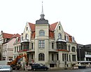
| Walderseestrasse 1 52 ° 23 ′ 20 ″ N, 9 ° 45 ′ 11 ″ E |
Residential building |
|
||
| Walderseestrasse 3 52 ° 23 ′ 22 ″ N, 9 ° 45 ′ 13 ″ E |
Residential building | Built in 1928 on behalf of the publisher Erich Madsack according to plans by Fritz Höger . |
 More pictures |
|
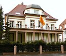
| Walderseestrasse 21 52 ° 23 ′ 33 ″ N, 9 ° 45 ′ 40 ″ E |
villa |
|
||
| Walderseestrasse 22 52 ° 23 ′ 33 ″ N, 9 ° 45 ′ 41 ″ E |
villa |

|
||
| Walderseestrasse 23 52 ° 23 ′ 35 ″ N, 9 ° 45 ′ 44 ″ E |
villa |

|
See also
literature
- Wolfgang Neß, Ilse Rüttgerodt-Riechmann, Georg Weiß (arrangement): City of Hanover, part 1. (= monument topography Federal Republic of Germany , architectural monuments in Lower Saxony , volume 10.1.) CW Niemeyer book publishers , Hameln 1983, ISBN 3-8271-8243-3 .
Web links
Commons : Kulturdenkmale in Vahrenwald-List - Collection of pictures, videos and audio files
Individual evidence
- ↑ a b c d e f g h i j k l m n o p q r s t u v w x y z aa ab ac ad ae af ag ah ai aj ak al am an ao ap aq ar as at au av aw ax ay az ba bb bc bd be bf bg bh bi bj bk bl bm bn bo bp bq br bs bt bu bv bw bx by bz ca cb cc cd ce cf cg ch ci cj ck cl cm cn co cp cq cr cs ct cu cv cw cx cy cz da db dc dd de df dg dh di dj dk dl dm dn do dp dq dr ds dt du dv dw dx dy dz ea eb ec ed ee ef eg eh ei ej ek el em en eo ep eq er Niedersächsisches State Administration Office - Institute for Monument Preservation: City of Hanover: Directory of architectural monuments according to § 4 (NDSchG) (excluding architectural monuments of the archaeological monument preservation) , as of July 1, 1985
- ↑ Marcel Schwarzenberger: List / Fire protection asserts itself against monument protection / After much back and forth because of monument protection requirements, the urgently needed renovation of the Sylter Weg daycare center can begin. Popular after-school care centers were at risk. on the page of the Hannoversche Allgemeine Zeitung from May 1, 2013, updated May 4, 2013, last accessed on December 4, 2016
- ↑ a b Conrad von Meding: Conversion in the historic Lister Waldhäuschen , in: Hannoversche Allgemeine Zeitung, September 29, 2011, p. 19

