List of cultural monuments in Goldisthal
The list of cultural monuments in Goldisthal includes the cultural monuments of the community Goldisthal in the Thuringian district of Sonneberg . This list is based on the book Monument Topography of the Federal Republic of Germany - Cultural Monuments in Thuringia / District of Sonneberg by Thomas Schwämmlein with the status of registration on May 30, 2005. The following information does not replace the legally binding information from the monument protection authority.
| Street | description | photo |
|---|---|---|
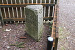
| Tin hammer | The signpost and distance stone dates from the 19th century and indicates the directions and distances to Sonneberg, Rudolstadt and Katzhütte. |

|
| Goldberg 2 | The construction of the former inn, a slated, two-story half-timbered building with a mansard hipped roof and massive, barrel-vaulted cellar, was commissioned by the mining entrepreneur Ernst Ludwig von Damnitz in 1737. In the 19th century the restaurant was called "Zum Fröhlichen Mann". It was used as an inn until 1990. After that, the building, also known as the manor house, stood empty for a long time. After extensive renovation, it has housed the newly established natural history museum "House of Nature" since the end of 2013. |

|
| Hauptstrasse 22 | The two-story main building of a former sawmill was built in 1919 by the owner of the sawmill, Berthold Langbein, in the style of homeland security architecture. |

|
| Hauptstrasse 30 | The Evangelical Lutheran Church was built in 1891/92 as a neo-Gothic hall church with a gable roof and gable turret according to plans by the Schwarzburg-Rudolstadt building council and architect Rudolph Brecht. |

|
| Wurzelberg | The Altfrauenteich, a former rafting pond, was dammed at the beginning of the 18th century at the instigation of the Schwarzburg-Rudolstadt forest administration and was used for rafting logs until 1873 . |

|
| High heather | The Kleine Dreiherrnstein on the Hohen Heide marked the border point of the territories of Saxony-Meiningen , Schwarzburg-Rudolstadt and Schwarzburg-Sondershausen from 1846 onwards . |

|
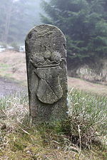
| Rennsteig | State boundary stones from the 17th to 19th centuries are on the Rennsteig, the former border between Schwarzburg-Rudolstadt and the Ernestine princes and duchies .
(See also the list of Rennsteig landmarks in the Saarzipfel – Hohe Heide section ) |

|
| Goldbachtal | State boundary stones from the 17th to 19th centuries are located in the Goldbachtal, the former border between Schwarzburg-Rudolstadt and Schwarzburg-Sondershausen. |

|
literature
- Thomas Schwämmlein: District of Sonneberg (= monument topography of the Federal Republic of Germany . Cultural monuments in Thuringia. Vol. 1). E. Reinhold, Altenburg 2005, ISBN 3-937940-09-X , pp. 241-247.
Web links
Commons : Kulturdenkmale in Goldisthal - Collection of pictures, videos and audio files