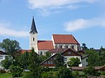
List of listed objects in Aschbach-Markt
The list of listed objects in Aschbach-Markt contains the 10 listed , immovable objects of the market town of Aschbach-Markt in the Lower Austrian district of Amstetten .
Monuments
| photo | monument | Location | description | Metadata |
|---|---|---|---|---|

|
Vicarage ObjectID : 27974 |
Kirchenplatz 1a KG location : Aschbach Markt |
Erected in 1740 by Laurenz Frühwald based on a design by Joseph Munggenast . Century expanded to a square. |
ObjectID : 27974 Status: § 2a Status of the BDA list: 2020-02-29 Name: Pfarrhof GstNr .: .55 Pfarrhof Aschbach-Markt |

|
Residential building, former sacristan's house ObjectID : 27977 |
Kirchenplatz 2 KG location : Aschbach Markt |
The sacristan's house was the first school house from 1616 to 1826, later also a youth home and finally a residential building with accommodation for the Lower Austrian relief organization. |
ObjektID : 27977 Status: § 2a Status of the BDA list: 2020-02-29 Name: Residential house, former sexton house GstNr .: .60 Former. Mesnerhaus Aschbach-Markt |
| Figure shrine St. Johannes Nepomuk ObjectID : 27982 |
Rathausplatz KG location : Aschbach Markt |
The statue, which is dated 1758, was moved in 1988/99 and placed in a neo-baroque basin . |
ObjectID : 27982 Status: § 2a Status of the BDA list: 2020-02-29 Name: Figurine picture stick hl. Johannes Nepomuk GstNr .: 903/12 |
|

|
Town hall ObjectID : 27981 |
Rathausplatz 1 KG location : Aschbach Markt |
A free-standing structure, the substance of which dates from 1769. The historicist facade with secessionist elements was added at the beginning of the 20th century. |
ObjectID : 27981 Status: § 2a Status of the BDA list: 2020-02-29 Name: Rathaus GstNr .: .22 Rathaus Aschbach-Markt |

|
Catholic parish church hl. Martin ObjectID : 27972 |
KG location : Aschbach Markt |
A late Gothic staggered church with a presented west tower, which has a neo-baroque bell storey. The neo-Gothic altars (high and side altars) were built on the 19th and 20th centuries. Turn of the century by Clemens Raffeiner to designs by Johann Maria Reiter. |
ObjectID : 27972 Status: § 2a Status of the BDA list: 2020-02-29 Name: Catholic parish church hl. Martin GstNr .: .59 Parish Church Aschbach-Markt |

|
Christian cemetery ObjectID : 27976 |
KG location : Aschbach Markt |
There is a priestly crypt chapel in the cemetery. This is a rectangular building with a half-hipped roof from the middle of the 19th century. |
ObjectID : 27976 Status: § 2a Status of the BDA list: 2020-02-29 Name: Friedhof christlich GstNr .: 418 Friedhof Aschbach-Markt |

|
Oberleitner Chapel ObjectID : 27956 |
Hauptstrasse location KG: Krenstetten |
A chapel with a gable roof built in the historicist mixed style in 1907. |
ObjectID : 27956 Status: § 2a Status of the BDA list: 2020-02-29 Name: Oberleitnerkapelle GstNr .: .109 |

|
Parsonage Object ID: 27953 |
Hauptstrasse 18 KG location : Krenstetten |
A two-story building with a hipped roof that was built in 1860. |
ObjectID : 27953 Status: § 2a Status of the BDA list: 2020-02-29 Name: Pfarrhof GstNr .: .46 / 2 Pfarrhof Krenstetten |

|
Karner ObjectID : 27952 |
Marienplatz 2 KG location : Krenstetten |
The small cubic building under a gable roof dates from the 1st half of the 19th century and is located in the walled cemetery. The original Karner was allegedly removed at the end of the 1980s and replaced by a new building. |
ObjectID : 27952 Status: § 2a Status of the BDA list: 2020-02-29 Name: Karner GstNr .: .52 Karner Krenstetten |

|
Catholic parish church / pilgrimage church Mariae Himmelfahrt and cemetery ObjectID : 27951 |
KG location : Krenstetten |
A late Gothic staggered church with an exposed west tower. The three altars are neo-Gothic. The early baroque pulpit comes from the Seitenstetten collegiate church . |
ObjektID : 27951 Status: § 2a Status of the BDA list: 2020-02-29 Name: Catholic parish church / pilgrimage church Mariae Himmelfahrt and cemetery GstNr .: .54; 664 Krenstetten pilgrimage church |
Web links
Commons : Listed objects in Aschbach-Markt - collection of pictures, videos and audio files
Individual evidence
- ↑ a b Lower Austria - immovable and archaeological monuments under monument protection. (PDF), ( CSV ). Federal Monuments Office , as of February 14, 2020.
- ↑ a b c d e f g Federal Monuments Office (ed.): Dehio-Handbuch. The art monuments of Austria. Lower Austria, south of the Danube , part 1, Berger Verlag, Horn / Vienna 2003, ISBN 3-85028-364-X
- ^ Homepage of the Aschbach elementary school
- ↑ Home Mostwiki on the town Aschbach Markt
- ↑ after Lower Austria Atlas; GstNr. 903/1 according to BDA not applicable
- ↑ § 2a Monument Protection Act in the legal information system of the Republic of Austria .
