List of listed objects in Hollenstein an der Ybbs
The list of listed objects in Hollenstein an der Ybbs contains the 21 listed , immovable objects of the municipality of Hollenstein an der Ybbs in the Lower Austrian district of Amstetten .
Monuments
| photo | monument | Location | description | Metadata |
|---|---|---|---|---|
|
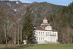
Hohenlehen palace complex ObjectID : 28179 |
Garnberg 8 KG location : Garnberg |
A monumental villa building from the years 1906 to 1910, which is currently used as an agricultural school. |
ObjectID : 28179 Status: § 2a Status of the BDA list: 2020-02-29 Name: Schlossanlage Hohenlehen GstNr .: 273/3; 329/3 |

|
Residential house, so-called stone house ObjectID : 28138 |
Village 4 location KG: Großhollenstein |
A two-story, gable-independent building with a richly decorated main and side front from the end of the 18th century. |
ObjectID : 28138 Status : Notification Status of the BDA list: 2020-02-29 Name: Residential house, so-called Steinhaus GstNr .: .40 / 1 |

|
Gasthaus Zur golden Sense ObjektID : 28140 |
Village 6 location KG: Großhollenstein |
A late Gothic building in substance with remains of a late Baroque facade painting. |
ObjectID : 28140 Status : Notification Status of the BDA list: 2020-02-29 Name: Gasthaus Zur golden Sense GstNr .: .55 / 1 |

|
Residential building, so-called Stiftshaus ObjectID : 28142 |
Dorf 11 KG location : Großhollenstein |
A two-storey building that is essentially late Gothic. |
ObjectID : 28142 Status : Notification Status of the BDA list: 2020-02-29 Name: Residential building, so-called Stiftshaus GstNr .: 341 |
|
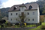
Residential building, former rectory ObjectID : 28143 |
Village 18 Location KG: Großhollenstein |
A two-storey baroque building with a crooked roof from the end of the 17th century. |
ObjectID : 28143 Status : Notification Status of the BDA list: 2020-02-29 Name: Residential building, former vicarage GstNr .: 387 |

|
Unterleiten Castle, agricultural college ObjectID : 28153 |
Dornleiten 1 KG location : Großhollenstein |
A former two story manor house currently used as an agricultural school. The substance of the building dates from the second half of the 18th century and was rebuilt around 1900 under Baron Rothschild . |
ObjectID : 28153 Status: § 2a Status of the BDA list: 2020-02-29 Name: Schloss Unterleiten, agricultural college GstNr .: 682/2 |
|
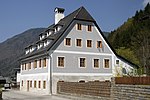
Former Hammerherrenhaus Kalchau ObjectID : 23120 |
Dornleiten 18 KG location : Großhollenstein |
A two-story mansion with a high two-story gable and a mighty crooked roof from the middle of the 18th century and with substance from the 16th / 17th century. Century. |
ObjectID : 23120 Status : Notification Status of the BDA list: 2020-02-29 Name: Former Hammerherrenhaus Kalchau GstNr .: .104 / 1 |
|
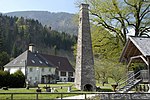
Former Hammerherrenhaus with two meals ObjektID : 28164 |
Dornleiten 19 KG location : Großhollenstein |
A two-story manor house dated 1831. |
ObjectID : 28164 Status : Notification Status of the BDA list: 2020-02-29 Name: Former Hammerherrenhaus with two meals GstNr .: 460 |

|
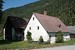
Town Hall / Municipal Office ObjectID : 28144 |
Walcherbauer 2 location KG: Großhollenstein |
A two-storey building with a wide hip gable with substance from the 17th century, which was rebuilt from 1961 to 1963 according to plans by Julius Bergmann. The historicist facade decor dates from the middle of the 19th century. |
ObjectID : 28144 Status: § 2a Status of the BDA list: 2020-02-29 Name: City Hall / Municipal Office GstNr .: .59 |
|
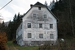
Farmhouse, vulgo Wieden ObjectID : 47760 |
Walcherbauer 7 KG location : Großhollenstein |
A rural property from the end of the 18th century, which was significantly changed in the third quarter of the 19th century. |
ObjectID : 47760 Status : Notification Status of the BDA list: 2020-02-29 Name: Bauernhaus, vulgo Wieden GstNr .: 167 |
|
Residential building ObjectID : 28176 |
Wenten 1 location KG: Großhollenstein |
A former manor house with a Biedermeier facade , which is dated 1839. |
ObjectID : 28176 Status: § 2a Status of the BDA list: 2020-02-29 Name: Wohnhaus GstNr .: .202 |

|
Hammerhaus, ruins of the hammer building, wayside chapel ObjectID : 28177 |
Wenten 3 location KG: Großhollenstein |
A two-storey mansion with a crooked roof from 1823, the core of which is older. |
ObjektID : 28177 Status : Notification Status of the BDA list: 2020-02-29 Name: Hammerhaus, ruins of the hammer building, Wegkapelle GstNr .: 888/5; 888/1; 888/4 |

|
Farmhouse, so-called Haus Haberfeld ObjectID : 76798 |
Wenten 13 KG location : Großhollenstein |
ObjectID : 76798 Status : Notification Status of the BDA list: 2020-02-29 Name: Farmhouse, so-called Haus Haberfeld GstNr .: 840 |
|
|
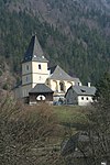
Catholic parish church hl. John the Baptist and St. Nikolaus ObjectID : 28134 |
Location KG: Großhollenstein |
A late baroque hall church with a mighty, three-storey west tower, visible from afar . The high altar and the side altars date from the middle to the end of the 18th century (the altar leaves from the middle of the 19th century). |
ObjectID : 28134 Status: § 2a Status of the BDA list: 2020-02-29 Name: Catholic parish church hl. John the Baptist and St. Nikolaus GstNr .: .72 Parish Church Hollenstein an der Ybbs |

|
War memorial ObjectID : 28148 |
Location KG: Großhollenstein |
Location between the elementary or secondary school and the old rectory . |
ObjectID : 28148 Status: § 2a Status of the BDA list: 2020-02-29 Name: War memorial GstNr .: 1257/1 |

|
Kalvarienbergkapelle / Kalvarienberg ObjektID : 28149 |
Location KG: Großhollenstein |
The Kalvarienberg chapel with a steep gable roof , high, curved gable and an imagined turret dates from the middle of the 18th century and was partially rebuilt in the 19th century. |
ObjectID : 28149 Status: § 2a Status of the BDA list: 2020-02-29 Name: Kalvarienbergkapelle / Kalvarienberg GstNr .: .82; 348/2; 348/3 Kalvarienberg (Hollenstein an der Ybbs) |

|
School Cross Chapel ObjectID : 28150 |
Location KG: Großhollenstein |
A semicircular open chapel with a curved gable from the third quarter of the 18th century on the square in front of the elementary or secondary school. |
ObjectID : 28150 Status: § 2a Status of the BDA list: 2020-02-29 Name: Schulkreuzkapelle GstNr .: 1257/1 |

|
Shrine Object ID: 28152 |
Location KG: Großhollenstein |
ObjectID : 28152 Status: § 2a Status of the BDA list: 2020-02-29 Name: wayside shrine GstNr .: 1251/6 wayside shrine Kreuzwag (Hollenstein an der Ybbs) |
|

|
Krengraben reception building ObjectID : 28191 |
Krenngraben 15 KG location : Krengraben |
ObjectID : 28191 Status : Notification Status of the BDA list: 2020-02-29 Name: Krengraben reception building GstNr .: .17 Kleinhollenstein station |
|
|
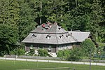
Altes Forsthaus Sandgraben ObjectID : 28174 |
Oberkirchen 15 KG location : Oberkirchen |
A single-storey shingle block building on a high stone wall plinth from the end of the 18th century. |
ObjectID : 28174 Status : Notification Status of the BDA list: 2020-02-29 Name: Altes Forsthaus Sandgraben GstNr .: 535/24 |
|
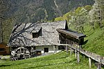
Mautmühle am Grubbach ObjectID : 28187 |
KG location : Oberkirchen |
ObjectID : 28187 Status : Notification Status of the BDA list: 2020-02-29 Name: Mautmühle am Grubbach GstNr .: 388 Gugermühle |
Web links
Commons : Listed objects in Hollenstein an der Ybbs - collection of images, videos and audio files
Individual evidence
- ↑ a b Lower Austria - immovable and archaeological monuments under monument protection. (PDF), ( CSV ). Federal Monuments Office , as of February 14, 2020.
- ↑ a b c d e f g h i j k l m n o p Federal Monuments Office (ed.): Dehio manual. The art monuments of Austria. Lower Austria, south of the Danube , part 1, Berger Verlag, Horn / Vienna 2003, ISBN 3-85028-364-X
- ↑ § 2a Monument Protection Act in the legal information system of the Republic of Austria .

