List of listed objects in Graz / Straßgang
The list of listed objects in Graz / Straßgang contains the 29 listed immovable objects of the XVI. Graz city district Straßgang taking into account the district part Webling .
Monuments
| photo | monument | Location | description | Metadata |
|---|---|---|---|---|

|
Catholic parish church hl. Rupert, Aribonenkirche ObjectID : 25665 |
at Aribonenstrasse 10, KG location : Straßgang |
ObjectID : 25665 Status : Notification Status of the BDA list: 2020-02-29 Name: Catholic parish church hl. Rupert, Aribonenkirche GstNr .: .18 |
|
|
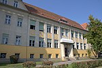
Secondary School Aribonenstraße ObjectID : 119303 |
Aribonenstraße 14 KG location : Straßgang |
ObjektID : 119303 Status: § 2a Status of the BDA list: 2020-02-29 Name: Primary school Aribonenstraße GstNr .: .220 |
|

|
Crucifix and figure of Mary ObjectID : 119149 |
Florianibergstraße KG location : Straßgang |
ObjectID : 119149 Status: § 2a Status of the BDA list: 2020-02-29 Name: Crucifix and Marienfigur GstNr .: 505 |
|

|
Catholic branch church hl. Florian ObjectID : 119150 |
Florianibergstraße KG location : Straßgang |
ObjectID : 119150 Status: § 2a Status of the BDA list: 2020-02-29 Name: Kath. Filialkirche hl. Florian GstNr .: .60 Filial church hl. Florian, Straßgang |
|
|
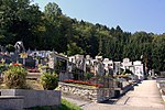
Cemetery ObjectID : 122706 |
Florianibergstraße KG location : Straßgang |
ObjectID : 122706 Status: § 2a Status of the BDA list: 2020-02-29 Name: Friedhof GstNr .: 279/1 |
|

|
Catholic Parish Church Maria Elend and Kirchhof ObjektID : 57109 |
Florianibergstrasse 13 KG location : Straßgang |
ObjectID : 57109 Status: § 2a Status of the BDA list: 2020-02-29 Name: Catholic Parish Church Maria Elend and Kirchhof GstNr .: .440 Church Maria im Elend (Straßgang) |
|

|
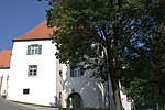
Jubilee Chapel ObjectID : 119146 |
at Florianibergstrasse 13 KG location : Straßgang |
The square jubilee chapel with a tent roof stands on the north wall of the churchyard and was probably built in the 18th century. The wrought iron lattice wings date from the 1st half of the 18th century. |
ObjectID : 119146 Status: § 2a Status of the BDA list: 2020-02-29 Name: Jubiläumskapelle GstNr .: .440 |
|
Parsonage Object ID: 57108 |
Florianibergstrasse 15 KG location : Straßgang |
ObjectID : 57108 Status: § 2a Status of the BDA list: 2020-02-29 Name: Pfarrhof GstNr .: .31 / 1 |
|
|
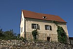
Residential building, former sacristan's house ObjectID : 57110 |
Florianibergstrasse 17 KG location : Straßgang |
According to the inscription, the former sacristan's house was built in 1529 and redesigned in the 18th century. |
ObjectID : 57110 Status: § 2a Status of the BDA list: 2020-02-29 Name: Residential house, former sexton house GstNr .: .31 / 2 |

|
Figure shrine St. Johannes Nepomuk ObjectID : 119147 |
at Florianibergstrasse 19 KG location : Straßgang |
The remarkable sandstone figure of St. John Nepomuk dates from around 1730. |
ObjectID : 119147 Status: § 2a Status of the BDA list: 2020-02-29 Name: Figurine picture stick hl. Johannes Nepomuk GstNr .: 345/1 Wayside shrine of Saint John Nepomuk, Straßgang |

|
District Office Straßgang ObjectID : 119358 |
Kärntner Straße 411 KG location : Straßgang |
According to the inscription, the house with a secessionist facade was built between 1908 and 1914. |
ObjectID : 119358 Status: § 2a Status of the BDA list: 2020-02-29 Name: District Office Straßgang GstNr .: .167 |
|
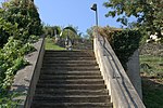
Rose plant Object ID: 128090 |
at Kärntner Straße 420, 422 KG location : Straßgang |
ObjectID : 128090 Status: § 2a Status of the BDA list: 2020-02-29 Name: Stairway system GstNr .: 507 |
|

|
House, Former School ObjectID : 57111 |
Kärntner Straße 428 KG location : Straßgang |
The main building dates from the 15th and 16th centuries and was rebuilt in 1783. |
ObjectID : 57111 Status : Notification Status of the BDA list: 2020-02-29 Name: Residential house, Former School GstNr .: .37 |
|
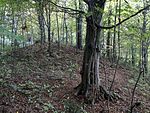
Roman settlement and barrows at Katzelbach ObjectID: 8763 |
Katzelbach / St. Martin location KG: Straßgang |
ObjectID: 8763 Status: Notification Status of the BDA list: 2020-02-29 Name: Roman settlement and barrows at Katzelbach GstNr .: 287; 288; 290/9 |
|

|
Hochkofler residence ObjektID : 36229 |
Am Weinhang 15 KG location : Webling |
Object ID: 36229 Status: notice prior BDA list: 2020-02-29 Name: Ansitz Hochkofler GstNr .: .95 Ansitz Hochkofler |
|

|
Garden pavilion of the Hochkofler residence ObjektID : 36230 |
at Am Weinhang 15 location KG: Webling |
ObjectID : 36230 Status : Notification Status of the BDA list: 2020-02-29 Name: Garden pavilion of the Hochkofler residence GstNr .: 676 Hochkofler residence |
|
| Schützenhütte at the Hochkofler residence ObjektID : 36231 |
Am Weinhang 17 KG location : Webling |
ObjectID : 36231 Status : Notification Status of the BDA list: 2020-02-29 Name: Schützenhütte at the Hochkofler residence GstNr .: .96 / 1 Hochkofler residence |
||

|
Roman burial group near Bründlteich ObjectID : 75125 |
Bründlteich location KG: Webling |
ObjektID : 75125 Status : Notification Status of the BDA list: 2020-02-29 Name: Roman-era tumulus group at Bründlteich GstNr .: 1/2 Roman grave at Bründlteiche |
|
| Prehistoric settlement on the Buchkogel ObjectID : 94031 |
Buchkogel location KG: Webling |
Note: Coordinate denotes the location of the prehistoric hilltop settlement near the church of St. Johann and Paul . |
ObjektID : 94031 Status : Notification Status of the BDA list: 2020-02-29 Name: Prehistoric settlement on Buchkogel GstNr .: 1/1 |
|

|
Farmer 's Chapel ObjectID : 128009 |
Harter Strasse 142, KG location : Webling |
ObjectID : 128009 Status: § 2a Status of the BDA list: 2020-02-29 Name: Bauernwirt-Kapelle GstNr .: 777/2 |
|

|
St. Martin Castle ObjectID : 57103 |
Kehlbergstrasse 35 KG location : Webling |
ObjectID : 57103 Status : Notification Status of the BDA list: 2020-02-29 Name: Schloss St. Martin GstNr .: 47 Schloss St. Martin, Graz |
|

|
Catholic branch church hl. Martin / Castle Church ObjectID : 57105 |
Kehlbergstrasse 36 KG location : Webling |
ObjectID : 57105 Status: § 2a Status of the BDA list: 2020-02-29 Name: Kath. Filialkirche hl. Martin / Schlosskirche GstNr .: .4 Schlosskirche St. Martin, Graz |
|

|
Outbuildings Object ID: 119272 |
Martinhofstrasse 111 KG location : Webling |
ObjectID : 119272 Status: § 2a Status of the BDA list: 2020-02-29 Name: Commercial building GstNr .: .2 |
|

|
Administration and management building ObjectID: 7309 |
Wagner-Jauregg-Platz 1 KG location : Webling |
ObjectID: 7309 Status: Notification Status of the BDA list: 2020-02-29 Name: Administration and directorate building GstNr .: .160 Landesnervenklinik Sigmund Freud |
|

|
Institution Church ObjectID: 7311 |
Wagner-Jauregg-Platz 26 KG location : Webling |
The institution church was built at the end of the 19th and beginning of the 20th centuries according to plans by Josef Flohr. It is a medium-sized building with a cross-shaped floor plan and was built in neo-Romanesque and neo-Gothic styles. On the southeast side there is a tower with a pointed helmet. The interior consists of a two-bay, single-nave nave with a groined vault on pillars. Some of the furnishings date from the time the church was built. |
ObjectID: 7311 Status: Notification Status of the BDA list: 2020-02-29 Name: Anstaltskirche GstNr .: .163 Landesnervenklinik Sigmund Freud |

|
Water tower with fountain facility ObjectID: 7312 |
Wagner-Jauregg-Platz 27 KG location : Webling |
ObjectID: 7312 Status: Notification Status of the BDA list: 2020-02-29 Name: Water tower with fountain system GstNr .: .207 Landesnervenklinik Sigmund Freud |
|

|
Pavilion A, house no.4 ObjectID: 7310 |
Wagner-Jauregg-Straße 4 KG location : Webling |
ObjectID: 7310 Status: Notification Status of the BDA list: 2020-02-29 Name: Pavilion A, House No. 4 GstNr .: .162 Landesnervenklinik Sigmund Freud |
|

|
Roman settlement and barrows Martinhofstrasse ObjectID: 8774 |
Martinhofstraße KG location : Webling |
ObjektID: 8774 Status: Notification Status of the BDA list: 2020-02-29 Name: Roman settlement and barrows Martinhofstrasse GstNr .: 20/1; 24/2 |
|

|
Rudolfswarte am Buchkogel ObjectID : 131000 since 2017 |
Buchkogel location KG: Webling |
ObjectID : 131000 Status : Notification Status of the BDA list: 2020-02-29 Name: Rudolfswarte am Buchkogel GstNr .: 1/1 Kronprinz-Rudolf-Warte Graz |
Web links
Commons : Listed objects in Straßgang - Collection of images, videos and audio files
Individual evidence
- ↑ a b Styria - immovable and archaeological monuments under monument protection. (PDF), ( CSV ). Federal Monuments Office , as of February 18, 2020.
- ↑ Georg Dehio (greeting), Horst Schweigert (editing): Graz ( Austria's art monuments ). Schroll Verlag, Vienna 1979, ISBN 3-7031-0475-9 .
- ↑ § 2a Monument Protection Act in the legal information system of the Republic of Austria .