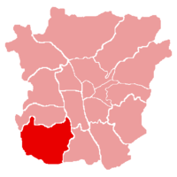
Webling (Graz)
| Webling ( district ) | ||
|---|---|---|
|
|
||
| Basic data | ||
| Pole. District , state | Graz , Styria | |
| Judicial district | Graz (city) | |
| Pole. local community | Graz ( KG Webling) | |
| Locality | Straßgang | |
| Coordinates | 47 ° 2 '24 " N , 15 ° 24' 36" E | |
| height | 360 m above sea level A. | |
| Straßgang district | ||

|
||
| Source: STAT : index of places ; BEV : GEONAM ; GIS-Stmk | ||
Webling is a cadastral district in the district Straßgang in Graz .
geography
Webling covers the northern part of Straßgang and borders in the north on Wetzelsdorf , in the east on Gries and Puntigam . In the west of the district, the southern part of the Plabutsch-Buchkogel train forms the city limits and separates Graz from Hitzendorf . Framed by the Buchkogel - Bockkogel - Florianiberg arch is the Weblinger Bucht - also the Bay of Kehlberg - which is filled with clayey deposits of the Torton , Sarmat and Unterpannons and partly covered with Pleistocene dust sand.
traffic
The Grazer Ring Straße , which is referred to here as Weblinger Gürtel , and Packer Straße , which is called Kärntner Straße , form the backbone. Both lead to the Webling distribution circle and thus represent the connection to the A9 ( Pyhrn Autobahn ).
Via the Graz Webling stop on the Köflacherbahn , Webling is connected to the rail network and connects to Graz main train station .
Individual evidence
- ↑ Helmut wing : The geology of the Grazer Bergland. In: Communications from the Department of Geology, Paleontology and Mining at the Landesmuseum Joanneum , Graz 1975, pp. 276–277. Online PDF , accessed July 30, 2019.
