List of listed objects in Harmannsdorf (Lower Austria)
The list of listed objects in Harmannsdorf contains the 17 listed , immovable objects of the Lower Austrian market town of Harmannsdorf .
Monuments
| photo | monument | Location | description | Metadata |
|---|---|---|---|---|

|
Kreisgrabenanlage Kleinrötz ObjectID : 2066 |
Zwingeläcker location KG: Kleinrötz |
Double circular ditch , diameter: 70 m / 104 m, 1997 magnetically prospected from the Middle Neolithic ~ 4800 BC BC to ~ 4500 BC However, the area of the complex was also used by later settlers, as the many other archaeological structures show. |
ObjectID: 2066 Status: Notification Status of the BDA list: 2020-02-29 Name: Kreisgrabenanlage Kleinrötz GstNr .: 1936/1; 1936/2 |

|
Shrine Object ID: 17509 |
KG location : Kleinrötz |
Imposing over four meters high niche shrines, chamfered pillars, niche top with segment arch openings each containing an image of a saint. The wayside shrine is on Landesstraße 33 at the southern entrance to Kleinrötz. |
ObjectID : 17509 Status: § 2a Status of the BDA list: 2020-02-29 Name: Bildstock GstNr .: 1848 |

|
Catholic branch church hl. Trinity ObjectID : 17510 |
Kirchengasse KG location : Kleinrötz |
The church was consecrated on October 20, 1907. Renovated in 1927 and rebuilt from 1968 to 1971. Simple hall construction with drawn-in, round closed choir, presented facade tower with tent roof. |
ObjectID : 17510 Status: § 2a Status of the BDA list: 2020-02-29 Name: Kath. Filialkirche hl. Dreifaltigkeit GstNr .: 2303 Filialkirche Kleinrötz |
|
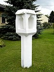
Late Gothic light column ObjectID: 897 |
Dorfstrasse 21 KG location : Mollmannsdorf |
Late Gothic light column . Cube on a hexagonal column. The pillar stands on private property in the garden of a family home. |
ObjectID: 897 Status: Notification Status of the BDA list: 2020-02-29 Name: Late Gothic light column GstNr .: 1249 |
|
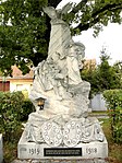
War memorial ObjectID: 891 |
Hollabrunner Straße KG location : Obergänserndorf |
War memorial from 1918 to commemorate those who fell in the First and Second World Wars. The fallen soldiers of the First World War are immortalized on the base of the monument with a photo and their name. The names of those who fell in World War II are written on plaques next to the memorial. |
ObjectID: 891 Status: § 2a Status of the BDA list: 2020-02-29 Name: War memorial GstNr .: 639 |
|
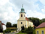
Catholic parish church hl. Barbara ObjectID: 890 |
Florianiplatz location KG: Obergänserndorf |
The parish church of St. Barbara in Obergänserndorf is a hall building from 1813 with a retracted, flat arched chancel. Narrower front yoke with entrance facade, in the middle the slightly protruding tower with arched sound windows and bell dome. |
ObjectID: 890 Status: § 2a Status of the BDA list: 2020-02-29 Name: Catholic parish church hl. Barbara GstNr .: 1 |

|
Wilantisdorf deserted area ObjectID: 2067 since 2014 |
Rückersdorf location KG: Rückersdorf |
A village called Wielensdorf was settled in the Rohrwald until the 15th century . Towards the end of the 15th century, the population fled to Rückersdorf to seek protection. The settlement was left to decay. |
ObjectID: 2067 Status: Notification Status of the BDA list: 2020-02-29 Name: Ortswüstung Wilantisdorf GstNr .: 5026/6; 5027; 5032/3; 5035; 5060; 5062 |

|
Corridor / path chapel ObjectID : 17512 |
Harmannsdorfer Straße KG location : Rückersdorf |
The wayside chapel at the southern entrance to Harmannsdorf was built in 1854. |
ObjectID : 17512 Status: § 2a Status of the BDA list: 2020-02-29 Name: Flur- / Wegkapelle GstNr .: .512 |
|
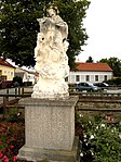
Figure St. Johannes Nepomuk ObjectID: 887 |
Kirchengasse KG location : Rückersdorf |
Baroque figure of John of Nepomuk with a golden halo and angels on a square base decorated with putti. Around 1730. In 1963 the statue was moved from Kirchenplatz 2 to the relief ditch of the Danube trench between the two bridges (Ringgasse and Kirchengasse) and restored. |
ObjectID: 887 Status: § 2a Status of the BDA list: 2020-02-29 Name: Figur hl. Johannes Nepomuk GstNr .: 196/5 |

|
Wayside shrine ObjectID: 886 |
Schubertplatz location KG: Rückersdorf |
Pillar shrine with square top and four-sided inscription. Niche top with arched openings, 16/17. Century. |
ObjectID: 886 Status: § 2a Status of the BDA list: 2020-02-29 Name: Bildstock GstNr .: 5225/3 |

|
Plague / Trinity Column, Beautiful Column ObjectID: 883 |
Rohrwald location KG: Rückersdorf |
Holy Trinity column, over 5 meters high. Erected in 1730 out of gratitude for a riding accident that was unharmed at this point in 1729. |
ObjectID: 883 Status: § 2a Status of the BDA list: 2020-02-29 Name: Pest- / Dreifaltigkeitssäule, Schöneäule GstNr .: 5187/1 |
|
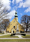
Catholic parish church hl. Hippolyt ObjectID: 888 |
Kirchenplatz KG location : Rückersdorf |
The parish church of Harmannsdorf is a hall construction whose Romanesque foundations were built according to estimates by 1217 at the latest. The church was first mentioned in a document in 1282. In 1689 the church, with the exception of the chancel and the Gothic chapel on the south side, was redesigned in baroque styles. In 1978 a complete interior renovation was carried out. |
ObjectID: 888 Status: § 2a Status of the BDA list: 2020-02-29 Name: Catholic parish church hl. Hippolyt GstNr .: 720/2 Parish Church St. Hippolyt (Harmannsdorf) |
|
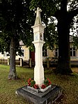
Shrine Object ID: 17505 |
at Landstrasse 2, KG location : Seebarn |
Pillar shrine, square tower with four holy images behind glass. |
ObjectID : 17505 Status: § 2a Status of the BDA list: 2020-02-29 Name: wayside shrine GstNr .: 664/1 |
|
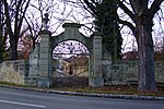
Seebarn Castle ObjectID: 898 |
Schloßstraße 1 KG location : Seebarn |
Seebarn Castle was built in the second half of the 17th century and redesigned around 1740 and in the 19th century. It is surrounded by a partially preserved stone wall. |
ObjectID: 898 Status: Notification Status of the BDA list: 2020-02-29 Name: Schloss Seebarn GstNr .: .1; 16/2; 16/3; 16/4; 16/6; 16/9; 16/10 Seebarn Castle |

|
Local chapel St. Rosalia ObjectID : 17507 |
Kirchenplatz KG location : Seebarn |
The chapel was consecrated on September 3, 1874. |
ObjectID : 17507 Status: § 2a Status of the BDA list: 2020-02-29 Name: Ortskapelle hl. Rosalia GstNr .: .57 |

|
Johannes v. Nepomuk wayside shrine ObjectID : 17504 |
Obere Allee location KG: Seebarn |
The statue of Johannes Nepomuk on a pedestal was erected in 1709. |
ObjectID : 17504 Status : Notification Status of the BDA list: 2020-02-29 Name: Johannes v. Nepomuk wayside shrine, GstNr .: 162 |

|
Figure St. Johannes Nepomuk ObjectID: 894 |
Friedhofstrasse location KG: Würnitz |
The Johannes Nepomuk figure on a square base was erected in 1707. |
ObjectID: 894 Status: § 2a Status of the BDA list: 2020-02-29 Name: Figur hl. Johannes Nepomuk GstNr .: 1458/3 |
Web links
Commons : Listed objects in Harmannsdorf - collection of pictures, videos and audio files
Individual evidence
- ↑ a b Lower Austria - immovable and archaeological monuments under monument protection. (PDF), ( CSV ). Federal Monuments Office , as of February 14, 2020.
- ↑ fallbach.at ( Memento of the original from February 27, 2012 in the Internet Archive ) Info: The archive link was inserted automatically and has not yet been checked. Please check the original and archive link according to the instructions and then remove this notice.
- ↑ Entry on Kleinrötz in the database Gedächtnis des Landes for the history of Lower Austria ( Museum Niederösterreich )
- ↑ derstandard.at
- ↑ Ludwig Bolzmann Institute ( page no longer available , search in web archives ) Info: The link was automatically marked as defective. Please check the link according to the instructions and then remove this notice.
- ↑ a b c d e Dehio Lower Austria - North of the Danube, Vienna 1990, ISBN 3-7031-0652-2
- ↑ a b c d Heimatbuch Harmannsdorf-Rückersdorf, compiled by Pastor Rudolf Neumayer
- ↑ Heimatbuch Harmannsdorf-Rückersdorf, compiled by Pastor Rudolf Neumayer
- ↑ Year on the chapel.
- ↑ Inscriptions on the base: "Anno 1730"
- ^ Eva Berger: Historical Gardens of Austria: Lower Austria, Burgenland , page 547
- ↑ Inscription on the wayside shrine base "1709"
- ↑ Inscription on the base
- ↑ § 2a Monument Protection Act in the legal information system of the Republic of Austria .