List of listed objects in Lengenfeld (Lower Austria)
The list of listed objects in Lengenfeld contains the 8 listed , immovable objects of the municipality of Lengenfeld .
Monuments
| photo | monument | Location | description | Metadata |
|---|---|---|---|---|

|
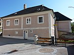
Parsonage Object ID: 54810 |
Kremser Straße 9 KG location : Lengenfeld |
The rectory of Lengenfeld, located opposite the church in the south of the fortified cemetery, is a two-storey, eaves-standing building with a core from the first half of the 16th century, which was rebuilt in the 18th and 19th centuries and is designated 1792 and 1856. Some of the rooms on the ground floor had lancet vaults . |
ObjectID : 54810 Status: § 2a Status of the BDA list: 2020-02-29 Name: Pfarrhof GstNr .: .206 |

|
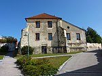
School, formerly Karner ObjectID : 80153 |
Kremser Straße 11, 13a KG location : Lengenfeld |
The building in the southeast corner of the churchyard, which was built as a chapel or karner , later used as a school and today as a residential building, was first mentioned in a document in the middle of the 13th century. The polygonal end can be seen in the southeast. In the north-west two buttresses placed over a corner and the reinforced base zone can be seen. The barrel vault in the cellar, built over formwork, was probably created in the 14th century. |
ObjectID : 80153 Status: § 2a Status of the BDA list: 2020-02-29 Name: School, former Karner GstNr .: 205/1 |

|
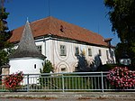
New Castle ObjectID : 32586 |
Langenloiser Straße 50 KG location : Lengenfeld |
The so-called New Castle - a former moated castle - is a four-wing complex with corner towers that was built in the first half of the 16th century and rebuilt in the 18th and 19th centuries. The two-storey complex encloses a square courtyard and is accessible in the east through a massive rusticated arched gate. The east and south sides are decorated with paintings by Johann Fruhmann from 1974. On the upper floor, facing the courtyard, there is a circumferential, flat covered arcade. Its wooden pillars are decorated with carvings with mannerist tendrils from the late 16th century. |
ObjectID : 32586 Status : Notification Status of the BDA list: 2020-02-29 Name: Neues Schloss GstNr .: .189 Lengenfeld Neues Schloss |

|
Press house, so-called cellar house ObjectID : 32585 |
Langenloiser Straße 79 KG location : Lengenfeld |
The so-called basement house - the former castle cellar - is a two-storey building, raised in 1962, with a groin -vaulted basement with a hipped mansard roof from the first third of the 18th century. |
ObjectID : 32585 Status : Notification Status of the BDA list: 2020-02-29 Name: Presshaus, so-called Kellerhaus GstNr .: .20 |

|
Stadttor, Biri-Tor ObjektID : 80154 |
Schickenberggasse KG location : Lengenfeld |
The Biri Gate is a mighty pointed arch gate with an adjoining quarry stone wall from the 15th century. |
ObjectID : 80154 Status: § 2a Status of the BDA list: 2020-02-29 Name: Stadttor, Biri-Tor GstNr .: 5050 |

|
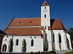
Catholic parish church hl. Pankratius and former Wehrkirchhof / so-called. Tabor ObjectID : 80151 |
KG location : Lengenfeld |
The parish church of St. Pankratius is a Gothic, essentially Romanesque stacked church with a Gothic choir and a mighty choir tower. The Wehrkirchof is surrounded by a high wall. |
ObjectID : 80151 Status: § 2a Status of the BDA list: 2020-02-29 Name: Catholic parish church hl. Pankratius and former Wehrkirchhof / so-called. Tabor GstNr .: .205; 194 Lengenfeld parish church, Lower Austria |

|
Stairway to the former Wehrkirchhof ObjektID : 80152 |
KG location : Lengenfeld |
The staircase to the churchyard with two flanking chapel pillars was created in 1713. |
ObjectID : 80152 Status: § 2a Status of the BDA list: 2020-02-29 Name: Stairway to the former Wehrkirchhof GstNr .: 4994/2 |

|
Fortified settlement Mühlfeldbreiten ObjektID: 130291 |
Mühlfeldbreiten location KG: Lengenfeld |
ObjectID: 130291 Status: Notification Status of the BDA list: 2020-02-29 Name: Fortified settlement Mühlfeldbreiten GstNr .: 2508/2; 2509/2; 2510/2; 2511/2; 2512/2; 2513/2; 2514/2; 2516/2; 2518/2; 2556/2; 2557; 2558; 2559; 2561; 2562; 2564; 2565; 2566; 2567; 2568/2; 2573/2; 2574/2; 2576/2; 2577/2; 2578/2; 2579/2; 2580/2; 2581/2 |
literature
- DEHIO Lower Austria north of the Danube . Schroll, Vienna 1990, ISBN 3-7031-0652-2 .
Web links
Commons : Listed objects in Lengenfeld - collection of pictures, videos and audio files
Individual evidence
- ↑ a b Lower Austria - immovable and archaeological monuments under monument protection. (PDF), ( CSV ). Federal Monuments Office , as of February 14, 2020.
- ↑ § 2a Monument Protection Act in the legal information system of the Republic of Austria .
