List of listed objects in Gföhl
The list of listed objects in Gföhl contains the 19 listed , immovable objects of the municipality of Gföhl in the Lower Austrian district of Krems-Land .
Monuments
| photo | monument | Location | description | Metadata |
|---|---|---|---|---|

|
Felling Castle and Chapel ObjectID : 31598 |
Felling 4 location KG: Felling |
Felling Castle is a simple two-story building around a small rectangular courtyard. It basically comes from the 16th / 17th centuries. Century and was renewed and extended in 1797 by the builder Andreas Zach . From 1553 it was owned by the Starhemberg family and after various changes it came into the possession of the Gudenus family in 1731 . |
ObjectID : 31598 Status : Notification Status of the BDA list: 2020-02-29 Name: Schloss Felling including chapel GstNr .: .23 Schloss Felling |

|
Local chapel ObjectID : 53751 |
Location KG: Garmanns |
The Garmanns local chapel is a simple rectangular building with a semicircular apse and roof turret, which was built between 1668 and 1669. At the altar table is the group of figures St. Anna Maria teaches reading from the late 17th century. |
ObjectID : 53751 Status: § 2a Status of the BDA list: 2020-02-29 Name: Ortskapelle GstNr .: .2 |

|
Christian cemetery with Sinzendorfer crypt ObjectID : 69748 |
Alt Gföhler Straße 13, 15 KG location : Gföhl |
The rectangular cemetery from the 18th century is surrounded by a wall with round corner towers. The former crypt chapel of the Sinzendorf family was built in 1761. The classical main gate was built around 1800. |
ObjektID : 69748 Status: § 2a Status of the BDA list: 2020-02-29 Name: Christian cemetery with Sinzendorfer crypt GstNr .: .105; 1075 Gföhl cemetery |

|
Fountain ObjectID : 70595 |
Hauptplatz location KG: Gföhl |
The neo-Gothic fountain on the main square was created in 1870 based on a design by the architect Carl Roesner . |
ObjectID : 70595 Status: § 2a Status of the BDA list: 2020-02-29 Name: Brunnen GstNr .: 1297/22 |

|
Catholic parish church hl. Andreas ObjectID : 53823 |
Hauptplatz location KG: Gföhl |
The St. Andreas, a stately baroque parish church with a medieval west tower in its core, was first mentioned in documents in 1327 and initially belonged to the parish of Meisling as a branch church. A new building of the church in the middle of the 17th century was followed by today's church building from 1715 to 1720, which was consecrated in 1724. Damage was caused by local fires in 1748 and 1820. As a result, the church gradually received an interior from the 19th century. |
ObjectID : 53823 Status: § 2a Status of the BDA list: 2020-02-29 Name: Catholic parish church hl. Andreas GstNr .: .81 Parish Church Gföhl |
|
Town hall / former Edhof ObjektID : 31706 |
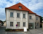
Hauptplatz 3 KG location : Gföhl |
The former Gasthaus Edhofer comes from the 16th / 17th century. Century. |
ObjectID : 31706 Status: § 2a Status of the BDA list: 2020-02-29 Name: City Hall / former. Edhof GstNr .: .13 |

|
Old Town Hall / former Hacklhof ObjectID : 53815 |
Jaidhofer Gasse 10 KG location : Gföhl |
The old town hall, in the core from the 16./17. Century, has a mighty square tower, courtyard-side walled arcades, a stabbed arched passage and several groin-vaulted rooms. |
ObjectID : 53815 Status : Notification Status of the BDA list: 2020-02-29 Name: Old Town Hall / formerly Hacklhof GstNr .: .12 |

|
Parsonage Object ID: 53816 |
Kirchengasse 4 KG location : Gföhl |
The rectory was built in 1889 with a strictly historical facade with pilasters and triangular gables. |
ObjectID : 53816 Status: § 2a Status of the BDA list: 2020-02-29 Name: Pfarrhof GstNr .: 90 |
|
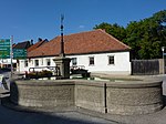
Fountain ObjectID : 90369 |
Körnermarkt location KG: Gföhl |
The neo-Gothic fountain at the Körnermarkt was built in 1873 by the builder Josef Utz the Elder. |
ObjectID : 90369 Status: § 2a Status of the BDA list: 2020-02-29 Name: Brunnen GstNr .: 1297/9 |
|
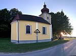
Rosaliakapelle Object ID: 70806 |
KG location : Gföhleramt |
The Rosalia Chapel Gföhleramt is a Roman Catholic pilgrimage chapel. |
ObjectID : 70806 Status: § 2a Status of the BDA list: 2020-02-29 Name: Rosaliakapelle GstNr .: .18 |
|
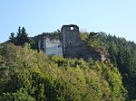
Hohenstein Castle Ruins ObjectID : 31597 |
Hohenstein 13 KG location : Hohenstein |
The castle ruin stands south of Hohenstein on a steep rock cone above the Krems River. It is mentioned for the first time in 1168. At the beginning of the 17th century it had already fallen into disrepair and in 1699 became the property of the Gudenus family. In the south of the formerly extensive castle complex there are still multi-storey building parts of a tower, two stone window walls, a round arched window, ashlar masonry and a round arched gate as ruins. |
ObjektID : 31597 Status : Notification Status of the BDA list: 2020-02-29 Name: Burgruine Hohenstein GstNr .: .20; 393 |

|
Local chapel ObjectID : 54258 |
Hohenstein 32 KG location : Hohenstein |
The local chapel is a small gabled building from the 19th century with a round top and a new wooden roof turret. There are baroque statues of the former interior of the castle chapel. Johann Gottlieb Jennichen cast the bell in 1848. |
ObjectID : 54258 Status: § 2a Status of the BDA list: 2020-02-29 Name: Ortskapelle GstNr .: .4 Ortskapelle Hohenstein (community Gföhl) |

|
Kath. Filialkirche Heiligste Dreifaltigkeit und Friedhof ObjektID : 55037 |
Moritzreith 1a location KG: Moritzreith |
The church, built in 1751 as a simple rectangular building with a semicircular apse and a square, half-retracted west tower with a slender pyramid roof, was expanded in the 19th century. The sacristy is in the north, a vestibule in the south. The single yoke interior has a groin vault. The stained glass from 1952 shows the 'Saint Anna Maria teaching reading' and Saint Leopold. |
ObjectID : 55037 Status: § 2a Status of the BDA list: 2020-02-29 Name: Kath. Filialkirche Heiligste Dreifaltigkeit und Friedhof GstNr .: .6 Holy Trinity Church (Moritzreith) |

|
Wayside shrine at the cemetery ObjectID : 55035 |
KG location : Moritzreith |
Without specifying the location, the Dehio mentions a renewed niche pillar with a curved top from the 18th century. |
ObjectID : 55035 Status: § 2a Status of the BDA list: 2020-02-29 Name: wayside shrine at the cemetery GstNr .: 467 |
|
Parsonage Object ID: 55180 |
Obermeisling 4 location KG: Obermeisling |
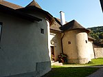
Located to the east of the church, integrated into the church courtyard wall, is the rectory, a one-story complex around a rectangular courtyard with a hipped roof, probably with an older core. The entrance side to the church is flanked by two massive semicircular, tower-like porches. Inside there are stitch cap vaults and flat ceilings with plaster cut mirrors. |
ObjectID : 55180 Status: § 2a Status of the BDA list: 2020-02-29 Name: Pfarrhof GstNr .: .22 |
|
Catholic parish church hl. Stephan and Friedhof ObjectID : 69750 |
KG location : Obermeisling |
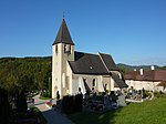
The parish church of St. Stephan is a Romanesque hall church with an axially forward west tower, a later, slightly shifted to the axis, higher east choir was extended to the north by the addition of a Gothic aisle and a Marienkapelle with five-eighth closure in the same axis. The originally Romanesque north wall of the hall was dissolved into three arches. The sacristy was added to the choir in the south. |
ObjectID : 69750 Status: § 2a Status of the BDA list: 2020-02-29 Name: Catholic parish church hl. Stephan and Friedhof GstNr .: .23; 183 Saint Stephen Church (Obermeisling) |
|
Rastbach Castle ObjectID : 33295 |
Rastbach 1 location KG: Rastbach |
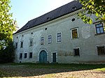
The castle was mentioned in a document in 1159, belonged to Hartwich von Lichteneck in 1192 and Maximilian von Pollheim in 1594. The two-storey three-wing complex from the late 16th and early 17th centuries has a courtyard open to the south. The castle is structurally connected to the Rastbach parish church - initially like a castle - and has a moat to the northeast at the castle path. |
ObjectID : 33295 Status : Notification Status of the BDA list: 2020-02-29 Name: Schloss Rastbach GstNr .: .1 Schloss Rastbach |

|
Catholic parish church hl. Pankraz ObjectID : 55451 |
Rastbach 50 KG location : Rastbach |
The church, consecrated to the ice saint Pankratius, is structurally connected to Rastbach Castle in the east, and initially formed a castle-like complex with the castle as a castle church. The medieval churchyard wall is partly still there. Mentioned in a document in 1159, a branch of the vicariate of Meisling, the church was probably a parish church from 1256. |
ObjectID : 55451 Status: § 2a Status of the BDA list: 2020-02-29 Name: Catholic parish church hl. Pankraz GstNr .: .2 Parish Church hl. Pankraz, Rastbach |

|
Local chapel St. Josef ObjectID : 90706 |
KG location : Seeb |
The baroque chapel with a hipped roof was built in 1780. The half-retracted tower with a pyramid helmet stands between volutes on the gable. Hall with lance-cap barrel with semicircular apse. Walls with richly profiled cornices. |
ObjectID : 90706 Status: § 2a Status of the BDA list: 2020-02-29 Name: Ortskapelle hl. Josef GstNr .: .11 Seeb local chapel |
Web links
Commons : Listed objects in Gföhl - collection of images, videos and audio files
Individual evidence
- ↑ a b Lower Austria - immovable and archaeological monuments under monument protection. (PDF), ( CSV ). Federal Monuments Office , as of February 14, 2020.
- ↑ Dehio Lower Austria north of the Danube 1990 , Felling (municipality of Gföhl), page 213
- ↑ Dehio Lower Austria north of the Danube 1990 , Garmanns (Gföhl municipality), page 237
- ↑ a b c d e f Dehio Lower Austria north of the Danube 1990 , Gföhl, pages 266ff
- ↑ Dehio Lower Austria north of the Danube 1990 , Hohenstein (municipality of Gföhl), page 438
- ^ Dehio Lower Austria north of the Danube 1990 , Moritzreith, page 759
- ↑ Dehio Lower Austria north of the Danube 1990 , Seeb, Chapel hl. Josef, pages 1073f
- ↑ § 2a Monument Protection Act in the legal information system of the Republic of Austria .
