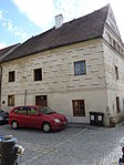
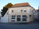
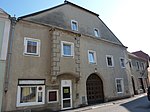
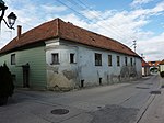
List of listed objects in Mautern an der Donau
The list of listed objects in Mautern an der Donau contains the 41 listed , immovable objects of the Lower Austrian city of Mautern an der Donau in the district of Krems-Land.
Monuments
| photo | monument | Location | description | Metadata |
|---|---|---|---|---|

|
Baumgarten Castle, formerly Kellerschlössl ObjectID : 48948 |
Baumgarten 1 location KG: Baumgarten |
The Castle Baumgarten is a core baroque building that was consuming rebarockisiert 1911-1922. The multi-wing complex around two courtyards has a uniform façade facing north (Kremser basin). The two monumental sphinxes at the entrance (by Franz Leopold Fahrmacher around 1700) originally come from Thürnthal Castle . |
ObjectID : 48948 Status : Notification Status of the BDA list: 2020-02-29 Name: Baumgarten Castle, former Kellerschlössl GstNr .: .1 Baumgarten Castle (Mautern an der Donau) |

|
Shrine Object ID: 85467 |
KG location : Baumgarten |
The wayside shrine at the northern end of Baumgarten bears a square top with a relief coat of arms of the Göttweig monastery and abbot Georg Schedler (1604–1610) and the inscription "Nascimur et morimur, GSAG" over an octagonal shaft |
ObjectID : 85467 Status: § 2a Status of the BDA list: 2020-02-29 Name: wayside shrine GstNr .: 66/1 wayside shrine Baumgarten near Mautern Nord |

|
Shrine Object ID: 85480 |
KG location : Baumgarten |
The tabernacle shrine to the southeast of Baumgarten dates from the 17th and 18th centuries. Century |
ObjectID : 85480 Status: § 2a Status of the BDA list: 2020-02-29 Name: Bildstock GstNr .: 432/15 |

|
Poor Hospital Chapel St. Margarete ObjectID : 84856 |
Alte Friedhofstrasse 6 KG location : Mautern |
Sacred building in the south of the old town. The oldest parts from the 9./10. Century, whereby in the south Roman walls from the 1st century. were used with. Incorporated in Göttweig Abbey in 1083. Around 1300 renovation / extension in the late Romanesque style. From 1571 the St. Anna Foundation's Citizens Hospital Church. Groin vault in the nave from the first half of the 17th century. In 1717, parts of the hospital wing were included on the west side. End of the 18th century profane. Since 2009 "Wachau Gold Hood and Costume Museum". |
ObjectID : 84856 Status : Notification Status of the BDA list: 2020-02-29 Name: Armenspitalskapelle hl. Margarete GstNr .: .45; 41; 39/1 Margaretenkapelle (Mautern an der Donau) |

|
Roman fort Favianis ObjectID : 130295 |
Altstadt location KG: Mautern |
The Favianis fort, as part of the security systems of the Roman Danube Limes, was probably continuously occupied by Roman troops from the 1st to the 5th century. |
ObjektID : 130295 Status : Notification Status of the BDA list: 2020-02-29 Name: Römisches Kastell Favianis GstNr .: .1 / 1; .1 / 2; .1 / 3; .2 / 1; .5; .6; .7; .8th; .9; .10 / 1; .10 / 2; .12; .14 / 2; .15; .16; .17; .19; .22; .23; .24; .26 / 1; .27; .40 / 1; .40 / 2; .41; .42; .43; .45; .46; .47; .48; .49; .50; .51; .52 / 1; .54; .55; .58; .59; .65; .66; .67; .68; .69; .70; .71; .75; .76 / 2; .77; .78 / 2; .79; .82; .83; .100 / 1; .100 / 3; .140; .270; .279; .310; 1/1; 1/2; 2; 7/1; 7/3; 9; 10; 13/1; 18; 21; 23; 24/1; 37; 39/1; 41; 55/1; 55/2; 57; 557/1; 557/5; 1432/2; 1432/3; 1432/4; 1432/5; 1432/6; 1432/7; 1432/8; 1449; 1457/2; 1478; 1479; 1480; 1495; 1507/1 Favianis |

|
Lasperger House and part of the Roman fort ObjectID : 32764 |
Kirchengasse 1 KG location : Mautern |
Eaves-facing corner building to St. Pöltner-Straße. Late Renaissance portal, round two-zone corner bay window. |
ObjectID : 32764 Status : Notification Status of the BDA list: 2020-02-29 Name: Lasperger House and part of the Roman fort GstNr .: .23 |

|
Göttweigisches Haus and parts of the Roman fort ObjectID : 32763 |
Kirchengasse 3 KG location : Mautern |
Gable-mounted two-storey corner house from the 15th and 16th centuries, perspective sgraffito decor from the 16th century. |
ObjektID : 32763 Status : Notification Status of the BDA list: 2020-02-29 Name: Göttweigisches Haus and parts of the Roman fort GstNr .: .24 |

|
Old shoemaker's house and parts of the Roman fort ObjectID : 32761 |
Kirchengasse 5 KG location : Mautern |
Narrow building, gable with blind arch from the second half of the 16th century. |
ObjektID : 32761 Status : Notification Status of the BDA list: 2020-02-29 Name: Old shoemaker's house and parts of the Roman fort GstNr .: .22 |

|
Town house and part of the Roman fort ObjectID : 32762 |
Kirchengasse 8 KG location : Mautern |
Building with a smooth front, parapet with blind arch and central hip gable. Facade restored in 1985. |
ObjectID : 32762 Status : Notification Status of the BDA list: 2020-02-29 Name: Town house and part of the Roman fort GstNr .: .16 |

|
Town house and part of the Roman fort ObjectID : 77567 |
Kirchengasse 10 KG location : Mautern |
Two-storey corner building with a rounded facade under a hipped roof. |
ObjektID : 77567 Status : Notification Status of the BDA list: 2020-02-29 Name : Town hall and part of the Roman fort GstNr .: .17 Mautern Kirchengasse 10 |

|
Catholic parish church hl. Stefan ObjectID : 54963 |
Kirchenplatz 1 KG location : Mautern |
Gothic staggered church with a rectangular choir from the 2nd half of the 14th century, surrounded by a churchyard wall. The interior of the nave was rebuilt in the Baroque style in 1696/96. Baroque south tower over the medieval core from 1774/77. |
ObjektID : 54963 Status: § 2a Status of the BDA list: 2020-02-29 Name: Catholic parish church hl. Stefan GstNr .: .5 Parish Church Mautern on the Danube |

|
Rectory and garden pavilion ObjectID : 70982 |
Kirchenplatz 1 KG location : Mautern |
Several adjoining eaves-standing structures under hipped roofs from the 15th to 18th centuries. Location on a step south of the parish church, connected to the medieval city wall to the west. |
ObjectID : 70982 Status: § 2a Status of the BDA list: 2020-02-29 Name: Rectory and garden pavilion GstNr .: .5; 7/1 Pfarrhof Mautern on the Danube |

|
Town house and part of the Roman fort ObjectID : 32765 |
Melker Straße 3 KG location : Mautern |
Two-storey building with a long courtyard wing, broadly positioned under a crooked roof. Arched passage portal. |
ObjektID : 32765 Status : Notification Status of the BDA list: 2020-02-29 Name: Town house and part of the Roman fort GstNr .: .68 |

|
Essigfabrik, former Kremsmünstererhof and part of the Roman fort ObjectID : 85182 |
Melker Straße 6 KG location : Mautern |
Two-storey building around the courtyard, essentially from the 16th and 17th centuries. Late historic facade with a bay window over a segmental arched passage. |
ObjectID : 85182 Status : Notification Status of the BDA list: 2020-02-29 Name: Essigfabrik, former Kremsmünstererhof and part of the Roman fort GstNr .: 7/3 |

|
Elementary school ObjectID: 85185 |
Melker Straße 10 KG location : Mautern |
Free-standing building with a central projectile facade from 1891. |
ObjectID: 85185 Status: § 2a Status of the BDA list: 2020-02-29 Name: Volksschule GstNr .: .144 |

|
Shrine Object ID: 85192 |
at Melker Straße 17, KG location : Mautern |
Octagonal shaft with a mighty square attachment. |
ObjectID : 85192 Status: § 2a Status of the BDA list: 2020-02-29 Name: Bildstock GstNr .: 1451/1 Mautern Melkerstraße Bildstock |

|
Shrine Object ID: 85209 |
Nikolaigasse location KG: Mautern |
To the northeast opposite the Nikolaihof there is a baroque pillar shrine. |
ObjectID : 85209 Status: § 2a Status of the BDA list: 2020-02-29 Name: Bildstock GstNr .: 1434 |

|
Nikolaihof and chapel ObjectID : 66390 |
Nikolaigasse 3 KG location : Mautern |
Stately complex of buildings with a chapel around a wide courtyard, built from the 9th to the 17th century over the lines of the Roman fort wall and the medieval city wall. |
ObjectID : 66390 Status : Notification Status of the BDA list: 2020-02-29 Name: Nikolaihof including chapel GstNr .: 55/1 Nikolaihof Mautern |

|
Town hall ObjectID : 85214 |
Rathausplatz 1 KG location : Mautern |
Corner building dominating Rathausplatz, part of a four-sided two-storey complex from the 17th and 18th centuries. Rich facade of late Viennese historicism, restored in 1971. |
ObjectID : 85214 Status: § 2a Status of the BDA list: 2020-02-29 Name: Rathaus GstNr .: .82 |

|
Bürgerhaus ObjektID: 32768 |
Rathausplatz 4 KG location : Mautern |
Basically from the 1st half of the 16th century. Two-axis stepped facade from around 1740. |
ObjectID: 32768 Status: Notification Status of the BDA list: 2020-02-29 Name: Bürgerhaus GstNr .: .33 Mautern Rathausplatz 4 |

|
Kobolt House ObjectID : 32769 |
Sankt Pöltner Straße 10 KG location : Mautern |
Double hipped roof behind a blind wall. Wide flat bay window on consoles and window frames from around 1500. |
ObjectID : 32769 Status : Notification Status of the BDA list: 2020-02-29 Name: Kobolt-Haus GstNr .: .78 / 1 |

|
Moldhof / Feldlehenhof ObjectID: 32770 |
Sankt Pöltner Straße 15 KG location : Mautern |
Stately two-story building with two courtyard wings, the core of the late medieval. |
ObjectID: 32770 Status: Notification Status of the BDA list: 2020-02-29 Name: Moldhof / Feldlehenhof GstNr .: .38 |

|
Town house and part of the Roman fort ObjectID : 32772 |
Schloßgasse 1 KG location : Mautern |
Two-storey building under a hipped roof, the core from the 16th century. |
ObjectID : 32772 Status : Notification Status of the BDA list: 2020-02-29 Name: Town house and part of the Roman fort GstNr .: .12 |

|
Castle ObjectID : 32771 |
Schloßgasse 6, 8 KG location : Mautern |
Free standing on the northern edge of the old town near the city wall. Four wings from different construction periods, each under a hip or crooked roof, an almost square courtyard. |
ObjectID : 32771 Status: § 2a Status of the BDA list: 2020-02-29 Name: Schloss GstNr .: .1 / 1 Schloss Mautern |

|
Event hall, former farm building of the castle ObjectID : 85379 |
Schloßgasse 10 KG location : Mautern |
The former farm building of Mautern Castle is located in the northwest corner of the medieval city fortifications and serves as the "Römerhalle" event hall. |
ObjectID : 85379 Status: § 2a Status of the BDA list: 2020-02-29 Name: Event hall, former farm building of the castle GstNr .: .1 / 3 Römerhalle Mautern |

|
Former Schüttkasten, so-called Roman Museum ObjectID : 54962 |
Schloßgasse 12 KG location : Mautern |
The former bulk box of Mautern Castle connects to the south of the Roman Hall; since 1997 it has served as a "Roman Museum" with exhibits from prehistoric, Roman and early medieval times. |
ObjectID : 54962 Status: § 2a Status of the BDA list: 2020-02-29 Name: Former Schüttkasten, so-called Roman museum GstNr .: .1 / 2 |

|
Fort vicus south ObjectID : 100331 |
Schubertstrasse Location KG: Mautern |
The settlement of the southern vicus began before 100 AD and was carried out according to plan along two streets. |
ObjectID : 100331 Status : Notification Status of the BDA list: 2020-02-29 Name: Kastellvicus Süd GstNr .: 705/1; 705/2; 707/3; 707/4; 705/3; 705/5; .92 |

|
Janaburg / Geierburg ObjectID : 85383 |
Südtiroler Platz 5 KG location : Mautern |
Three-sided complex, built in the second half of the 16th century, owned by the Göttweig monastery until 1723 . Closed to the street with a wall and a triumphal arch-like portal. |
ObjectID : 85383 Status : Notification Status of the BDA list: 2020-02-29 Name: Janaburg / Geierburg GstNr .: 705/1 Janaburg Mautern |

|
Road bridge, Danube bridge ObjectID : 85418 |
Vorstadt 22 KG location : Mautern |
The 374 meter long steel truss bridge over the Danube was opened in 1895. Towards the end of the Second World War it was partially blown up by the Wehrmacht . The restoration and reopening took place in 1945. Note: The Danube bridge connects the two communities Krems and Mautern. |
ObjectID : 85418 Status: § 2a Status of the BDA list: 2020-02-29 Name: Road bridge, Donaubrücke GstNr .: 1476/1; 1493/2; 1442/1 Mauterner Danube Bridge |

|
Shrine Object ID: 85419 |
KG location : Mautern |
In the pillar shrine on the road to Furth opposite the Mautern barracks are a coat of arms relief (marked 1680) and a mosaic “ St. Severin ”from the 20th century. |
ObjectID : 85419 Status: § 2a Status of the BDA list: 2020-02-29 Name: Bildstock GstNr .: 795/12 |

|
Rom. Building remains , Bz burial ground ObjectID : 47304 since 2013 |
Langer Zaum KG location : Mautern |
ObjectID : 47304 Status : Notification Status of the BDA list: 2020-02-29 Name: Röm. Building remains , Bz grave field GstNr .: 830/1; 830/2 |
|

|
Monument complex Weinhauerhaus / Hanifoglhof ObjektID : 131085 since 2017 |
Mauternbach 6 KG location : Mauternbach |
Grape harvest yard, with two-storey wine cellar and beginnings of Romanesque masonry. In essence, however, from the 15th / 16th. Century with flat bay window and smoking room. A representation room around 1600 with a circumferential lancet wreath and egg bar border is interpreted as a chapel and thus attributed to the probable cloister courtyard of the Augustinian canons of St. Pölten, who have lived since the middle of the 13th century. had vineyards in Mauternbach. |
ObjektID : 131085 Status : Notification Status of the BDA list: 2020-02-29 Name: Monument complex Weinhauerhaus / Hanifoglhof GstNr .: .31 Mauternbach 6 |

|
Farm (facility) ObjectID: 8243 |
Mauternbach 10 KG location : Mauternbach |
Mighty elongated three-sided courtyard, free-standing under a hipped roof, essentially from the 1st half of the 16th century. |
ObjectID: 8243 Status: Notification Status of the BDA list: 2020-02-29 Name: Farm (facility) GstNr .: .35 |

|
Farm (facility) ObjectID: 9899 |
Mauternbach 12 KG location : Mauternbach |
Courtyard directly on the river ditch with farm buildings around an irregular courtyard. Essentially late medieval, the substance from the 16th century. |
ObjectID: 9899 Status: Notification Status of the BDA list: 2020-02-29 Name: Farm (facility) GstNr .: 18 |

|
Former St. Pöltner Hof ObjectID: 7514 |
Mauternbach 17 KG location : Mauternbach |
Core of an originally fortified village complex high above the Mauternbachtal. Late Gothic double-gabled group of houses with a medieval defense tower and a striking chimney. |
ObjectID: 7514 Status : Notification Status of the BDA list: 2020-02-29 Name: Former St. Pöltner Hof GstNr .: .9 |

|
Residential building ObjectID: 7515 |
Mauternbach 18 KG location : Mauternbach |
One to two-storey quarry stone building on the Bachgraben. Tracts with staggered fronts, double gables and crooked roofs. |
ObjectID: 7515 Status: Notification Status of the BDA list: 2020-02-29 Name: Residential house GstNr .: .11 |

|
Wayside shrine, Ladoshen Cross ObjectID : 85390 |
on the road to Mauternbach KG location : Mauternbach |
The "Ladoshen Cross", a pillar shrine above a pedestal with a cube top and a cross roof from the end of the 18th century, stands on the road connecting Mautern to Mauternbach. |
ObjectID : 85390 Status: § 2a Status of the BDA list: 2020-02-29 Name: wayside shrine, Ladoshenkreuz GstNr .: 478/7 |

|
Wegkapelle ObjektID : 84832 |
Location KG: Mauternbach |
The gabled chapel shrine dates from the 1st half of the 19th century. |
ObjectID : 84832 Status: § 2a Status of the BDA list: 2020-02-29 Name: Wegkapelle GstNr .: 1/1 |

|
War memorial ObjectID : 84833 |
Location KG: Mauternbach |
The war memorial includes a group of figures "Family" (referred to as Horak 1930) and two memorial plaques in 1930 and 1945. |
ObjectID : 84833 Status: § 2a Status of the BDA list: 2020-02-29 Name: War memorial GstNr .: 1/1 War memorial Mauternbach |

|
Römerstraße ObjectID : 84834 |
Location KG: Mauternbach |
A Roman road with pronounced ruts is visible south of Mauternbach. |
ObjectID : 84834 Status: § 2a Status of the BDA list: 2020-02-29 Name: Römerstraße GstNr .: 474 Römerstraße Mauternbach |

|
Catholic branch church hl. John the Baptist ObjectID : 54307 |
Location KG: Mauternbach |
The branch church of St. John the Baptist is located on the north-western outskirts of Hundsheim near the Danube . The simple hall with a southeast tower was built by Cypriano Biasino in 1628–1635 using a previous building; the high altar painting "Baptism of Christ" comes from Martin Johann Schmidt (1758), the altar structure - according to tradition - from his father, Johann Schmidt . |
ObjectID : 54307 Status: § 2a Status of the BDA list: 2020-02-29 Name: Kath. Filialkirche hl. John the Baptist GstNr .: .58 Filialkirche Hundsheim |
Former monuments
| photo | monument | Location | description | Metadata |
|---|---|---|---|---|

|
Former Poor Hospital St. Anna, Bürgerspital ObjectID : 84995 until 2015 |
Frauenhofgasse 5 KG location : Mautern |
One-storey former hospital complex, completely rebuilt in the 19th and 20th centuries. To Frauenhofgasse arched portal from the middle of the 19th century. |
ObjectID : 84995 Status: § 2a Status of the BDA list: 2015-06-26 Name: Former. Poor Hospital St. Anna, Bürgerspital GstNr .: .45 |
literature
- Peter Aichinger-Rosenberger, Evelyn Benesch, Kurt Bleicher, Sibylle Grün, Renate Holzschuh-Hofer, Wolfgang Huber, Herbert Karner, Katharina Packpfeifer, Anna Piuk, Gabriele Russwurm-Biró, Otmar Rychlik, Agnes Szendey, Franz Peter Wanek (editing). Christian Benedik, Christa Farka, Ulrike Knall-Brskovsky, Johann Kräftner , Markus Kristan, Johannes-Wolfgang Neugebauer , Marianne Pollak, Margareta Vyoral-Tschapka, Ronald Woldron (contributions): Dehio-Handbuch. The art monuments of Austria . Lower Austria south of the Danube. Ed .: Federal Monuments Office. Berger Verlag, Horn / Vienna 2003, ISBN 3-85028-364-X , p. 236-238, 875-876, 1368-1385 .
Web links
Commons : Listed objects in Mautern on the Danube - collection of images, videos and audio files
Individual evidence
- ↑ a b Lower Austria - immovable and archaeological monuments under monument protection. (PDF), ( CSV ). Federal Monuments Office , as of February 14, 2020.
- ↑ The Roman Limes in Austria: excavation Margaret Chapel; Status: January 10, 2016
- ↑ Churches on the river: Chapel of St. Margarete
- ↑ Eva Maria Zweckmair, Lesehof Mauternbach: Building research, inventory and development of future scenarios , diploma thesis of the TU Vienna, May 2017
- ↑ Rudolf Malli, The Treasure in the Cellar. On the wine industry of the Waldviertel monasteries, series of publications by the Waldviertel Heimatbund 41, Horn-Waidhofen / Thaya 2001. ISBN 3-900708-15-0 , page 87
- ^ Lower Austria - immovable and archaeological monuments under monument protection. ( Memento of May 7, 2016 in the Internet Archive ) . Federal Monuments Office , as of June 26, 2015 (PDF).
- ↑ § 2a Monument Protection Act in the legal information system of the Republic of Austria .
