List of listed objects in Tiefgraben
The list of listed objects in Tiefgraben contains the 7 listed , immovable objects of the Upper Austrian municipality of Tiefgraben .
Monuments
| photo | monument | Location | description | Metadata |
|---|---|---|---|---|

|
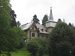
Villa Tree ObjectID : 73661 |
Gaisbergstrasse 12 Location KG: Hof |
ObjectID : 73661 Status : Notification Status of the BDA list: 2020-02-29 Name: Villa Baum GstNr .: .201 |
|

|
Kath. Filialkirche St. Koloman ObjectID : 110724 |
Location KG: Hof |
The current building dates from 1742, making it the oldest wooden church in Austria. The shingle roof has only one roof turret as a tower . Inside there is a baroque altar, which, according to records, was renewed by Abbot Simon in 1658 and previously stood in a previous building. |
ObjectID : 110724 Status: § 2a Status of the BDA list: 2020-02-29 Name: Kath. Filialkirche St. Koloman GstNr .: .199 Filialkirche St. Koloman, Kolomansberg |

|
Former kuk Forestry Office Building ObjectID : 110698 |
Dr Lechner-Weg 31 KG location : Tiefgraben |
ObjectID : 110698 Status: § 2a Status of the BDA list: 2020-02-29 Name: Former kuk Forestry Office Building GstNr .: .99 / 1 |
|

|
Open-air museum Mondseer Rauchhaus, Bischofergut ObjectID : 116626 |
Hilfberg 7 KG location : Tiefgraben |
ObjektID : 116626 Status : Notification Status of the BDA list: 2020-02-29 Name: Open-air museum Mondseer Rauchhaus, Bischofergut GstNr .: 177/9; 177/12 |
|

|
Mesnerhaus ObjektID : 116661 |
Hilfberg 12 Location KG: Tiefgraben |
ObjectID : 116661 Status: § 2a Status of the BDA list: 2020-02-29 Name: Mesnerhaus GstNr .: .100 / 2 |
|

|
Shrine Object ID: 110674 |
next to Hilfberg 13 location KG: Tiefgraben |
ObjectID : 110674 Status: § 2a Status of the BDA list: 2020-02-29 Name: Bildstock GstNr .: 1916/1 |
|

|
Chapel shrine ObjectID : 123264 |
at Hochkreuzstrasse 10, KG location : Tiefgraben |
The simple path chapel, Gasterbauer chapel, with hipped roof was built in 1998 and is modeled on a chapel from the 19th century that was demolished in 1959. The altar comes from the previous chapel. Note: managed by the BDA in the municipality of Mondsee, but is actually very close to Tiefgraben |
ObjectID : 123264 Status: § 2a Status of the BDA list: 2020-02-29 Name: Kapellenbildstock GstNr .: 217/7 Gasterbauer-Kapelle, Mondsee |
literature
- Federal Monuments Office (ed.): Dehio manual. The art monuments of Austria. Upper Austria , Verlag Anton Schroll & Co, Vienna 1971, 5th edition
Web links
Commons : Listed Objects in Tiefgraben - Collection of images, videos and audio files
Individual evidence
- ↑ a b Upper Austria - immovable and archaeological monuments under monument protection. (PDF), ( CSV ). Federal Monuments Office , as of February 18, 2020.
- ↑ Kolomansberg Church. Retrieved April 29, 2015 .
- ↑ Gasterbauerkapelle. in: Parish newspaper Parish St. Michael Mondsee , 40th year 2015–16 No. 1, pp. 52–53.
- ↑ § 2a Monument Protection Act in the legal information system of the Republic of Austria .
