Luce (Avre)
| Luce | ||
|
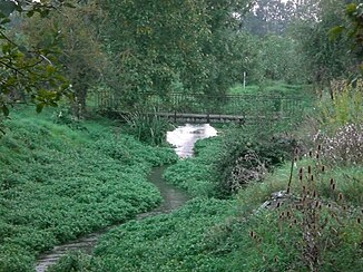
The river at Domart-sur-la-Luce |
||
| Data | ||
| Water code | FR : E6400700 | |
| location | France , Hauts-de-France region | |
| River system | Somme | |
| Drain over | Avre → Somme → English Channel | |
| source | in the parish of Caix 49 ° 48 ′ 51 ″ N , 2 ° 39 ′ 20 ″ E |
|
| Source height | approx. 60 m | |
| muzzle | in the municipality of Thézy-Glimont in the Avre coordinates: 49 ° 48 '26 " N , 2 ° 26' 54" E 49 ° 48 '26 " N , 2 ° 26' 54" E |
|
| Mouth height | approx. 30 m | |
| Height difference | approx. 30 m | |
| Bottom slope | approx. 1.7 ‰ | |
| length | 18 km | |
The Luce is a river in France that runs in the Somme department in the Hauts-de-France region . It rises on the eastern outskirts of Caix , generally drains in a westerly direction through the Santerre landscape and flows 18 kilometers into the municipality of Thézy-Glimont , but close to the municipality boundary with Thennes , as a right tributary into the Avre .
Places on the river
(in flow order)
- Caix
- Cayeux-en-Santerre
- Ignaucourt
- Aubercourt
- Demuin
- Hangard
- Domart-sur-la-Luce
- Thennes
- Berteaucourt-lès-Thennes
Remarks
- ↑ Source geoportail.gouv.fr
- ↑ estuary geoportail.gouv.fr
- ↑ a b The information on the length of the river is based on the information about the Luce at SANDRE (French), accessed on March 11, 2013, rounded to full kilometers.
