Bistrica e Deçanit
| Bistrica e Deçanit - Dečanska Bistrica | ||
|
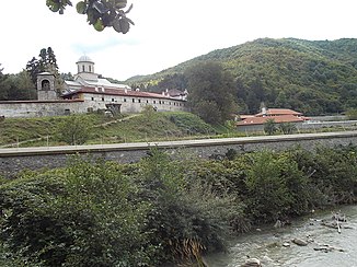
The river at the Visoki Dečani Monastery outside Deçan |
||
| Data | ||
| location | Kosovo | |
| River system | Buna | |
| Drain over | White Drin → Drin → Buna → Adriatic | |
| source | on Mount Bogiçevica near Gjeravica 42 ° 35 ′ 42 ″ N , 20 ° 10 ′ 4 ″ E |
|
| muzzle | at Kralan in the White Drin coordinates: 42 ° 34 ′ 54 " N , 20 ° 34 ′ 6" E 42 ° 34 ′ 54 " N , 20 ° 34 ′ 6" E
|
|
| length | 53 km | |
| Medium-sized cities | Deçan | |
The Bistrica e Deçanit ( Albanian also Lumbardh i Deçanit , Serbian Дечанска Бистрица Dečanska Bistrica ) is a 53 kilometer long river in western Kosovo . It drains parts of the Albanian Alps on the western border of Kosovo with Albania and Montenegro north of the Gjeravica .
The river has its source in the mountainous area Bogiçevica near the border with Montenegro and flows east through the Bjeshkët e Nemuna National Park . After a few kilometers the direction changes more to the southeast. Energy is generated in a small hydroelectric power station . The Lumbardh then takes on a branch on the right, which comes from the northwest slopes of the Gjeravica. Visoki Dečani Monastery is located at the exit from the mountains . The Lumbardh then passes the city of Deçan , which is eponymous for the river, a little north of the center. It flows further east at Kralan into the White Drin .
