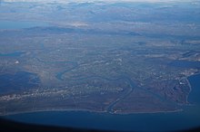
Buna (Adriatic Sea)
|
Buna Bunë, Bojana, Barbana |
||
|
Outflow from Lake Skadar at low tide and the older bridge over the Buna (2008) |
||
| Data | ||
| location | Border between Albania and Montenegro | |
| River system | Buna | |
| origin |
Skadar Lake at Shkodra 42 ° 3 ′ 20 ″ N , 19 ° 28 ′ 36 ″ E |
|
| Source height | 1 m above sea level A. | |
| muzzle | with two branches of the mouth into the Adriatic Sea Coordinates: 41 ° 51 ′ 24 ″ N , 19 ° 21 ′ 3 ″ E 41 ° 51 ′ 24 ″ N , 19 ° 21 ′ 3 ″ E |
|
| Mouth height | 0 m | |
| Height difference | 1 m | |
| Bottom slope | 0.02 ‰ | |
| length | 44 km | |
| Catchment area | 5187 km² (without it) | |
| Left tributaries | Inside | |
| Right tributaries | Šasko jezero canal | |
| Medium-sized cities | Shkodra | |
| Navigable | 44 km | |
|
Tributaries and hydraulic structures
|
||||||||||||||||||||||||||||||||||||||||||||||||||||||||||||||||||||||||||||||||||||||||||||||||||||||||||||
The Buna ( Albanian also Bunë ; Serbian Бојана Bojana ; Latin Barbana ) is the short outflow from the Skadar Lake into the Adriatic Sea . At around two thirds of its length of 44 kilometers, the Buna forms the border between Albania and Montenegro .
Most of the water in the Buna comes from the Drin coming from the Albanian Alps , which adds around 352 m³ / s to the 320 m³ / s of the Buna. The catchment area of the Buna without Drin covers an area of 5187 km² around the Skadar Lake, which is surrounded in the west by the Rumija and Lovćen mountain range and in the east by the Albanian Alps. This makes it the second largest tributary to the Adriatic after the Po .
Immediately after exiting Lake Skadar, the Buna passes an incision between the Tarabosh in the west and the castle hill of Shkodra in the east. Shortly afterwards it absorbs the most important inflow, the Drin. The Drin has only been a tributary of the Buna since the subsidence in 1858. The changes in the terrain led to the fact that the Drin parted and the majority of the water masses looked for a new way west to the Buna. The two rivers unite one and a half kilometers below Lake Shkodra, after the Drin had previously taken in the small river Kir on the right-hand side from the Albanian Alps.
The course of the Buna between Albania and Montenegro is still very natural and often boggy. The estuary is partially protected, but with its long sandy beaches it is also of tourist interest. The small delta is a bird sanctuary of international importance, which is an important stopover especially for migratory birds . The small island of Ada between the estuary is a popular bathing beach for nudist tourists. The island is entirely in Montenegro, as the eastern branch of the estuary forms the border. A sandbank in the estuary between Albania and Montenegro is named after Franz Joseph I ( Albanian Ishulli i Franc Jozefit ) - the island formed from alluvioins becomes a peninsula when the water level is low.
With an average width of 150 meters and a depth of 3 meters, the Buna is considered navigable, even if there are hardly any ships today . In the second half of the 19th century a regular service was operated by Austrian Lloyd . Before the Second World War , it served as an important transport route, especially for goods from the sea port in Ulcinj to Shkodra .
bridges
The river is only crossed by two bridges shortly after leaving Lake Shkodra. Until 2011 there was only one steel bridge covered with wood, which was only accessible in alternating single lanes . In May 2011 a multi-lane swing bridge was opened a few hundred meters downstream , which will facilitate road traffic from Shkodra to Ulcinj. The cost of building the new steel truss cover bridge was approximately $ 7,185,000. It was planned that the bridge should be opened in 2010, but construction work was delayed due to the flooding in the Shkodra plain at the time. In contrast to the wooden bridge, the new swing bridge enables ships to pass through. But the old bridge still blocks the passage into the lake further up.
Web links
- Euronatur Foundation
- In Your Pocket Guide: Buna Delta ( Memento of May 21, 2015 in the Internet Archive )
- Canoeing on the river on YouTube (Albanian)
Individual evidence
- ^ Tatort Adria - Bird hunting in the Balkans. (PDF) Euronatur , July 2009, accessed on November 10, 2012 (PDF file, 885 KB).
- ↑ Shkodër, inaugurohet ura e re e Bunës. (No longer available online.) May 24, 2011, archived from the original on July 14, 2014 ; Retrieved November 10, 2012 (Albanian). Info: The archive link was inserted automatically and has not yet been checked. Please check the original and archive link according to the instructions and then remove this notice.
- ^ Ridvan Dibra: Pas 1 shekull lundrimi mbi Bunë, inaugurohet ura e re. In: Panorama Online. May 25, 2011, accessed April 2, 2018 (Albanian).


