Lutheran Wäldele
|
Protected landscape area "Lutherisch Wäldele"
|
||
| location | City of Karlsruhe , Baden-Württemberg , Germany | |
| surface | 8.3 ha | |
| Identifier | 2.12.004 | |
| WDPA ID | 322866 | |
| Geographical location | 49 ° 1 ' N , 8 ° 20' E | |
|
|
||
| Setup date | January 8, 1962 | |
| administration | City of Karlsruhe | |
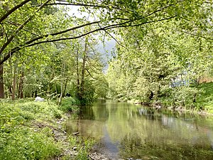
The Lutherisch Wäldele (also Lutherisches Wäldele ) is a landscape protection area (protected area number 2.12.004) in the Mühlburg district of the city of Karlsruhe on the border with the Daxlanden district .
Location, characteristics and size
The 8.3 hectare landscape protection area lies in a loop of the Alb in its flood plain south of Karlsruhe's Rhine port and north of Daxlander Strasse. It stretches from the river Alb to the lower terrace and consists largely of forest in former flood areas. The existing hybrid poplars were felled to enable the development of a natural alluvial forest . In the north it is bounded by the Rheinhafenbad and in the east by the Karlsruhe municipal utility.
In the Wäldele there is a listed one-yoke railway bridge in solid construction that was built in 1921 for the planned second port railway, but never put into operation.
history
The protected landscape area was established in 1962.
See also
Individual evidence
- ↑ http://rips-dienste.lubw.baden-wuerttemberg.de/rips/ripsservices/apps/naturschutz/schutzgebiete/steckbrief.aspx?id=2129003000015
- ↑ https://web1.karlsruhe.de/db/kulturdenkmale/detail.php?id=01981
- ↑ http://www.karlsruhe.de/b3/natur_und_umwelt/naturschutz/gebietsschutz/lsgebiete/lutherischeswaeldele.de
Web links
- Profile of the landscape protection area in the protected area directory of the LUBW
- http://www.schygulla.de/verkehrsrelktionen/bahn/suedw/karlsruhe.htm


