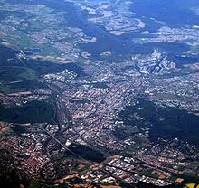
Oberwald (Karlsruhe)
The Oberwald in the urban area of Karlsruhe is by far the largest forest area in the Karlsruhe area of the Kinzig-Murg-Rinne .
location
The Oberwald lies in the Rhine plain south of the center of Karlsruhe; it is essentially bounded in the north by the Karlsruhe Südtangente (district roads 9657 and 9652), in the east and south by the federal autobahn 5 and the Karlsruhe motorway triangle, and in the west by the Karlsruhe districts of Dammerstock and Rüppurr , which separate it from the Alb . Like the neighboring Weiherwald to the west, the Oberwald lies in an old river valley; the post-glacial river divided into different arms, the remains of which are still visible.
Several small bodies of water run through the Oberwald, including the artificial Scheidgraben. There are two quarry ponds in the Oberwald, namely the Oberwaldsee and the fenced Erlachsee that was created during the construction of the motorway and is up to twelve meters deep .
Protected areas, flora and fauna
The area has been designated as a landscape protection area of Oberwald since March 29, 1977 under the number 2.12.008 with an area of 573.2 hectares . In the middle of the LSG is the 16.4 hectare nature reserve no. 2066 Erlachsee , designated by ordinance of the Karlsruhe Regional Council of November 20, 1983. A part of the Oberwald has been under the name Oberwald-Rißnert with 185.3 hectares since May 31, 1988 Forest reserve (protected area number 200236) designated.
The forest is made up of English oaks and hornbeams . There are numerous wood anemones as well as lesser celandine , meadow scum herb , anemone and the purple dead nettle . The Oberwald is rich in insects and butterflies such as the blue oak hairstreak .
The Erlachsee is a retreat for waders and water birds.
use
On the northern edge of the Oberwald is the Durlacher Wald waterworks, planned by Robert Gerwig and commissioned in 1871, with a striking stump of the water tower, which today is only used as a top plant because of the main roads and the freight station in its vicinity. Various sports facilities form the end to Dammerstock and Rüppurr. There are also sports fields in the east, including the Oberwaldstadion and a shooting range (near the Oberwaldsee).
In the northern part of the Oberwald is the 16 hectare large, open-air zoo with large outdoor enclosures, which has been in existence since 1965 and relocated from the Karlsruhe Zoo on the occasion of the work on the Federal Horticultural Show . a. for the Przewalski primal wild horse , the Mesopotamian fallow deer , the kiang , the stag goat antelope , the Persian goitre gazelle and the bison .
Events
The Rißnert run is held annually in the Rißnert and Oberwald.
In the Oberwald jogging trails of 3, 5, 7 and 10 km in length are marked (with an orientation plan south of the waterworks bridge).
literature
- Volker Hahn: Enchanted Sleeping Beauty: The Oberwald. In: Karlsruhe Nature Guide. regional culture publisher, Ubstadt-Weiher 2006, ISBN 3-89735-424-1 , pp. 155–163.
- Dieter Buck: Walking destinations around Karlsruhe. Silberburg-Verlag, Tübingen 2011, ISBN 978-3-8425-1144-6 , pp. 65-67.
Web links
- Profile of the landscape protection area in the protected area directory of the LUBW
- The Oberwald in the Stadtwiki Karlsruhe
- Zoo-Dependance Oberwald
- Website with numerous photos
Individual evidence
- ↑ https://stadtwerke-karlsruhe.de/cms/PDF/Service/Infomaterial/Schule/karlsruher_wasserweg.pdf
- ↑ Archived copy ( Memento of the original from March 3, 2014 in the Internet Archive ) Info: The archive link was inserted automatically and has not yet been checked. Please check the original and archive link according to the instructions and then remove this notice.
Coordinates: 48 ° 58 ′ 54 ″ N , 8 ° 25 ′ 29 ″ E


