Mālpils
| Mālpils | ||
|---|---|---|
 Help on coat of arms |
|
|
| Basic data | ||
| State : |
|
|
| Landscape: | Livonia ( Latvian : Vidzeme ) | |
| Administrative district : | Mālpils novads | |
| Coordinates : | 57 ° 1 ' N , 24 ° 58' E | |
| Residents : | 1,921 (Jun 3, 2015) | |
| Area : | ||
| Population density : | ||
| Height : | 90 m | |
| Website: | www.malpils.lv | |
| Post Code: | ||
| ISO code: | ||
| Manor of Gut Lemburg (lett: Mālpils) | ||
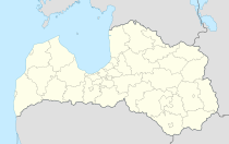
Mālpils (German Lemburg ) is a place in Latvia , around 50 kilometers northeast of Riga and the center of the district of the same name (Mālpils novads).
history
Between 1386 and 1413, the Lemburg fortress was built by the Teutonic Order . A church existed from the 15th century. In 1577 the castle was taken by the troops of the Danish Prince Magnus .
The village developed around the Lemburg estate, which was established after the Swedish conquest in 1622. A Lutheran pastor is attested as early as 1613. In 1693 there was a community school.
The district administrator of the Livonia Governorate Gustav von Taube became the owner in 1760 and built larger parks. In 1766 a stone church was built. In 1845, many of the local farmers changed their denominations and established a Russian Orthodox community. After the mansion was burned down during the Russian Revolution in 1905 , renovations began in the classical style based on plans by Wilhelm Bockslaff . In 1920 the property was expropriated and divided into 166 farms for new settlers . The mansion served as a school and rest home for soldiers.
After the Second World War there was a school for building technology and later the administration of a sovkhoz . During this time the population, which in 1935 still consisted of 279 inhabitants, grew to over 2500.
The restored manor buildings were opened in 2008 for the 150th birthday of the architect Bockslaff and now serve as an exclusive hotel.
Origin of name
The place appears as Lehmborch (1466), Leemborch (1498), Lemborch (1530) and Latvian Mahlpils (1909) in documents.
The Lives resident here called the place lembit-urga , which means something like "chief river". In terms of folk ethymology , the German crusaders turned it into "loam castle". The Latvian name in turn is a translation: "Lehm-Burg" - Latvian Māls-Pils .
There are also stories that the Latvian farmers used to call the castle Mārpils because a girl named Māra was walled in by the Crusaders when the castle was built.
Mālpils novads
The municipality of Mālpils has been known as Mālpils novads since 2009 as part of an administrative reform without changing the territory. In addition to the main town, there are the villages of Sidgunda (459 inhabitants), Upmalas (157 inhabitants), Vite (52 inhabitants) and Bukas (39 inhabitants) in the district. The remaining of the 4039 inhabitants (as of 2009) live on individual farms or in smaller settlements.
The Mergupe and Suda rivers converge in the district to form the great Jugla. On the 220.9 km² territory there are several wetlands with more than 1000 hectares.
Transport links
The state road P3 ( Alauksts - Garkalne ) leads north past the city center in an east-west direction. The state road P8 (Inciems - Sigulda - Ķegums ) runs in a north-south direction west of the city center. Both streets intersect in the northeast of the urban area. It is 58 km to Riga and 20 km to Sigulda.
Mālpils has a small bus station with several daily bus connections to Riga and Sigulda.
Sons and daughters of the place
- Johann Gottlieb von Wolff (1756–1817): Electoral Saxon lieutenant and chamberlain , district administrator and landowner in Livonia . He was born in today's district of Vite ( German : Wittenhof).
literature
- Hans Feldmann , Heinz von zur Mühlen (ed.): Baltic historical local dictionary, part 2: Latvia (southern Livonia and Courland). Böhlau, Cologne 1990, ISBN 3-412-06889-6 , pp. 336–337.
- Astrīda Iltnere (ed.): Latvijas Pagasti, Enciklopēdija. Preses Nams, Riga 2002, ISBN 9984-00-436-8 .


