Mad River (Pacific Ocean)
| Mad River | ||
|
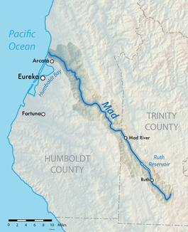
Course of the river and catchment area of the Mad River |
||
| Data | ||
| Water code | US : 217920 | |
| location | California (USA) | |
| River system | Mad River | |
| source | in Trinity County 40 ° 12 ′ 20 ″ N , 123 ° 9 ′ 23 ″ W. |
|
| Source height | approx. 1470 m | |
| muzzle | at McKinleyville in the Pacific Coordinates: 40 ° 58 ′ 19 " N , 124 ° 7 ′ 14" W 40 ° 58 ′ 19 " N , 124 ° 7 ′ 14" W |
|
| Mouth height | 0 m | |
| Height difference | approx. 1470 m | |
| Bottom slope | approx. 8.1 ‰ | |
| length | 182 km | |
| Catchment area | approx. 1290 km² | |
| Discharge at the Arcata A Eo gauge : 1256 km² |
MQ 1963/2016 Mq 1963/2016 |
37.7 m³ / s 30 l / (s km²) |
| Reservoirs flowed through | Ruth Reservoir | |
| Small towns | Arcata , McKinleyville | |
| Communities | Blue Lake , Mad River | |
|
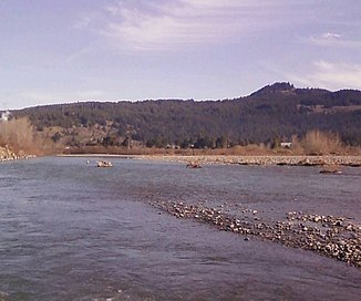
Mad River 15 miles above the mouth |
||
The Mad River is a 182 km long river in the northwest of the US state California . It drains an area of approximately 1290 km².
The Mad River has its source in the California Coast Mountains in Trinity County . It initially flows 10 km to the south, but then turns to the north-northwest. On the upper reaches, the river is dammed up by RW Matthews Dam, built in 1962, to form Ruth Reservoir . The narrow and sometimes only a few kilometers wide catchment area of the Mad River is wedged in the upper reaches between that of the Van Duzen River in the west and that of the South Fork Trinity River in the east. The Mad River settlement is located on the middle reaches of the river. The river meanders through the coastal mountains in Humboldt County . At the lower reaches of the Mad River passes the town of Blue Lake and the northern outskirts of Arcata . It flows around the city of McKinleyville and flows into an estuary that is connected to the Pacific Ocean at the level of Arcata-Eureka Airport .
The timber industry and gravel mining dominate the catchment area. The river carries a large amount of sediment with it.
Web links
- Mad River in the United States Geological Survey's Geographic Names Information System
- California EPA, North Coast Regional Water Quality Control Board: Mad River - Hydrologic Unit 109
Individual evidence
- ↑ a b Mad River Watershed Erosion Investigation, June 1982 (PDF, 1.4 MB) State of California, The Resources Agency, Dept. of Water Resources, Northern District. Retrieved August 14, 2017.
- ↑ a b Mad River Population (PDF, 1.8 MB) NOAA Fisheries, West Coast Region. Retrieved August 14, 2017.
- ↑ USGS 11481000 MAD R NR ARCATA CA

