Makonde plateau
| Makonde plateau | ||
|---|---|---|
| location | Tanzania | |
|
|
||
| Coordinates | 10 ° 44 ′ S , 39 ° 36 ′ E | |
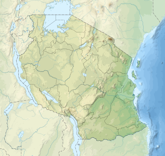
The Makonde Plateau is a low mountain range in the Mtwara region in southeastern Tanzania .
geography
The plateau covers an almost rectangular area of west-south-west - east-north-east extension and a size of about 100 × 80 km. It lies between the Lukuledi and Rovuma rivers . In the west it forms a steep drop, where it reaches its greatest heights of about 900 m. To the east it flattens out towards the coast to less than 100 m, where it is more severely cut by river erosion . Originally it was probably made up of dense forest, which has now disappeared except for individual forest islands and isolated trees.
geology
The rocks that make it up come mainly from the Lower Cretaceous . As in the Muera Plateau, these so-called Makonde layers consist mainly of red to red-brown sandstones (Newala sandstone, Aptium ), which lie on gneiss in the area of the Makonde Plateau . The sandstones are heavily silicified . Inlaid in the sandstones are clayey Letten , marl and leafy claystones . North of the Makonde plateau beyond the Lukuledi the dinosaur -Fundstätten of Tendaguru that there the lying form of Newala Sandstone and the transition Jura - originate chalk.
population
The Makonde Plateau is the northern settlement area of the Bantu people Makonde , which is also south of the Rovuma River in Mozambique is based. Among other things, cashew nuts are grown, the cultivation of which leads to soil acidification due to the use of sulfur to combat powdery mildew . The sandstones of the plateau are mostly deeply weathered and result in sandy soils that, in contrast to the lower-lying areas around the plateau, have hardly any buffer capacities.
References and comments
- ↑ According to some authors, the plateau south of the Rovuma, also inhabited by the Makonde, is called the Makonde plateau, for example by Briggs 2008 (p. 603)
- ↑ Philip Briggs: Tanzania: With Zanzibar, Pemba & Mafia . In: Bradt Travel Guides . 2008, ISBN 1-84162-153-6 , pp. 603 f .
- ↑ Macon layers. In: Deutsches Koloniallexikon 1920. Retrieved December 15, 2009 .
- ↑ H. Louis, K. Fischer: Allgemeine Geomorphologie Walter de Gruyter 1960, p. 364ff. ISBN 3-11-007103-7
- ↑ EL Ngatunga, N. Cools, S. Dondeyne, JA Deckers, R. Merckx: Buffering capacity of cashew soils in South Eastern Tanzania . In: Soil use and management . tape 17 , no. 3 , 2001, ISSN 0266-0032 , p. 155-162 .
