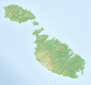
Maltese islands
| Maltese islands | ||
|---|---|---|
| Waters | Mediterranean Sea | |
| Geographical location | 35 ° 53 ' N , 14 ° 27' E | |
|
|
||
| Number of islands | 10 | |
| Main island | Malta | |
| Total land area | 246 km² | |
| Residents | 449,000 (July 2018) | |
The Maltese Islands (also known as the Maltese Archipelago or the Malta Archipelago ) are a group of islands in the Mediterranean Sea . They are 96 km south of Sicily and 295 km north of the African coast.
topography
The archipelago extends from the northernmost point at 36 ° 5 'latitude south to 35 ° 48', east from Żonqor Point at 14 ° 35 'longitude to the westernmost point at 14 ° 11'. It includes the populated islands of Malta , Gozo and Comino as well as the smaller islands Cominotto , Filfla , Filfoletta , Fungus Rock and the Saint Paul's Islands ; Manoel Island is also regarded by some authors as an island in its own right. The coasts of the main islands are characterized by deeply cut bays .
In the southwest of the island of Malta, the Ta 'Dmejrek in the Dingli Cliffs reaches the maximum height of 253 meters. Because of the porous limestone, no rivers have formed on Malta, there are only dry valleys ( Maltese wied ), which only carry water after rainfall.
The smaller islands are rocky ropes separated from the main islands by weathering .
geology
The geological origins of the Maltese islands lie in the initial movement within the primary continent of Pangea . Today's African continent collided with today's Eurasia in the Paleozoic . This brought sediments to the surface that had been deposited over millions of years. It was initially coralline limestone, which is characterized by fossils such as Scutella subrotunda and which today forms the lowest horizon of the Maltese archipelago, the lower coralline limestone ( Lower Coralline Limestone ).
Over the course of the next millions of years, the continents shifted further and diverged. As a result of this continental drift , the sediments dived several times below the surface of the sea and emerged again. Raised by these tectonic deformations of the earth's mantle from the late Miocene onwards , the three larger islands now jut out of the Mediterranean as sloping clods .
The surface horizon of the large islands consists essentially of Oligocene and Miocene globigerine limestones ( Maltese Qawwi ta 'Fuq ). Below there is a layer of green sand ( Ġebla s-Safra ), below that again blue clay ( Tafal ), which is further underlain by the frequent globegerine limestone ( Franka ). The lowest layer, which is hardly visible, is formed by the coralline limestone.
Flora and fauna
flora
The flora of the Maltese islands hardly differs from that of other Mediterranean areas. Aleppo pine , caper bush and various thorny bushes are widespread here . The Maltese sponge was of great importance as a medicine in the early modern period . Salsola melitensis , Atriplex lanfrancoi , Euphorbia melitensis and Limonium melitense are endemic .
fauna
Endemic animal species on the Maltese islands include the Malta lizard and the Maltese bee .
history
According to archaeological finds, the islands have been in existence since the Neolithic from around 5200 BC. Settled there are the oldest free-standing buildings in the world, the remains of which are UNESCO World Heritage Sites . Over time, the islands came under Punic , Roman , Byzantine and Spanish rule until the Knights of the Order of Malta established an independent state here that lasted until the Second War of the Coalition . After that, the islands were under British rule. In 1964 Malta became an independent state.
population
The population of the Maltese archipelago was around 449,000 in July 2018. The Maltese islands have the fifth highest population density in the world and the third highest in Europe. About 94% of the people live in cities, only 6% live in the countryside. Population growth is about 0.31% per year.
literature
- Neville Ransley, Anton Azzopardi: A Geography of the Maltese Islands. 4th edition. Malta 1988.
- Claudia Sagona: The Archeology of Malta. From the Neolithic through the Roman Period. Cambridge University Press, 2015.
Individual evidence
- ^ Neville Ransley, Anton Azzopardi: A Geography of the Maltese Islands. 4th edition. Malta 1988, p. 1
- ↑ cf. Joe Zammit Ciantar: The Names of the Town and Villages of Gozo (Malta). P. 80
- ^ A b c Joseph Caruana: Geology and Geomorphology of the Djeira Bay. Retrieved January 4, 2020 .
- ↑ Maltese Indigenous and Endemic Flora. In: Argotti Botanic Gardens & Resource Center. L-Università ta 'Malta, August 4, 2016, accessed on February 4, 2020 .
- ↑ The CIA World Factbook , accessed December 22, 2019
