Manse (river)
| Manse | ||
|
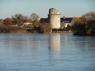
Castle ruins on the Etang du Milieu reservoir , which is formed by the river. |
||
| Data | ||
| Water code | FR : L7024000 | |
| location | France , Center-Val de Loire region | |
| River system | Loire | |
| Drain over | Vienne → Loire → Atlantic Ocean | |
| source | in the municipality of Bossée 47 ° 5 '46 " N , 0 ° 44' 28" O |
|
| Source height | approx. 116 m | |
| muzzle | in the municipality of L'Île-Bouchard in the Vienne Coordinates: 47 ° 7 '14 " N , 0 ° 25' 38" E 47 ° 7 '14 " N , 0 ° 25' 38" E |
|
| Mouth height | approx. 31 m | |
| Height difference | approx. 85 m | |
| Bottom slope | approx. 2.8 ‰ | |
| length | approx. 30 km | |
| Reservoirs flowed through | Étang du Milieu, Étang du Bas | |
|
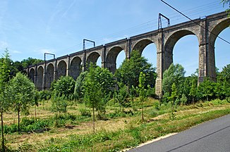
Besnault railway viaduct |
||
The Manse is a river in France that runs in the Indre-et-Loire department in the Center-Val de Loire region . It rises in the municipality of Bossée , drains generally in a westerly direction through the historical province of Touraine , reaches the Loire-Anjou-Touraine Regional Nature Park and, after around 30 kilometers, flows into the Vienne as a right tributary in the municipality of L'Île-Bouchard . In the middle section, the river valley is flanked by numerous caves and grottos .
Places on the river
(Order in flow direction)
- Bissac , municipality of Bossée
- La Roche-Ploquin , Sepmes municipality
- Sainte-Maure-de-Touraine
- Noyant-de-Touraine
- Saint-Épain
- Crissay-sur-Manse
- Saint-Gilles , municipality of L'Île-Bouchard
Transport links
In the greater Sainte-Maure-de-Touraine area, the river crosses several important transport links. These are seen in the direction of flow:
- Railway line LGV Sud Europe Atlantique ,
- A10 motorway ,
- Paris – Bordeaux railway line with the 19th century Besnault railway viaduct near Noyant-de-Touraine.

