Mateh Yehuda
| Mateh Yehuda | ||
|---|---|---|
| Basic data | ||
| State : |
|
|
| District : | Jerusalem | |
| Founded : | June 25, 1964 | |
| Coordinates : | 31 ° 46 ′ N , 35 ° 0 ′ E | |
| Area : | 520 km² | |
| Residents : | 41,700 (2009) | |
| Population density : | 80 inhabitants per km² | |
| Time zone : | UTC + 2 | |
| Community type: | Regional administration | |
| Mayor : | Moshe Dadon | |
|
|
||
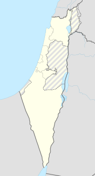
The regional administration Mateh Jehuda ( מועצה אזורית מטה יהודה Mo'atza Azorit Mateh Yehuda ) is a regional government in Israel's Jerusalem district . It is named after one of the twelve tribes of Israel , the tribe of Judah .
location
The regional administration borders the city limits of Jerusalem to the west . Mateh Jehuda was founded on June 25, 1964, when 4 smaller administrative units were combined. Over 50% of the area consists of forests, national parks and nature reserves as well as archaeological sites.
structure
- 8 kibbutzim : → List of kibbutzim
- 41 moshavim : → table of moshavim
- 3 community settlements: Nataf, Srigim and Tzur Hadassa; → Table of community settlements
- 2 Jewish villages : Gizo and Motza Illit
- 2 Arab villages : Ein Naqquba and Ein Rafa
- 1 Arab-Jewish village : Newe Shalom
- Other facilities: Deir Rafat Monastery , 'Ein Kerem Agricultural School, Eitanim, Memorial of Deported Jews from France , Giv'at Schemesch, Jedida, Kfar Zoharim, Kirjat Je'arim youth village
Residents
The Israeli Central Statistical Office gives the following population figures for the regional administration in the censuses of May 22, 1961, May 19, 1972, June 4, 1983, November 4, 1995 and December 28, 2008:
| Year of the census | 1961 | 1972 | 1983 | 1995 | 2008 |
| Number of inhabitants | 15,800 | 16,600 | 23,000 | 24,500 | 39,700 |
Parish partnership
-
 Vantaa , Finland, since 1967
 -
 Würzburg district , Bavaria , Germany, since 1997
 -
 Nümbrecht , North Rhine-Westphalia , Germany, since November 8, 2008
