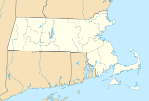
Methuen, Massachusetts
| Methuen | ||
|---|---|---|
 |
||
| Location in Massachusetts | ||
|
|
||
| Basic data | ||
| Foundation : | 1642 | |
| State : | United States | |
| State : | Massachusetts | |
| County : | Essex County | |
| Coordinates : | 42 ° 44 ′ N , 71 ° 11 ′ W | |
| Time zone : | Eastern ( UTC − 5 / −4 ) | |
| Residents : | 47,255 (as of 2010) | |
| Population density : | 820.4 inhabitants per km 2 | |
| Area : | 59.7 km 2 (approx. 23 mi 2 ) of which 57.6 km 2 (approx. 22 mi 2 ) are land |
|
| Height : | 37 m | |
| Postal code : | 01844 | |
| Area code : | +1 978,351 | |
| FIPS : | 25-40710 | |
| GNIS ID : | 612337 | |
| Website : | www.cityofmethuen.net | |
| Mayor : | James P. Jajuga (since January 2018) | |
 Methuen Square in Methuen MA |
||
Methuen is a city in Essex County in the US state of Massachusetts in the United States . In 2010 the population was 47,255 people.
Demographics
| Population development | |||||
|---|---|---|---|---|---|
| year | Residents | year | Residents | ||
| 1850 | 2,538 | 1940 | 21,880 | ||
| 1860 | 2,566 | 1950 | 24,477 | ||
| 1870 | 2,959 | 1960 | 28,114 | ||
| 1880 | 4,392 | 1970 | 35,456 | ||
| 1890 | 4,814 | 1980 | 36,701 | ||
| 1900 | 7,512 | 1990 | 39,990 | ||
| 1910 | 11,448 | 2000 | 43,789 | ||
| 1920 | 15,189 | 2010 | 47,255 | ||
traffic
The Manchester – Lawrence railway runs through Methuen. Interstate 93 runs west of the city .
additional
The Methuen Memorial Music Hall , which was completed in 1909, is located in Methuen . The rock band Cave In comes from Methuen.
In Methuen is the Basilius Monastery of the Basilian of the Most Holy Redeemer . It is the only monastery of this order of the Melkite Greek Catholic Church outside of Lebanon .
sons and daughters of the town
- Steve Bedrosian (born 1957), American baseball player
- Joseph Bodwell (1818–1887), politician and in 1887 Governor of the State of Maine
- Joanne Chory (* 1955), plant biologist
- Elias James Corey (* 1928), chemist
- Robert Devaney (* 1948), mathematician
- Alphonse Fournier (1893–1961), Canadian lawyer and politician with the Liberal Party of Canada
- Christopher Lennertz (* 1972), composer of film, television series and video game music
- Mel Pollan (* 1931), jazz and studio musician
- Robert Rogers (1731–1795), British-American officer in the Seven Years North American War
- Paul Thompson (* 1988), ice hockey player
See also
Web links
Commons : Methuen, Massachusetts - collection of pictures, videos, and audio files
Individual evidence
- ^ A b Profile of General Population and Housing Characteristics: 2010 Demographic Profile Data (DP-1): Methuen Town city, Massachusetts . US Census Bureau, American Factfinder. Retrieved August 30, 2012.
