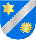
Metslawier
 flag |
 coat of arms |
| province |
|
| local community | Noardeast-Fryslân |
|
Area - land - water |
3.66 km 2 3.62 km 2 0.04 km 2 |
| Residents | 905 (Jan. 1, 2017) |
| Coordinates | 53 ° 22 ′ N , 6 ° 4 ′ E |
| Important traffic route |
|
| prefix | 0519 |
| Postcodes | 9123-9124, 9137-3138 |
Metslawier ( West Frisian Mitselwier ) is a village in the municipality of Noardeast-Fryslân in the Dutch province of Friesland . It is 6 km northeast of Dokkum and has 905 inhabitants (as of January 1, 2017). The islands of Ameland and Schiermonnikoog can be easily reached from Metslawier.
Like many other Frisian villages, Metslawier was built on a terp . Metslawier was the municipality seat of Oostdongeradeel until 1984 when the district reform was completed and from then on it was part of the municipality of Dongeradeel until it merged with Noardeast-Fryslân in 2019.
Personalities
- Balthasar Bekker (March 20, 1634 - June 11, 1698), theologian and philosopher
Web links
Commons : Metslawier - collection of images, videos and audio files
- Village website (Dutch)
- Information on Metslawier In: friesland-digitaal.eu (Dutch)
Individual evidence
- ↑ a b Kerncijfers wijken en buurten 2017 Centraal Bureau voor de Statistiek , accessed on June 16, 2018 (Dutch)
