Miami and Erie Canal

The Miami and Erie Canal is a disused shipping canal in the western US state of Ohio . It connects the city of Cincinnati on the Ohio River in the south with Lake Erie in the north over a length of approx. 290 km , while it runs for about half of its length through the valley of the Great Miami River . Side canals lead to Defiance on the Wabash River and to Grand Lake St. Marys , an artificial lake that was created as a reservoir for the Miami and Erie Canal. Individual structures on the canal were included in the National Register of Historic Places , including the Lockington Locks , seven locks at or near the apex position .
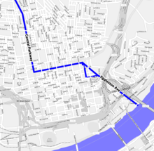
The construction of the canal was decided in 1825 by the Parliament of Ohio and lasted from 1825 to 1845. After a flood in 1913, parts of the canal were destroyed and in 1929 it was officially abandoned. The Cincinnati Subway , which has started but has been abandoned , partly follows the Miami and Erie Canal, which was closed at the same time as the subway construction .
Disused lock in Lockington
See also
Web links
- Canals in Ohio, see letter A ( January 22, 2008 memento on the Internet Archive )
Coordinates: 39 ° 6 ′ 3 ″ N , 84 ° 29 ′ 49 ″ W.


