Michelbach (Wied)
| Michelbach | ||
|
Michelbach (Wied) |
||
| Data | ||
| location | Altenkirchen (Westerwald) district , Rhineland-Palatinate , Germany | |
| River system | Rhine | |
| Drain over | Wied → Rhine → North Sea | |
| source | on the northern edge of Michelbach (Westerwald) 50 ° 41 ′ 19 ″ N , 7 ° 40 ′ 15 ″ E |
|
| Source height | 275 m above sea level NN | |
| muzzle | in Michelbach in the Wied coordinates: 50 ° 40 ′ 56 " N , 7 ° 40 ′ 9" E 50 ° 40 ′ 56 " N , 7 ° 40 ′ 9" E |
|
| Mouth height | 225 m above sea level NN | |
| Height difference | 50 m | |
| Bottom slope | 63 ‰ | |
| length | 800 m | |
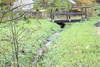
The Michelbach , also known as the Feldgraben , is an almost one kilometer long right and northern tributary of the Wied in the Rhineland-Palatinate district of Altenkirchen (Westerwald) .
course
The Michelbach rises at an altitude of about 275 m above sea level. NN on the eastern edge of Altenkirchen (Westerwald) in a meadow corridor ( above the bulge ) in the Michelbach district below the industrial area Graf-Zeppelin-Straße . It flows south through grassland and then feeds in the corridor above in the ground at a height of 250 m above sea level. NN a small pond ( water retention ) above the Limburg – Altenkirchen railway line , the embankment of which it crosses in a tunnel. It reaches the eastern center of Michelbach near Altenkirchen in the hallway down in the ground ; In front of the Mittelstraße at the playground, the stream disappears into the ground and finally flows out at a height of about 225 m above sea level. NN from the right into the Wied .
Individual evidence
- ↑ a b Map service of the landscape information system of the Rhineland-Palatinate Nature Conservation Administration (LANIS map) ( notes )
- ↑ Own measurement using the map service of the landscape information system of the Rhineland-Palatinate nature conservation administration
