Wied (river)
| Wied | ||
|
The Wied near Roßbach |
||
| Data | ||
| Water code | EN : 2716 | |
| location | Rhineland-Palatinate , Germany | |
| River system | Rhine | |
| Drain over | Rhine → North Sea | |
| source | North of Linden 50 ° 36 ′ 16 ″ N , 7 ° 51 ′ 11 ″ E |
|
| Source height | approx. 463 m above sea level NN | |
| muzzle | At Neuwied in the Rhine Coordinates: 50 ° 26 '30 " N , 7 ° 26' 33" E 50 ° 26 '30 " N , 7 ° 26' 33" E |
|
| Mouth height | approx. 63 m above sea level NN | |
| Height difference | approx. 400 m | |
| Bottom slope | approx. 3.9 ‰ | |
| length | 102 km | |
| Catchment area | 770.8 km² | |
| Discharge at the Friedrichsthal A Eo gauge: 680.1 km² Location: 11 km above the mouth |
NNQ (1947) MNQ 1937-2007 MQ 1937-2007 Mq 1937-2007 MHQ 1937-2007 HHQ (1984) |
366 l / s 1.17 m³ / s 8.27 m³ / s 12.2 l / (s km²) 92.7 m³ / s 176 m³ / s |
| Discharge at the mouth of the A Eo : 770.8 km² |
MQ Mq |
9 m³ / s 11.7 l / (s km²) |
| Reservoirs flowed through | Dreifelder pond | |
The Wied is a 102 km long, right, i.e. eastern tributary of the Rhine in Germany . It flows through the Rhineland-Palatinate area from the source to the mouth . From its catchment area of 770.8 km², it supplies around 9 m³ / s of water to the Rhine.
course
The Wied rises in the Westerwald at 464 m above sea level. NN directly north of the local community of Linden , part of the Hachenburg community . Initially, it passes linden trees on the eastern edge of the village and runs in a south-south-west direction, to flow into the Dreifelder Weiher (largest pond in the Westerwald lake district ) on the east bank and to leave it in a north-west direction.
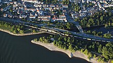
Then the Wied flows in a north-westerly direction to Altenkirchen , then westwards, passing the scenic Rhine-Westerwald Nature Park , Neustadt . Then it bends again to the south, not far from the nature park boundary on the outskirts of Irlich (a district of Neuwied ) into the north-west flowing Middle Rhine .
Origin of name and history
The oldest written form of the river name Wied is uuida (read: wida ) from the year 857. In the Middle Ages , the Wied formed the boundary of the old Archdiocese of Trier on the left and the Archdiocese of Cologne on the right of the stream in about the first half of its course, from Steinebach to above Neustadt (Wied) .
Tributaries
The Wied tributaries include:
|
Left the Wied
|
Right the Wied
|
Localities
The villages on and near the Wied include:
Water status
According to the Rhineland-Palatinate State Water Act, the Wied is a second-order body of water from the Rothenbach estuary (northeast of Wahlrod ) to the confluence with the Rhine , so that the districts are responsible for keeping it clean .
Economy and tourism
The last half kilometer of the river Wied is navigable and leads to the factory harbor of ThyssenKrupp Rasselstein GmbH, today a member of the Thyssen Krupp group. For hikers, the river and landscape are made accessible through the Wiedwanderweg (100 km long). There is also a hydropower plant in Altwied and at the Michelbacher Mühle . Electricity is also generated in the Strickhausener Mühle (Gem. Berzhausen). Depending on the water level, the Wied is passable for kayaks from Altenkirchen and for Canadians from Schöneberg, at lower water levels only from Oberlahr.
The Wied is named after a cinema and cultural center in Neitersen that Wied-Scala .
After 100 years of operation, the Altwied hydropower plant burned down completely on July 19, 2012 and went back into operation after more than a year of extensive restoration.
Individual evidence
- ↑ a b Topographic map 1: 25,000
- ↑ GeoExplorer of the Rhineland-Palatinate Water Management Authority ( information )
- ↑ MQ Friedrichsthal der Wied (8.25 m³ / s) plus MQ Oberbieber of the downstream Aubach (0.36 m³ / s), increased by the area runoff (7 l / s km²) of the remaining catchment area (61.3 km²)
- ↑ Helmut Priewer, Mathias Priewer, Gerhard Hachenberg: Why is the Wied a Witt? In: Heimat-Jahrbuch des Landkreis Neuwied 2011 , ISBN 3-9809797-8-4 , pp. 232–235.
- ↑ Report from the Rhein-Zeitung from July 19, 2012
- ↑ http://www.nr-kurier.de/artikel/24422-wasserkraftwerk-in-altwied-wieder-in-betrieb NR-Kurier October 1, 2013


