Dreifelder pond
| Dreifelder pond | ||
|---|---|---|

|
||
| View of the Dreifelder Weiher in spring | ||
| Geographical location | Rhineland-Palatinate | |
| Tributaries | Wied | |
| Drain | Wied | |
| Data | ||
| Coordinates | 50 ° 35 '30 " N , 7 ° 49' 28" E | |
|
|
||
| Altitude above sea level | 410 m above sea level NN | |
| surface | 1.23 km² | |
The three-field pond with a surface area of 123 hectares is the largest pond of the Westerwald ( Rhineland-Palatinate , Germany situated) Westerwald Lake District .
Geographical location
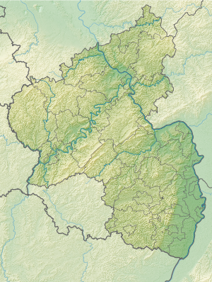
The Dreifelder Weiher is located in the northern part of the Westerwaldkreis , which lies in the northern part of Rhineland-Palatinate. It belongs to the small community of Dreifelden , which lies on its eastern bank and is part of the Hachenburg community. The small settlement Seeburg (24 inhabitants) is located on its west bank .
The surface of the Dreifelder Weiher, which is about 2 km long and a maximum of 1 km wide, is about 410 m above sea level. NN . The pond is close to the sources of Sayn , Holzbach and Wied ; the latter rises directly north of the nearby village of Linden and flows through the pond, into which it flows on the east bank, in a north-westerly direction.
It's about a drain ditch with the under nature conservation standing heath pond connected.
The federal highway 8 runs about two kilometers southwest of the Dreifelder Weiher .
history
Emergence
The Dreifelder Weiher is a shallow, artificially created still water (a pond), the water of which could also be drained because of its barrier structure located on the north bank . The pond was after the end of the Thirty Years War together with five other ponds by Count Friedrich III. zu Wied (1634–1698) laid out for the purpose of fish farming in partly swampy terrain, while the count's hunting station Haus Seeburg was expanded into a stately home.
The area around the Westerwald lake district was a preferred hunting area and also the object of early scientific studies by Prince Maximilian zu Wied , who later became known through his scientifically documented trips to America.
today
Large parts of the Dreifelder Weiher and its surroundings are designated as nature reserves due to their silting up zones with rare plant and animal species .
The landscape around the pond is open to tourists. For example, tourists can spend the night at the campsite on the northwestern bank of the pond .
Once a year, almost all of the lake's water is drained in order to fish out the fish that has been washed up with it. Otherwise the pond is mainly used for sporting activities.
vegetation
The near-natural still waters of the Westerwälder Lake District and thus also of the Dreifelder Weiher are of national importance for the protection of animal and plant species. The pond has also been declared a European fauna-flora-habitat reserve . The decisive factor is the high occurrence of the rare dwarf rush meadows . The egg-shaped swamp rushes, for example, are able to bloom very quickly after the pond has dried out. The riparian vegetation is also characterized by extensive reed zones .
hike
The total distance of the paved paths that lead around the Dreifelder Weiher is 5.9 km. The pond passes the 7-Weiher-Weg , an approximately 36 km long circular hiking and cycling path in the High Westerwald.


