Mildura
| Mildura | |||||||
|---|---|---|---|---|---|---|---|
|
|||||||
|
|||||||
|
|||||||
|
|||||||
|
|
|||||||
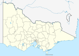
Mildura is a city in the Australian state of Victoria and is located in the northwest of the state on the Murray River on the border with New South Wales . It is the capital of the Local Government Area Rural City of Mildura . The city is the center of an agricultural region known as Sunraysia . Above all citrus fruits and grapes are produced here.
history
The city was founded in 1887 and attracted over 3,000 settlers in just four years, although it was only 550 km from the capital, Melbourne, that it was not connected to the railway network until 1903. Due to the transport situation, a dried fruit industry developed in Mildura , for which Sunraysia is still known today.
However, the region also has to struggle with pests time and again. A rabbit plague combined with a general recession led to a severe crisis in the early years . Today the city is located in a "Fruit Fly Exclusion Zone", into which certain types of fruit and vegetables may not be imported to protect against fruit flies .
The rapid initial growth of the settlement meant that Mildura was planned generously and extensively; this makes Deakin Avenue the longest straight street in the country at 12.1 km. Around 33,000 people live in Mildura itself and around 54,000 in the entire Local Government Area.
The largest thermal power plant in the world is planned near Mildura , which will have a collector roof 7 kilometers in diameter and a tower 1000 m high.
sons and daughters of the town
- Leigh Adams (* 1971), track athlete
- Leslie Rogers Tomlinson (born 1943), Roman Catholic Bishop of Sandhurst
Miscellaneous
To international fame came Mildura in December 2012 by an error in the navigation and map software in the smartphone - operating system iOS 6 from Apple . The city was drawn in the national park offset by 70 kilometers, which stranded several tourists.
Web links
Individual evidence
- ↑ a b Australian Bureau of Statistics : Mildura ( English ) In: 2016 Census QuickStats . June 27, 2017. Retrieved April 19, 2020.
- ↑ Australian Bureau of Statistics : Mildura (RC) ( English ) In: 2016 Census QuickStats . June 27, 2017. Retrieved April 19, 2020.
- ↑ Australian police warns of Apple Maps (December 10, 2012) on derStandard.at


