Middle rear tip
| Middle rear tip | ||
|---|---|---|
|
Hintereisspitzen from the north, from the Brandenburger Haus : from left to right front, middle and rear Hintereisspitze |
||
| height | 3450 m above sea level A. | |
| location | Tyrol , Austria | |
| Mountains | Ötztal Alps | |
| Dominance | 0.77 km → Hintere Hintereisspitze | |
| Notch height | 97 m ↓ notch to the rear rear tip | |
| Coordinates | 46 ° 49 ′ 36 " N , 10 ° 46 ′ 31" E | |
|
|
||
The Mittlere Hintereisspitze is a 3450 m high peak in the Ötztal Alps . It is located in the Weißkamm between the Vorderen ( 3437 m ) and the Hinteren Hintereisspitze ( 3485 m ) and rises with them about 100 m above the southeast Gepatschferner . The Mittlere Hintereisspitze is located exactly on the border between the Tyrolean communities Kaunertal and Sölden in Austria .
The first known ascent of the Mittlerer Hintereisspitze dates back to July 28, 1875, when Theodor Petersen and Alois Ennemoser reached the summit. The closest support points for mountaineers are the nearby Brandenburger Haus in the north and the Weißkugelhütte in the west. It is often reached in the course of exceeding all three rear tips.
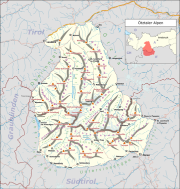
location
Location of the Middle Hintereisspitze in the
Ötztal Alps (left) and the entire Alps (right).
literature
- Walter Klier : Alpine Club Guide Ötztaler Alpen , Bergverlag Rudolf Rother , Munich 2006. ISBN 3-7633-1123-8
- Alpine club map sheet 30/2, 1: 25,000, Ötztal Alps, Weißkugel , ISBN 3-928777-39-4


