Posterior posterior tip
| Posterior posterior tip | ||
|---|---|---|
|
Hintereisspitzen from the north, from the Brandenburger Haus : from left to right front, middle and rear Hintereisspitze |
||
| height | 3485 m above sea level A. | |
| location | Tyrol , Austria and South Tyrol , Italy | |
| Mountains | Ötztal Alps | |
| Dominance | 2.4 km → Langtauferer Spitze | |
| Notch height | 275 m ↓ Kesselwandjoch | |
| Coordinates | 46 ° 49 '22 " N , 10 ° 45' 51" E | |
|
|
||
| First ascent | July 28, 1875 by Theodor Petersen and Alois Ennemoser | |
| Normal way | From the north over the Gepatschferner | |
The Hintere Hintereisspitze is a 3485 m high peak in the Ötztal Alps . Together with the Vorderen ( 3437 m ) and Mittleren Hintereisspitze ( 3450 m ) as well as the Hochvernaglwand ( 3435 m ) it forms the southeastern border of the Gepatschferner . The ridge of these neighboring peaks, which is part of the Weißkamm , rises about 100 m above the ice field. The Hintere Hintereisspitze is located exactly on the border between Italy and Austria or between the federal state of Tyrol and the province of South Tyrol .
The first known climbers of the Hinteren Hintereisspitze were Theodor Petersen and Alois Ennemoser on July 28, 1875. The easiest ascent today is from the north, from the Brandenburger Haus over the Gepatschferner. An alternative base for the ascent route is the Weißkugelhütte in the Langtaufer valley . The posterior rear tip is often visited when all three rear tips are exceeded. This takes about three hours and has level II of difficulty .
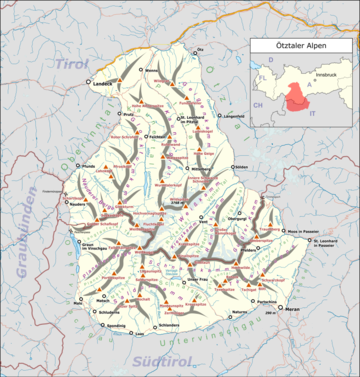
location
Location of the Hinteren Hintereisspitze in the
Ötztal Alps (left) and the entire Alps (right).
literature
- Walter Klier : Alpine Club Guide Ötztaler Alpen , Bergverlag Rudolf Rother , Munich 2006. ISBN 3-7633-1123-8
- Alpine club map sheet 30/2, 1: 25,000, Ötztal Alps, Weißkugel , ISBN 3-928777-39-4


