Monongahela
|
|
This article was on the basis of substantive defects quality assurance side of the project USA entered. Help bring the quality of this article to an acceptable level and take part in the discussion ! A closer description on the resolving issues is missing. |
| Monongahela | ||
|---|---|---|
| Nickname : Mon City | ||
|
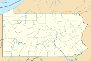
Location in Pennsylvania
|
||
| Basic data | ||
| Foundation : | 1770 | |
| State : | United States | |
| State : | Pennsylvania | |
| County : | Washington County | |
| Coordinates : | 40 ° 12 ′ N , 79 ° 56 ′ W | |
| Time zone : | Eastern ( UTC − 5 / −4 ) | |
| Residents : | 4,761 (as of: 2000) | |
| Population density : | 952.2 inhabitants per km 2 | |
| Area : | 5.5 km 2 (approx. 2 mi 2 ) of which 5.0 km 2 (approx. 2 mi 2 ) is land |
|
| Height : | 230 m | |
| Postal code : | 15063 | |
| Area code : | +1 724 | |
| FIPS : | 42-50408 | |
| GNIS ID : | 1213991 | |
| Website : | www.cityofmonongahela-pa.gov | |
| Mayor : | Robert (Bob) Kepics | |
Monongahela is a city in Washington County in the US state of Pennsylvania .
Facts
The city, which has almost 4,760 inhabitants, extends over an area of 5.5 km² .
The founding of Monongahela can be traced back to 1769 . Thus, the city was founded seven years before the USA was founded in 1776 by the three men William Nowland , Peter Froman and James Linnes .
Monongahela got its name from the nearby Monongahela River .
On July 9, 1755, the British were defeated by the French in the Battle of Monongahela .
Monongahela is the seat of the Church of Jesus Christ (Bickertonites) .
sons and daughters of the town
- Frederick D. Rossini (1899-1990), chemist
- Roland Kibbee (1914–1984), screenwriter and film producer
- Henrietta Leaver (1916-1993), ninth Miss America (1935)
- Carl E. Vuono (born 1934), General in the United States Army
- John Taylor Gatto (1935–2018), teacher, author and public speaker
- Jay Chattaway (* 1946), film music composer
- Mitch Daniels (* 1949), politician and governor of the state of Indiana (2005–13)
- Jim Renacci (* 1958), politician and member of the US House of Representatives

