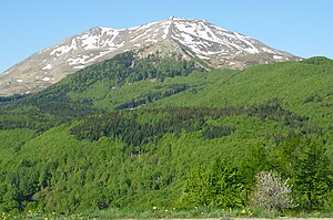
Monte Cimone (Apennines)
| Monte Cimone | ||
|---|---|---|
|
View of the Monte Cimone |
||
| height | 2165 m slm | |
| location | Emilia-Romagna , Italy | |
| Mountains | Tuscan-Emilian Apennines | |
| Coordinates | 44 ° 11 '37 " N , 10 ° 42' 0" E | |
|
|
||
The Monte Cimone ( 2165 m slm ) is the most famous mountain in the northern Apennines in the Emilia-Romagna region . It belongs to the municipalities of Fiumalbo, Séstola, Fanano and Riolunato in the province of Modena . Its shape forms a characteristic landscape in the Apennines, the mountain is visible from the provinces of Modena , Reggio Emilia , Parma , Pistoia , Bologna and Ravenna . During the Cold War , access to the summit was forbidden for military reasons. The Italian weather service is located on the mountain .
With good visibility you can see the Alps , the Adriatic Sea , the Tyrrhenian Sea , Monte Amiata , Monte Argentario and the islands of Elba , Corsica and Capraia from the summit . There is a very popular ski area on the mountain, there are 31 slopes with a total length of more than 50 km (the longest route is 3.6 km) and 26 lifts. The ski season usually lasts from the beginning of December to mid-April. A funicular connects Passo del Lupo (accessible by car) with Pian Cavallaro, from which you can reach the summit in about an hour. The “Lago della Ninfa” (Eng. Nymphensee) is located on the north-eastern mountain slope. A good starting point to reach the mountain is Sestola ( 1020 m slm ).


