Mount Neumayer
| Mount Neumayer | ||
|---|---|---|
| height | 719 m | |
| location | Victoria Land , East Antarctica | |
| Mountains | Prince Albert Mountains , Transantarctic Mountains | |
| Coordinates | 75 ° 16 ′ 0 ″ S , 162 ° 17 ′ 0 ″ E | |
|
|
||
|
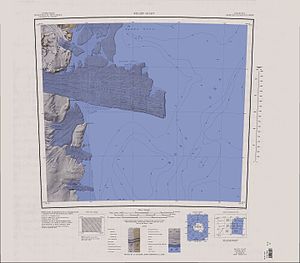
Topographic map with the Drygalski ice tongue and Mount Neumayer (top left) |
||
Mount Neumayer is a 719 m high mountain on the Scott coast of the East Antarctic Victoria Land . In the Prince Albert Mountains it rises from the D'Urville Wall on the northern flank of the transition from the David Glacier to the Drygalski Ice Tongue .
Participants of the Discovery Expedition (1901-1904) led by the British polar explorer Robert Falcon Scott discovered him. Scott named it after the German geophysicist Georg von Neumayer (1826–1909).
Web links
- Mount Neumayer in the Geographic Names Information System of the United States Geological Survey (English)
- Mount Neumayer on geographic.org (English)

