Mousa
| Mousa | ||
|---|---|---|
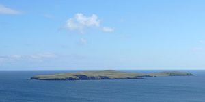
| Mousa as seen from Mainland | ||
| Waters | North Sea | |
| Archipelago | Shetland Islands | |
| Geographical location | 59 ° 59 '43 " N , 1 ° 10' 55" W | |
|
|
||
| length | 2.4 km | |
| width | 1.3 km | |
| surface | 1.8 km² | |
| Highest elevation | Mid field 73 m |
|
| Residents | uninhabited | |
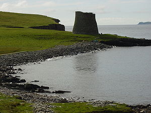
| The Mousa brochure | ||
Mousa is a small Scottish Shetland island, east of the main island Mainland , which is separated from it by the Mousa Sound, which is about one kilometer wide.
administration
Mousa belongs to the Community council area Sandwick , or the former Civil parish Sandwick, which was incorporated into Dunrossness towards the end of the 19th century .
geography
The flat and treeless island is about 2.5 km long in a north-west-south-east direction and a good one kilometer wide. It consists of the smaller North Isle in the northwest and the South Isle in the southeast, which are separated from each other by the incised bays East Ham and West Ham .
Mousa has been uninhabited since the 19th century at the latest and is home to numerous species of birds. It can be visited with organized tours. The Mousa brochure is one of the best-preserved brochures ever.


