Muttekopf (Parzinn)
| Motherhead | ||
|---|---|---|
|
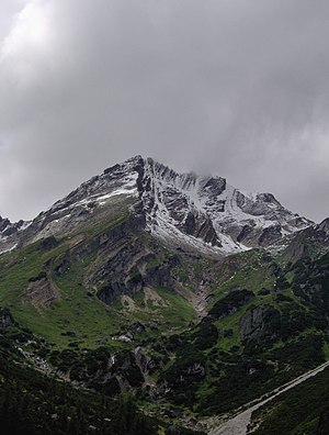
The Imster Muttekopf. The Muttekopfhütte is located exactly below the summit |
||
| height | 2774 m above sea level A. | |
| location | Tyrol , Austria | |
| Mountains | Lechtal Alps | |
| Dominance | 3.34 km → Great dangling peak | |
| Notch height | 296 m ↓ Scharte between Rotkopf and Brunnkarspitze | |
| Coordinates | 47 ° 16 '3 " N , 10 ° 39' 6" E | |
|
|
||
The Muttekopf ( Imster Muttekopf , 2774 m above sea level ) is a vantage point in the Lechtal Alps in Tyrol . It is located northwest of Imst and directly south of the Hahntennjoch .
The path leads from Imst via a road or through the narrow Rosengarten Gorge to Hochimst . From there on a footpath in about 2 hours to the Muttekopfhütte ( 1934 m above sea level ), alternatively with a chairlift to the mountain station of the Untermarkt chairlift and then to the mountain station of the Alpjoch chairlift and from there at about the same height in half an hour Hut.
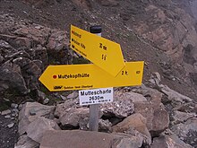
From the hut on an alpinistically attractive path to the Muttekopfscharte and from there gently ascending to the Muttekopf, 2 to 3 hours from the hut, in dry weather without difficulties , suitable for children. Another ascent takes place from Pfafflar ( 1619 m above sea level ) through the Fundais valley and the bucket walls up to the mountain.
The crossing to the Hanauer Hütte also leads over the Muttekopfscharte, without any difficulties in dry weather, but long.
Geologically, the Muttekopf is shaped by the conglomerate rocks of the Gosau strata .
literature
- Heinz Groth: Alpine Club Leader Lechtaler Alpen , Bergverlag Rother , Munich, out of print
- Dieter Seibert: Alpine Club Guide alpin, Lechtaler Alpen , Bergverlag Rother Munich, ISBN 978-3-7633-1268-9


