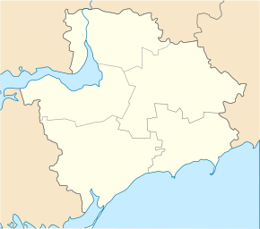
Mychajlo-Lukasheve
| Mychajlo-Lukasheve | ||
| Mikhailo-Lukasheve | ||

|
|
|
| Basic data | ||
|---|---|---|
| Oblast : | Zaporizhia Oblast | |
| Rajon : | Vilnyansk Raion | |
| Height : | no information | |
| Area : | 2.769 km² | |
| Residents : | 1,106 (2001) | |
| Population density : | 399 inhabitants per km² | |
| Postcodes : | 70042 | |
| Area code : | +380 6143 | |
| Geographic location : | 47 ° 57 ' N , 35 ° 36' E | |
| KOATUU : | 2321584501 | |
| Administrative structure : | 4 villages | |
| Address: | вул. Космічна буд. 8 А 70042 с. Mikhailo-Lukasheve |
|
| Website : | Website of the district council | |
| Statistical information | ||
|
|
||
Mychajlo-Lukaschewe ( Ukrainian Михайло-Лукашеве ; Russian Михайло-Лукашово Michailo-Lukaschowo ) is a village in the north of the Ukrainian Oblast of Zaporizhia with about 1100 inhabitants (2001).
Geographical location
The village is located on the upper reaches of the Mokra Moskowka ( Мокра Московка ), a 62 km long left tributary of the Dnieper , 12 km east of the district center Vilnjansk and about 40 km northeast of the Oblast center Zaporizhia .
Through the village extending highway N 15 .
local community
Mychajlo-Lukaschewe is the administrative center of the same, 71.088 square kilometer district community in the southeastern Rayon Vilnyansk to the still villages Myroljubiwka ( Миролюбівка , ⊙ ) with about 480 inhabitants, Nowowassyliwske ( Нововасилівське , ⊙ ) with about 80 inhabitants and Nowomychajliwske ( Новомихайлівське , ⊙ ) with about 80 inhabitants.
history
In the village founded in 1780 on the property of Mikhailo Karawatka ( Михайло Караватка ), the former commandant of the Alexander Fortress ( Александровская крепость ), serfs who were deported from the Kursk province were initially settled. After the village was acquired by the landowner Lukashevich in 1793, serfs from the Poltava and Kharkov provinces were also brought here and hired out as arable farmers and cattle breeders. The place name was derived from the names of the first two landowners.
Mychajlo-Lukasheve grew to 45 farms with a total of 242 inhabitants by 1859 and in 1880 the village became the Volost Center . At that time it owned several stone houses and a post office. In 1894 a private agricultural tool factory was built in the village. In 1897 the village already had 653 residents and by 1913 the population had grown to 929. From October 3, 1941 to September 20, 1943 the village was occupied by the Wehrmacht .
Web links
- Entry on Mychajlo-Lukasheve in the Encyclopedia of Modern Ukraine (Ukrainian)
- Municipal Council website on rada.info (Ukrainian)
Individual evidence
- ↑ Local website on the official website of the Verkhovna Rada ; accessed on September 14, 2019 (Ukrainian)
- ^ Website of the district council on the official website of the Verkhovna Rada; accessed on September 14, 2019 (Ukrainian)
- ^ Local history Mychajlo-Lukasheve in the history of the cities and villages of the Ukrainian SSR ; accessed on September 14, 2019 (Ukrainian)
- ^ Village history on the official website of the district council; accessed on September 14, 2019 (Ukrainian)

