
Nagytőke
| Nagytőke | |||||
|
|||||
| Basic data | |||||
|---|---|---|---|---|---|
| State : | Hungary | ||||
| Region : | Southern Great Plain | ||||
| County : | Csongrád-Csanád | ||||
| Small area until December 31, 2012 : | Szentes | ||||
| District since 1.1.2013 : | Szentes | ||||
| Coordinates : | 46 ° 45 ' N , 20 ° 17' E | ||||
| Area : | 54.68 km² | ||||
| Residents : | 1,159 (Jan. 1, 2011) | ||||
| Population density : | 21 inhabitants per km² | ||||
| Telephone code : | (+36) 63 | ||||
| Postal code : | 6612 | ||||
| KSH kódja: | 09432 | ||||
| Structure and administration (status: 2018) | |||||
| Community type : | local community | ||||
| Mayor : | Zsolt Szénászky (independent) | ||||
| Postal address : | Széchenyi tér 4 5515 Nagytőke |
||||
| Website : | |||||
| (Source: A Magyar Köztársaság helységnévkönyve 2011. január 1st at Központi statisztikai hivatal ) | |||||


Nagytőke is a Hungarian community in the county Szentes in Csongrád-Csanád .
Geographical location
Nagytőke is about halfway between the cities of Kunszentmárton and Szentes . The village of Magyartés , about five kilometers to the southwest, belongs to the city of Szentes.
history
The name of the place goes back to the Hungarian word töke , which means a log on which wood is chopped. Many residents used to work as lumberjacks. The first written mention of the place comes from the year 1488. The place has had different names over the years, in 1553 it was called Tewke , 1808 Tőke , 1895 Nagy-tőke and from 1913 Nagytőke. In the 1910 census, the place had 298 inhabitants. In 1952 Nagytőke became an independent municipality, which in that year had 1,371 inhabitants.
Infrastructure
The village has a kindergarten, school, library, community center, cultural center, mayor's office, train station, as well as a general store and a family doctor's practice.
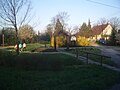
Park on Jókai utca

Landscape near Nagytőke


traffic
The main road No. 45 runs east of Nagytőke. The village is connected to the railway line from Szentes to Tiszatenyő.
literature
- Nagytőke - Településképi Arculati Kézikönyv 2017. Published by the municipal administration, Nagytőke 2017.
Web links
- Official website ( Hungarian )
- Nagytőke at Szentes.hu