Nanjō (Okinawa)
| Nanjō-shi 南 城市 |
||
|---|---|---|
|
|
||
| Geographical location in Japan | ||
| Region : | Kyushu | |
| Prefecture : | Okinawa | |
| Coordinates : | 26 ° 10 ' N , 127 ° 44' E | |
| Basic data | ||
| Surface: | 49.69 km² | |
| Residents : | 43,539 (October 1, 2019) |
|
| Population density : | 876 inhabitants per km² | |
| Community key : | 47215-8 | |
| Symbols | ||
| Flag / coat of arms: | ||
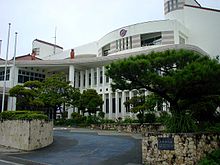
| town hall | ||
| Address : |
Nanjō City Hall 143 Tamagusuku-azatomisato Nanjō -shi Okinawa 901-0695 |
|
| Website URL: | http://www.city.nanjo.okinawa.jp/ | |
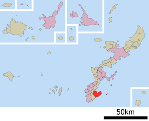
| Location Nanjōs in Okinawa Prefecture | ||
Nanjō ( Japanese 南 城市 , - shi ) is a city on Okinawa Hontō in Okinawa Prefecture , Japan .
history
The city of Nanjō was founded on January 1, 2006 from the former communities of Sashiki, Chinen, Tamagusuku and Ozato.
traffic
- Street
- National road 331
Web links
Commons : Nanjō (Okinawa) - collection of images, videos and audio files
- Official website (Japanese, English, Chinese, Korean, Spanish, Portuguese, German)


